


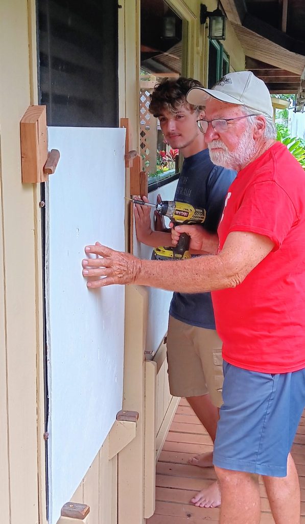
Steve Soltysik was boarding up the windows on his Līhu‘e home on Thursday in preparation for what was then Category 4 Hurricane Lowell, with winds of 130 mph and on track to impact Kaua‘i early next week.
The 78-year-old American Red Cross volunteer said he thinks people on the small Hawaiian island are anxious about “possibly having another ‘Iniki.”
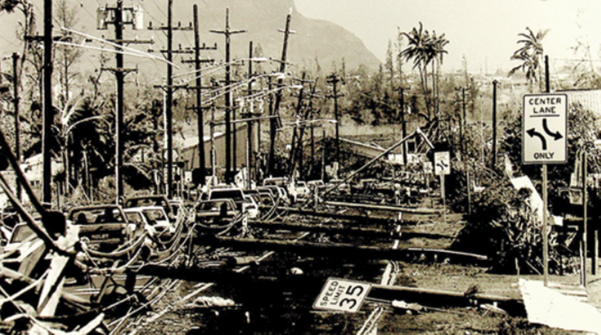
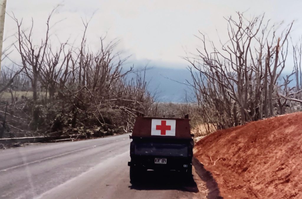
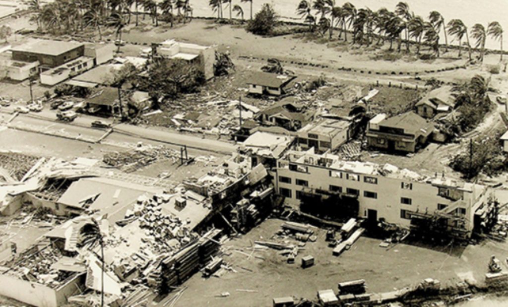
In 1992, Hurricane ʻIniki — a monster Category 4 storm — directly hit Kaua‘i, killing seven people, destroying 1,421 homes and the iconic Coco Palms Resort. Total damage was estimated at more than $3 billion.
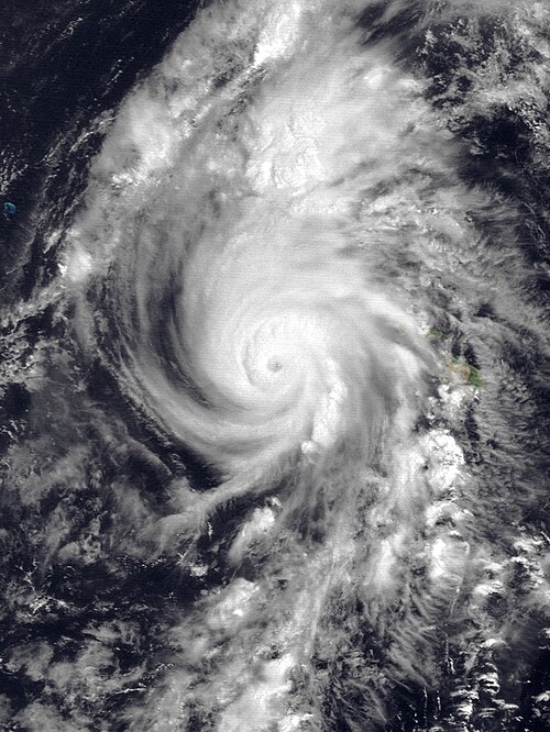
As of Thursday afternoon, John Bravender, Warning Coordination Meteorologist with the National Weather Service, said Lowell is not forecast to have the same impact as ‘Iniki. And while Lowell’s track is still uncertain, the federal forecasters are raising awareness about the approaching storm now, because it could happen.
“Anytime you see a major hurricane moving west and then taking a sudden turn to the north, it brings back memories of ‘Iniki,” Bravender said.
That is the case for JoAnn Yukimura, who was Kaua‘i mayor during ‘Iniki.
She said the Garden Isle was hit by both the front winds and the back winds in the 1992 hurricane: “It was a one-two punch that devastated us.”
Yukimura said Lowellʻs projected path is ominous and concerning, but not a certainty.
“We need to stay calm, deliberately prepare for the worst, and visualize, pray, hope – whatever form feels most comfortable – for the best,” Yukimura said.
Soltysik recalled on Thursday that the 1992 storm battered his home with 165 mph winds. He sheltered in place with his wife, daughter, their dog and rabbit in the center of the house, surrounded by mattresses.
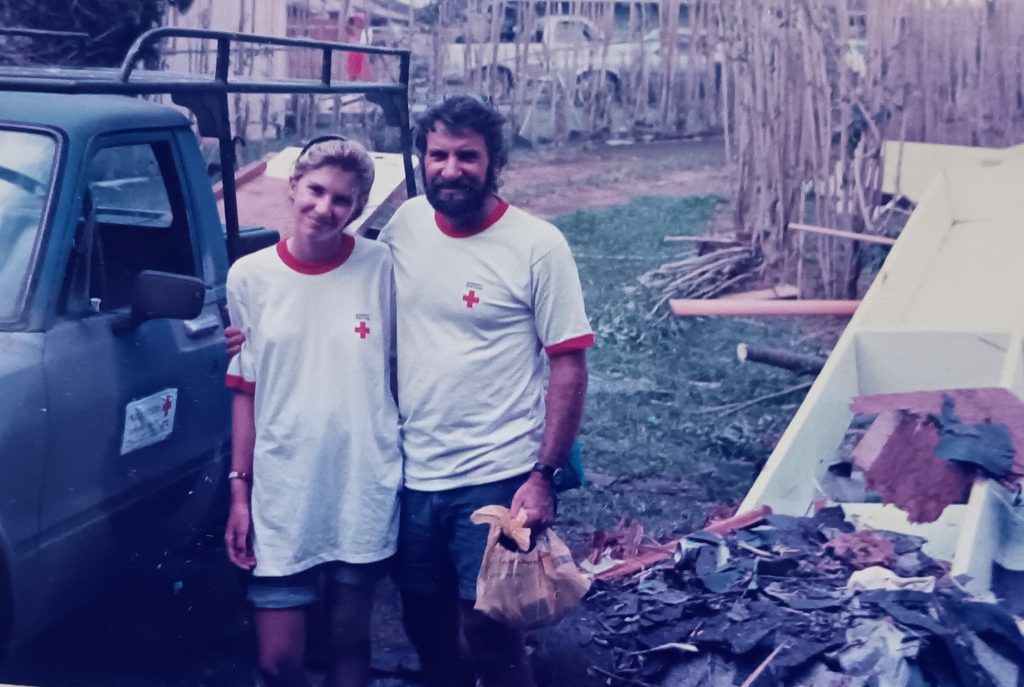
“We got clobbered just like everybody else,” Soltysik said. “Virtually every single green leaf in the jungle was stripped clean from the trees. Everything except palm trees.”
‘Iniki is the most powerful hurricane to strike the Hawaiian Islands in recent history, producing a storm tide of 6 feet, with water levels (storm surge and waves combined) nearly 30 feet above normal.
According to the National Oceanic and Atmospheric Administration, ‘Iniki brought maximum over-land sustained winds of 140 mph and gusts as high as 175 mph.
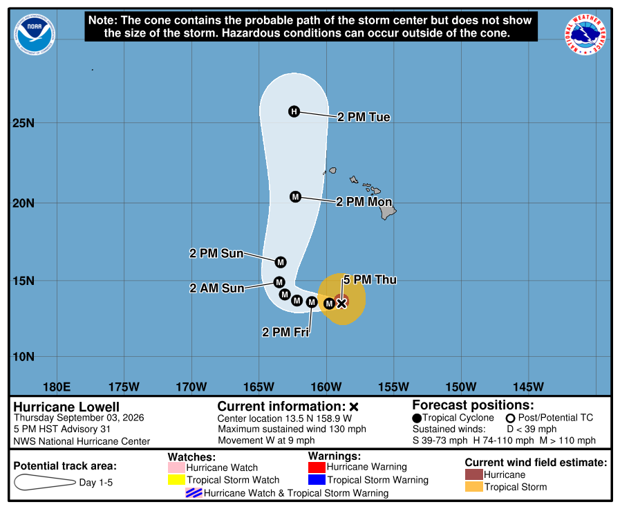
Lowell had slightly weakened to a Category 3 hurricane and was 595 miles south of Līhu‘e as of Thursday’s 11 p.m. advisory from the Central Pacific Hurricane Center.
Elton Ushio, administrator of the Kaua‘i Emergency Management Agency, said county officials have been meeting with state partners and the National Weather Service, looking at weather models for the past several days, and discussing Lowell’s potential turn northward toward Kaua‘i.
While the storm track is forecast to turn north across several models, Ushio said the “timing and actual path vary.”
Lowell could veer west away from Kaua‘i, or it could move east. If it takes the more easterly path, Ushio said it would be first time since ‘Iniki that the Garden Isle would have a hurricane landfall.
Bravender said forecasters won’t know until the weekend what path Lowell will take.
“There’s enough uncertainty in the forecast four or five days out that it could be farther east,” Bravender said. “It could be more of a direct impact. And that’s what we want people to prepare for, just in case.”
While Lowell is expected to weaken early next week, Bravender said it will still be a well-established strong major hurricane as it moves north.
There will be more wind shear affecting the storm that will cause it to weaken. That will, however, also expand its wind field, making the tropical-storm-force winds impact greater and also lead to larger surf for bigger areas.
“The best case scenario is that Lowell would take longer to turn north or not turn as sharp and it’ll track farther west and not bring a direct impact,” Bravender said.
In that situation, he said, the island would still see dangerous surf along the south shores but may avoid some of the big wind damage.
“The worst-case scenario would be that it turns sharper or turns faster and comes near or over Kaua‘i as a major hurricane, causing a lot of wind and rain damage to the island,” Bravender said.
In that case, Lowell’s impact on the Garden Isle would be similar to ‘Iniki, with the caveat that Lowell is forecast to be a little weaker, a Category 3, when it reaches Kaua‘i.
With forecast track uncertainty, Ushio said the county can’t focus on specific areas for impact. However, the county is carefully monitoring three primary threats that could impact Kaua‘i: heavy and destructive winds, rainfall that could bring flooding, and storm surge that could result in coastal inundation.
With the Kauaʻi Emergency Operations Center activated, Ushio said the county has been having regular conversations with its local partners across nonprofits and private sectors about their emergency preparations.
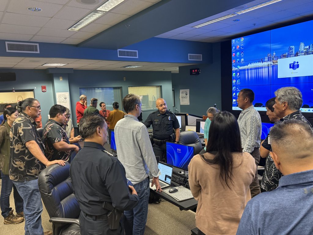
“We do what FEMA (Federal Emergency Management Agency) would call the whole community approach, which means full society, all levels of government and non-governmental partners as well,” he said.
Each partner has a different expertise and focus.
Within the county, Ushio said Public Works partners have been checking drainages, pre-staging equipment, dropping off generators and topping off fuel in those generators and other heavy equipment.
The fire and police departments are looking at their staffing levels to see if they need to bring in additional personnel. And the county is working on staffing and other logistics for refuge areas, if they are needed for people to safely ride out the storm.
Ushio said the county is also communicating with Kaua‘i Island Utility Cooperative to ensure the grid is as resilient as possible with backup systems and emergency generators in place.
Aside from stocking up on food, water and medication, Bravender also suggested residents clear their gutters so drainage areas don’t get clogged and take down tents or anything that can blow away.
Ushio first became KEMA administrator in 2015. During that first year, he said there was a record number of storm activity during hurricane season, “but nothing came close.”
“This year is crazy and active, and everything is coming close.”

