

Island forecast
Waimea, Kaua`i Weather
Clear daily guidance, radar access and the latest regional weather reporting in one place.
- Change Towns
- Anahola
- Lihue
- Princeville
- Waimea
Multi-day outlook
Forecast timeline
Scroll for the full forecast
Overnight
Friday
Friday Night
Saturday
Saturday Night
Sunday
Sunday Night
Monday
Monday Night
Tuesday
Tuesday Night
Wednesday
Wednesday Night
Thursday
Latest Weather News
Thursday weather updates: Ponding, down trees close roads; Kalalau Trail, Polihale State Park also closed
A flood advisory is expected to continue through 10:45 a.m.

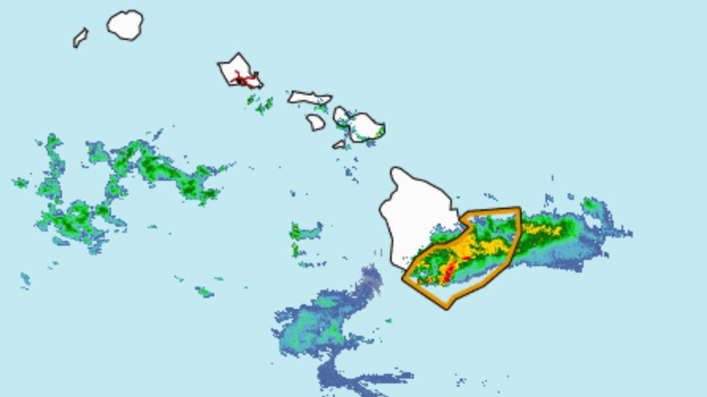
Monitor real-time stream conditions as storm approaches Hawaiian Islands
Federal, state and county agencies are monitoring 88 locations across the five main Hawaiian Islands.
Wednesday weather updates: Kaua‘i County under flood watch
Check out the latest watches and advisories in place for the Garden Island.
Strengthening system northwest of islands continues to support ‘increasingly active weather pattern’
More intense heavy rainfall, which could lead to more flooding in already drowned locations throughout the state, along with isolated thunderstorms, some of which could be…
‘It will not take much rain to induce flash flooding’: Heavy rainfall, stormy conditions to continue rest of week
Stormy conditions will continue through the rest of the week, with a major risk of even more heavy rainfall Wednesday through Friday for the entire state,…
 Weather Radar
Regional forecast
Regional Kaua`i Weather Forecast April 10, 2026

West Kaua’i
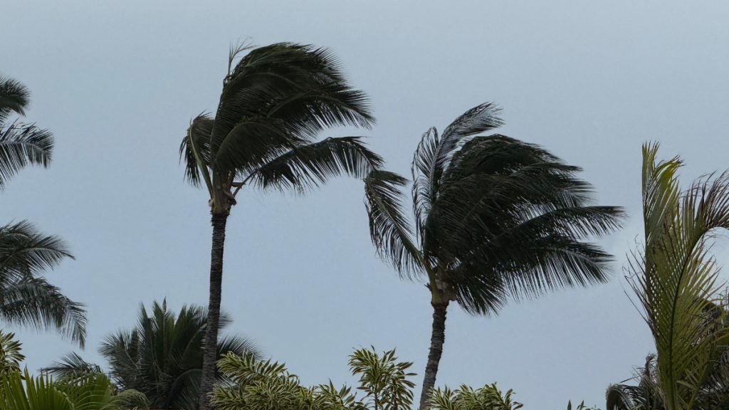
Tonight: Windy. Showers and slight chance of thunderstorms. Locally heavy rainfall possible. Lows around 65 near the shore to around 58 above 3000 feet. South winds up to 35 mph with gusts to 60 mph becoming northeast up to 10 mph after midnight. Chance of rain near 100 percent.
Friday: Mostly cloudy with frequent showers and slight chance of thunderstorms until late afternoon, then partly sunny with slight chance of thunderstorms and isolated showers late in the afternoon. Locally heavy rainfall possible. Highs around 81 near the shore to around 69 above 3000 feet. Southwest winds up to 15 mph. Chance of rain 90 percent.
Friday Night: Partly cloudy with slight chance of thunderstorms and isolated showers early in the evening, then partly cloudy in the late evening and overnight. Locally heavy rainfall possible early in the evening. Lows around 66 near the shore to around 57 above 3000 feet. Southwest winds around 10 mph. Chance of rain 20 percent.
South Kaua’i
Tonight: Breezy. Showers and slight chance of thunderstorms. Locally heavy rainfall possible. Lows around 66. South winds 10 to 25 mph becoming west after midnight. Chance of rain near 100 percent.
Friday: Mostly cloudy with frequent showers and slight chance of thunderstorms until late afternoon, then partly sunny with scattered showers and slight chance of thunderstorms late in the afternoon. Locally heavy rainfall possible. Highs 77 to 83. Southwest winds up to 10 mph shifting to the west in the afternoon. Chance of rain 90 percent.
Friday Night: Partly cloudy with scattered showers and slight chance of thunderstorms early in the evening, then partly cloudy with isolated showers in the late evening and early morning. Mostly cloudy early in the morning. Locally heavy rainfall possible early in the evening. Lows around 66. West winds around 10 mph. Chance of rain 30 percent.
Kaua’i Mountains
Tonight: Windy. Showers and slight chance of thunderstorms. Locally heavy rainfall possible. Lows 60 to 65 in the valleys to around 56 above 4000 feet. South winds up to 35 mph with gusts to 60 mph shifting to the southwest up to 20 mph after midnight. Chance of rain near 100 percent.
Friday: Mostly cloudy. Frequent showers and slight chance of thunderstorms until late afternoon, then scattered showers and slight chance of thunderstorms late in the afternoon. Locally heavy rainfall possible. Highs 73 to 78 in the valleys to around 63 above 4000 feet. Southwest winds up to 15 mph. Chance of rain 90 percent.
Friday Night: Partly cloudy with scattered showers and slight chance of thunderstorms early in the evening, then partly cloudy with isolated showers in the late evening and overnight. Locally heavy rainfall possible early in the evening. Lows 59 to 65 in the valleys to around 54 above 4000 feet. Southwest winds up to 15 mph. Chance of rain 40 percent.
North Kaua’i
Tonight: Windy. Showers and slight chance of thunderstorms. Locally heavy rainfall possible. Lows 60 to 68. South winds up to 30 mph with gusts to 50 mph decreasing to up to 15 mph after midnight. Chance of rain near 100 percent.
Friday: Mostly cloudy with frequent showers and slight chance of thunderstorms until late afternoon, then partly sunny with slight chance of thunderstorms and isolated showers late in the afternoon. Locally heavy rainfall possible. Highs 72 to 80. Southeast winds up to 10 mph shifting to the northwest in the afternoon. Chance of rain 90 percent.
Friday Night: Partly cloudy. Slight chance of thunderstorms and isolated showers early in the evening. Locally heavy rainfall possible early in the evening. Lows 60 to 68. Southwest winds up to 15 mph. Chance of rain 20 percent.
East Kaua’i
Tonight: Windy. Showers and slight chance of thunderstorms. Locally heavy rainfall possible. Lows 62 to 69. South winds up to 30 mph shifting to the west up to 15 mph after midnight. Chance of rain near 100 percent.
Friday: Mostly cloudy. Frequent showers and slight chance of thunderstorms until late afternoon, then scattered showers and slight chance of thunderstorms late in the afternoon. Locally heavy rainfall possible. Highs 72 to 82. South winds up to 10 mph shifting to the northeast in the afternoon. Chance of rain 90 percent.
Friday Night: Partly cloudy with scattered showers and slight chance of thunderstorms early in the evening, then partly cloudy with isolated showers in the late evening and overnight. Locally heavy rainfall possible early in the evening. Lows 61 to 70. West winds up to 10 mph. Chance of rain 40 percent.
Detailed Forecast
Synopsis
An active weather pattern will persist through Friday as low pressure strengthens northwest of the state. Deep tropical moisture being drawn northward into the islands will support periods of heavy rainfall, strong southerly winds, and isolated strong to severe thunderstorms through Friday. Although some brief improvement for portions of the state is possible by Saturday, another active period appears possible from Sunday through early next week.
Discussion
Issued at 413 PM HST Thu Apr 9 2026
This afternoon, a deepening surface low and deep upper trough with embedded shortwave energy is located northwest of the state. This feature is drawing deep tropical moisture northward towards the main Hawaiian Islands, and has the potential to bring high- impact weather to the state through Friday. The primary concerns with this system are heavy rainfall capable of producing flash flooding, strong southerly winds, and a few strong to severe thunderstorms.
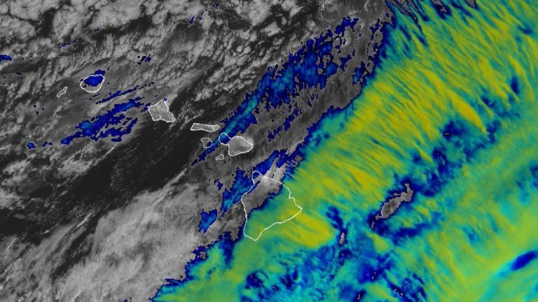
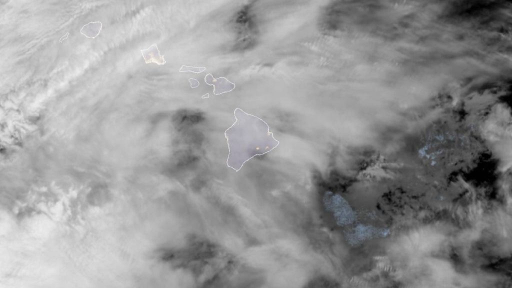
It is notable that the event's heavy rainfall has been delayed to some degree from what forecast guidance originally depicted. Therefore, refinements to timing and QPF have been made to the forecast with this afternoon's updates based on the latest observations and trends. Mid-afternoon satellite and radar imagery shows that an initial band of rain with higher rainfall rates up to 3 inches has finally arrived to Kauai as of press time. The afternoon upper air sounding from Lihue shows that instability has continued to gradually increase, and precipitable water values are hovering right around 2.0 inches.
This evening into tonight, large-scale ascent and strengthening low- level convergence will support favorable conditions for organized heavy rainfall and isolated strong to severe thunderstorms for Kauai, with flooding concerns significantly increasing as rain rates become more intense, thunderstorms begin moving into the western part of the state, and potential training occurs over certain areas or basins. Tonight into early Friday morning, the heavier shower bands are anticipated for Oahu, followed by a shift in focus to the central and eastern islands later Friday.
In addition to the heavy rain and flood threat, strong downsloping winds will continue to be a concern across the western islands through early Friday, with strong gusts possible in areas north and downwind of steep terrain. The stronger southerly winds will shift farther east to mainly Maui County and areas around the Big Island by Friday afternoon, though not anticipating wind headlines for the lower elevations at this time. Much lighter winds will prevail statewide this weekend.
Also of note, lava fountain episode 44 of the ongoing Kilauea eruption began earlier today. An Ashfall Warning remains in effect for Hawaii Volcanoes National Park and areas to the north and northeast. Transport of ash, Pele's hair, and other lightweight tephra is possible to locations downwind of the eruption. See the latest Ashfall Warning for details.
For the Big Island summits, gusty winds along with a wintry mix supports the Winter Weather Advisory and High Wind Advisory into Friday.
Although forecast confidence decreases somewhat beyond Friday, some gradual or temporary improvement is anticipated this weekend as upper heights rise and some drier air advances down the island chain from the west. Guidance, however, shows another shortwave dipping southeastward into the area late in the weekend, likely supporting another active weather period across the state that may extend through early next week.
Aviation
Issued at 413 PM HST Thu Apr 9 2026
Light to moderate showers have moved in from the SW through the majority of the state. MVFR to VFR conditions have occurred from Oahu to the Big Island, with heavier showers bringing MVFR to IFR conditions to Kauai. The heavier showers will continue to move through Kauai, and are accompanied by gustier S winds. These winds will expand eastward along with the heavier band of showers, primarily affecting Oahu and Kauai overnight. Maui County and the Big Island will likely not receive heavier showers until tomorrow. Expect MVFR conditions within preceding showers, and periods of IFR within heavier showers.
Recently, Kilauea erupted producing an ash cloud reaching up to 15-20kft. This also prompted an ashfall warning for areas east and southeast of the volcano, including Hilo. SIGMET series Quebec is issued to cover the ash plume. Ashfall is currently in the PHTO TAF, but the threat is expected to diminish shortly, as the plume cloud continues to decrease in altitude.
AIRMET Sierra is in effect for mountain obscuration above 020 ft for Kauai. This will likely need to be expanded later tonight, as showers move west to east across the island chain.
AIRMET Tango remains in effect for moderate turbulence between FL180 and FL360 across the entire islands, and for moderate turbulence downwind of terrain for Oahu and Kauai.
AIRMET Zulu remains in effect for moderate icing between 140-FL200 as this ongoing weather pattern envelops the islands with extensive cloud cover.
Marine
Issued at 413 PM HST Thu Apr 9 2026
South to southeast winds are expected to steadily increase to strong to gale force speeds tonight as a low pressure system develops just northwest of the state and lifts northward. A Gale Warning remains in effect for the western half of the coastal waters and the offshore waters for these strengthening winds. Gales are expected to continue over the western half of the coastal waters through the first half of the night, gradually shifting eastward throughout the night and potentially lingering near Oahu early on Friday. The likelihood of any significant widespread gale force winds reaching further east (near Maui) has decreased, and as a result, the Gale Watch for those waters has been canceled. Instead, the Small Craft Advisory (SCA) has been extended for most of the remaining waters through Friday evening.
As the low pressure system further deepens today into Friday, we will likely see a greater coverage of thunderstorms and gusty winds, especially tonight into Friday, where we could potentially see severe thunderstorms over the coastal waters capable of producing waterspouts and damaging winds. Very rough boating conditions are also expected later today into Friday as seas quickly rise in response to the strong to gale force winds. South facing harbor entrances will also be greatly impacted due to rough conditions.
Strong to gale force southerly winds are expected to quickly develop today over the western half of the state tonight, supporting a High Surf Advisory for Kauai County and Oahu. Large disorganized surf is expected along south facing shores of Kauai and Oahu through at least tonight, but may persist into the day on Friday. The probability of high surf conditions for Maui on Friday has decreased.
Along north facing shores, the current mid period northwest (320 degree) swell will steadily lower tonight and dissipate to background levels on Friday. However a smaller short-period northwest swell generated by the low developing just northwest of the islands will fill in Friday night through early next week.
Surf along east facing shores could see an increase later this week due to the strengthening southeasterly winds especially for southeast exposures.
HFO Watches/Warnings/Advisories
Flood Watch through Friday afternoon for all Hawaiian islands.
High Surf Advisory until 6 AM HST Friday for East Honolulu, Ewa Plain, Honolulu Metro, Kauai South, Kauai Southwest, Niihau, Waianae Coast.
High Wind Warning until 6 AM HST Friday for Central Oahu, Kauai Mountains, Kauai North, Koolau Leeward, Koolau Windward, Oahu North Shore, Olomana, Waianae Mountains.
Ashfall Warning until midnight HST tonight for Big Island East, Big Island Interior, Big Island Southeast.
Wind Advisory until 6 PM HST Friday for Big Island Summits.
Winter Weather Advisory until 6 PM HST Friday for Big Island Summits.
Gale Warning until 6 AM HST Friday for Kauai Channel, Kauai Leeward Waters, Kauai Northwest Waters, Kauai Windward Waters, Oahu Leeward Waters, Oahu Windward Waters.
Small Craft Advisory until 6 PM HST Friday for Alenuihaha Channel, Big Island Leeward Waters, Big Island Southeast Waters, Big Island Windward Waters, Kaiwi Channel, Maui County Leeward Waters, Maui County Windward Waters.
Kauai Now Weather is brought to you by Blue Hawaiian Helicopters.
Check out their Kaua‘i Helicopter Tours today!
Data Courtesy of NOAA.gov