


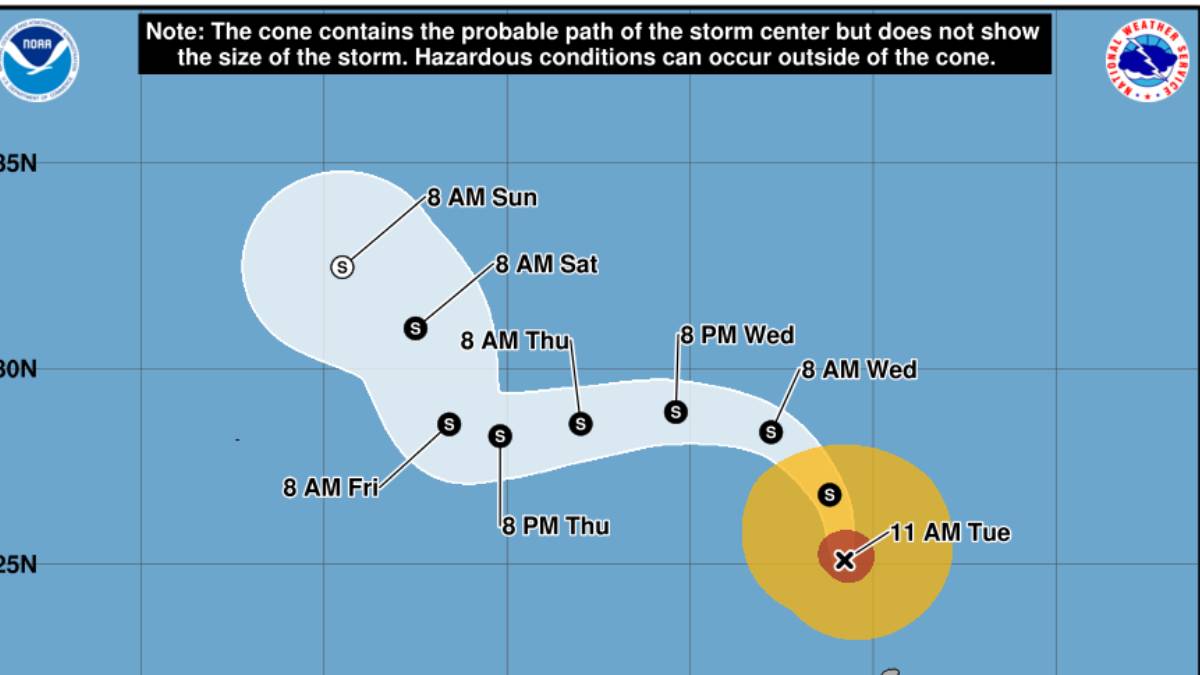
Updated at 11 a.m., Sept. 8
Hurricane Lowell continues to move away from Kaua‘i and Ni‘ihau and is forecast to gradually weaken over the next few days, according to the 11 a.m. advisory from the National Hurricane Center.
The fast-moving storm reached its closest point to the main Hawaiian Islands on Monday night. As of Tuesday morning, it is 230 miles north-northwest of Līhu‘e.
Flash flooding remains a threat to all Hawaiian Islands as periods of heavy rainfall associated with Lowell will linger over the eastern Hawaiian Islands through Wednesday. This may produce areas of flooding for urban and low-lying regions.
Hurricane Lowell’s sustained maximum winds have decreased to 75 mph, with higher gusts. The storm is traveling north at 15 mph. Lowell is then forecast to turn toward the northwest
and west and slow down on Wednesday and Thursday after passing the main Hawaiian Islands.
The National Weather Service has canceled the tornado watch for Kauaʻi County. It also has canceled the flash flood warning for the county.
As of 4:22 a.m. on Tuesday, heavy rain had ended over Kauaʻi. Most rivers and streams have dropped considerably though streamflows remain elevated and impacted locations may remain inundated by standing water for some time.
But Hanalei River Bridge in Hanalei remains flooded and is closed. Heed all road closures.
And periods of heavy rainfall associated with Hurricane Lowell will continue through Wednesday, the advisory said.
Conditions are deteriorating for Niʻihau, Kauaʻi and Oʻahu, with flash flooding, damaging waves and high winds expected, the advisory said.
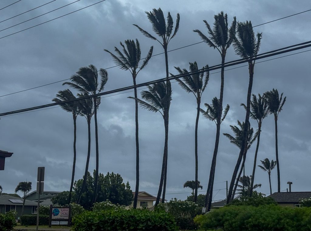
Hurricane-force winds extend outward up to 60 miles from the center and tropical-storm-force winds extend outward up to 205 miles. Līhuʻe Airport, which closed at 2:30 p.m. on Monday, recently reported sustained winds of 35 mph with gusts up to 47 mph.
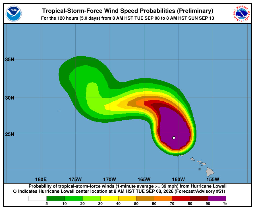
Hurricane winds
Damaging wind gusts of 40 to 50 mph are still occuring on Kauaʻi and Niʻihau.
According to the National Weather Service, it is important to note that winds can be accelerated over and downwind of terrain, leading to areas of stronger wind gusts. As winds shift to south overnight, areas affected by downslope wind gusts will likely change.
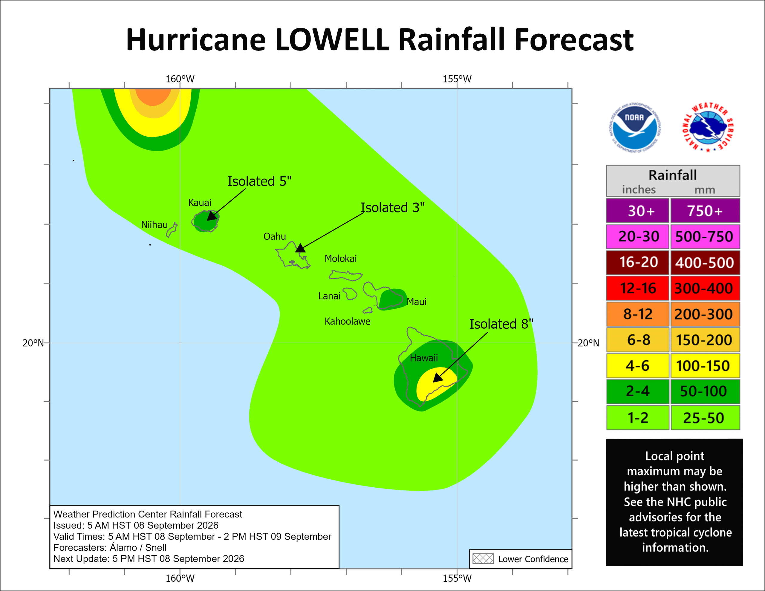
Flood warning
While the flash flood warning has been canceled there remains a flood watch remains in effect for Kauaʻi.
Heavy downpours could lead to flash flooding and mudslides, especially in steep terrain, and rainbands could become persistent and anchored in some areas, exacerbating the flash flood threat. The flood threat also exists for all other islands due to deep moisture surrounding Lowell.
Hurricane Lowell is expected to produce additional rainfall totals of 1 to 3 inches for Kauai, with maximum storm totals of 24 inches possible.
Up 12 inches remains possible over the southeast Big Island.
Do not cross fast-flowing or rising water in your vehicle or on foot.
Ponding, low visibility, and other hazardous driving conditions are expected. If you must drive, please do so with caution.
For updates on road conditions and closures, call 808-241-1725. Do not call Kauaʻi police at 911 unless you have an emergency.
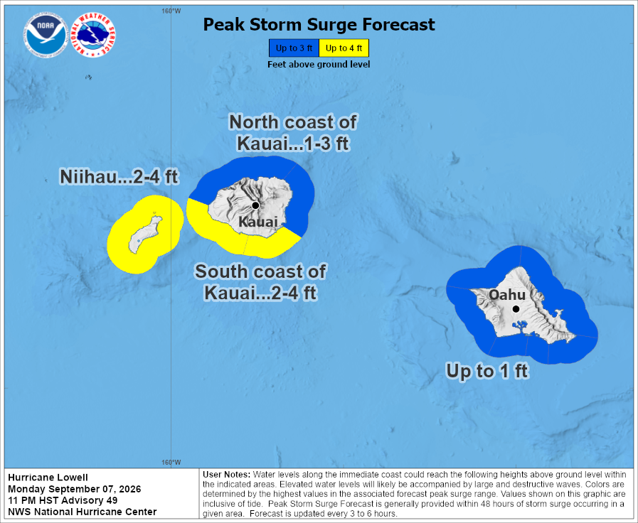
High surf warning
A high surf warning for south and west-facing shores of Kaua‘i and Ni‘ihau has been extended until 6 p.m. Tuesday.
An extremely large south to southwest swell generated by Lowell will continue to rapidly build through the evening and peak tonight. A high surf warning is in effect for south-facing shores of all islands and for west-facing shores of the Big Island.
Dangerously large and damaging surf and coastal inundation are expected along the immediate coast of exposed south and west-facing shores of Kauaʻi and Niʻihau.
Surf of 20 to 30 feet along south-facing shores is expected to rapidly decline through the day, becoming 6 to 8 feet by this afternoon.
Extra large surf, on top of 1 to 4 feet of storm surge, will generate major wave run-up and coastal inundation along exposed low lying areas of south and west-facing shores of Kauaʻi and Niʻihau.
Entering the water in these areas during the high surf warning is very hazardous and could cause serious injury or death. Beachgoers are also advised to use extreme caution, as large breaking waves could make it dangerous for those standing along the shoreline.
For updated information on ocean and weather alerts, visit the NWS website, www.weather.gov/hfo.
For up-to-date information about Kaua‘i ocean conditions and ocean safety, speak to a county lifeguard at any lifeguard station, visit https://safebeachday.com/county/kauai/, or call the Ocean Safety Bureau at 808-241-4984.
Hunker down
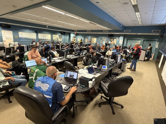
Residents and visitors should avoid unnecessary travel as dangerous conditions continue. Never drive, walk or swim through floodwaters.
For everything you should know about refuges, closures, preparation tips and more, click here.
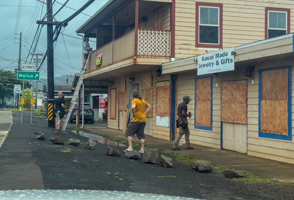
Visitors should confirm flights, accommodations and activities directly with airlines, hotels and other providers. Visitor information is available online and by calling 1-800-GOHAWAII.
Text KAUAIEMA to 888777 to receive county emergency alerts.
The public should continue closely monitoring Lowell’s progress. Check National Weather Service forecasts and products for any additional advisories, watches or warnings issued and for specific weather information for your community.
Stay safe.

