Updated at 11:34 p.m. Sept. 5, 2026.
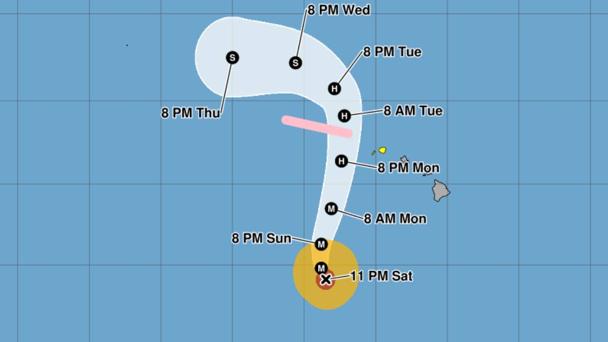
Lowell is now a powerful Category 3 hurricane as it begins to turn northward, with sustained winds of 125 mph moving northwest at 5 mph.
Some fluctuations in intensity remain possible through early Sunday, followed by gradual weakening by Sunday and Monday.
The storm is about 610 miles south-southwest of Līhuʻe as of the Central Pacific Hurricane 11 p.m. advisory update, with hurricane force winds extending up to 45 mph and tropical storm force winds extending up to 175 miles from Lowell’s center.
Lowell’s eye is forecast to make it’s closest approach to the main Hawaiian Islands on Monday night, passing 100 to 200 miles west of Niʻihau.
A tropical storm watch is in effect until further for Kauaʻi County, which includes Kauaʻi and Niʻihau, as well as a hurricane watch for Papahānaumokuākea Marine National Monument, from Nīhoa to French Frigate Shoals.
Tropical storm conditions are possible by late Monday or Monday night for Kauaʻi County, and hurricane conditions possible Monday night in eastern portions of Papahānaumokuākea.
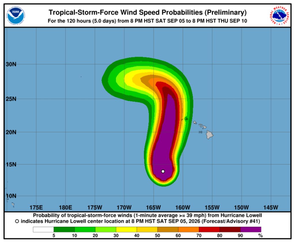
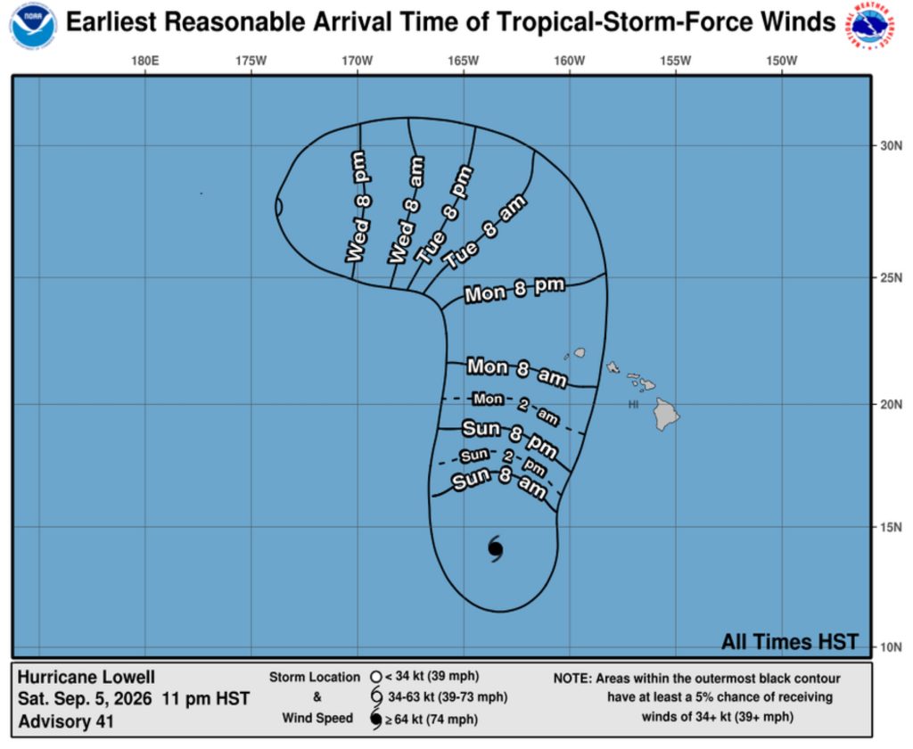
As of the 11 p.m. update, National Weather Service graphics showed Kauaʻi County has between a 10% and 60% chance of experiencing tropical storm force winds of between 39 mph and 73 mph, depending on specific locations on both islands.
The earliest arrival time for those winds is sometime after 8 a.m. Monday.
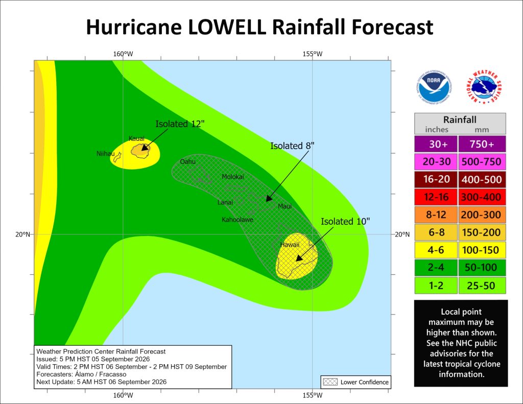
A flood watch is in effect for the entire state, with peak rainfall amounts throughout Kauaʻi County expected at 4 to 8 inches, with maximum totals possibly exceeding 12 inches in some locations.
The Big Island is forecast to receive 2 to 6 inches of rainfall, with isolated totals up to 10 inches possible, while Maui is expected to get 2 to 4 inches of rain, with isolated maximum totals of 8 inches possible. The rest of the main Hawaiian Islands should see 2 to 4 inches of rain.
Rainfall could produce significant flash flooding and mudslides, especially on Kauaʻi and portions of the Big Island.
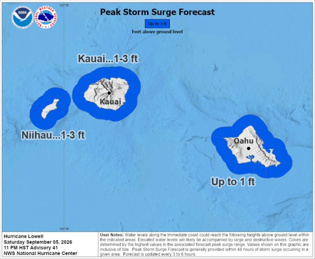
Localized storm surge also is possible for Kauaʻi County, with a potential for 1 to 3 feet of water above ground in areas prone to surge. The time frame of main storm surge concern is Monday afternoon through Tuesday afternoon.
The deepest waters will occur along the immediate coast near and to the right of Lowell’s center, where the surge will be accompanied by large and destructive waves.
Surge-related flooding depends on relative timing of the surge and the tidal cycle; it can vary greatly over short distances.
A high surf advisory for south and east shorelines also was extended until Tuesday morning, with swells from Hurricane Lowell and Tropical Storm Karina producing surf up to 14 feet along eastern shorelines and up to 12 feet along south-facing shores, increasing to 14 feet by Sunday night.
The advisory is expected to be upgraded to a high surf warning Sunday night into Monday for affected south-facing shores as surf heights are forecast to rapidly increase to warning levels.
Conditions also will become favorable for fast-moving, short-lived waterspouts and tornadoes in the rainbands associated with Lowell, mainly near Kauaʻi and Niʻihau, later Monday, continuing into Monday night and the threat diminishing quickly Tuesday morning.
Lowell is expected to continue turning more toward the north or north-northeast tonight into Sunday, with an increase in forward speed Sunday into Monday.
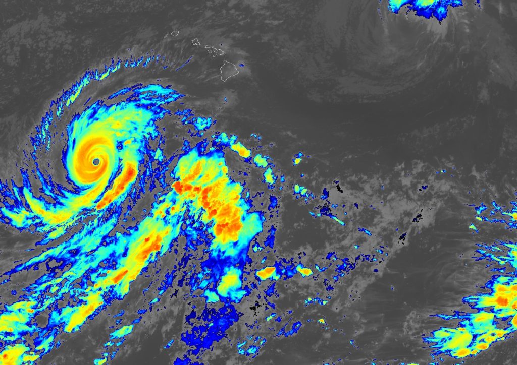
“On the forecast track, the center of Lowell will move across portions of the Papahānaumokuākea Marine National Monument, just west of the main Hawaiian Islands, Monday night,” the 11 p.m. advisory update said.
The storm is bringing back memories for some Kauaʻi residents of the catastrophic Category 4 Hurricane ʻIniki, which in 1992 struck the island, killing seven people and doing an estimated $3 billion in damage.
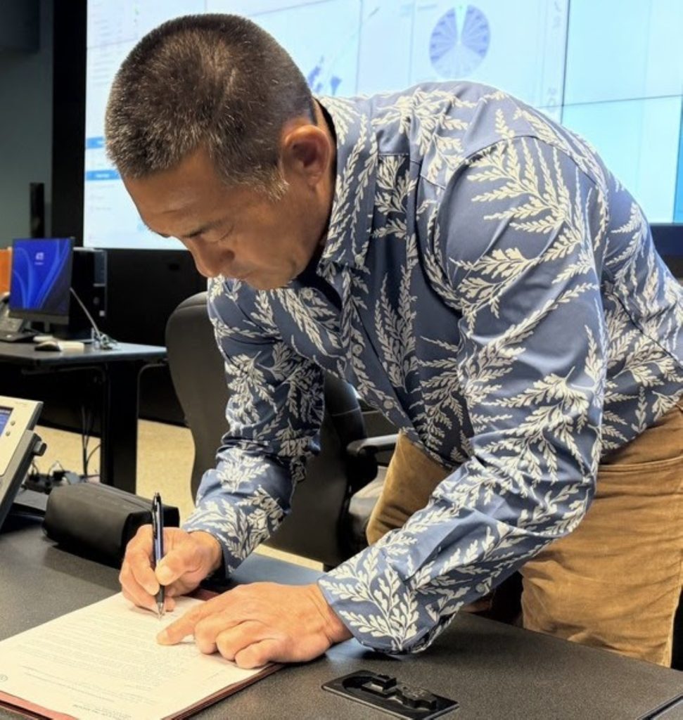
“We need everyone on Kauaʻi to take this storm seriously and finish preparing now,” said Kauaʻi County Mayor Derek Kawakami. “Know where you will go if you need to leave your home, gather essential supplies and sign up for emergency alerts. Our county teams are ready, but preparedness begins with each household.”
Residents and visitors should monitor official forecasts, prepare emergency supplies, charge electronic devices, secure outdoor objects and avoid unnecessary travel as conditions worsen. Never drive, walk or swim through floodwaters.
Visitors should confirm flights, accommodations and activities directly with airlines, hotels and other providers. Visitor information is available online and by calling 1-800-GOHAWAII.
Text KAUAIEMA to 888777 to receive county emergency alerts.
The public should continue closely monitoring Lowell’s progress. Check National Weather Service forecasts and products for any additional advisories, watches or warnings issued and for specific weather information for your community.