

Island forecast
Waimea, Kauai Weather
Clear daily guidance, radar access and the latest regional weather reporting in one place.
- Change Towns
- Anahola
- Lihue
- Princeville
- Waimea
Multi-day outlook
Forecast timeline
Scroll for the full forecast
This Afternoon
Tonight
Monday
Monday Night
Tuesday
Tuesday Night
Wednesday
Wednesday Night
Thursday
Thursday Night
Friday
Friday Night
Saturday
Saturday Night
Latest Weather News
 Weather Radar
Regional forecast
Regional Kauai Weather Forecast August 02, 2026

West Kaua’i
Rest Of Tonight: Breezy. Mostly cloudy with scattered showers in the evening, then partly cloudy with isolated showers after midnight. Lows around 74 near the shore to around 64 above 3000 feet. East winds up to 20 mph. Gusts up to 40 mph in the evening. Chance of rain 40 percent.
Sunday: Breezy. Sunny with isolated showers. Highs 85 to 92 near the shore to around 77 above 3000 feet. East winds up to 20 mph. Chance of rain 20 percent.
Sunday Night: Mostly clear. Breezy. Isolated showers after midnight. Lows around 74 near the shore to around 63 above 3000 feet. Northeast winds up to 20 mph decreasing to up to 10 mph after midnight. Chance of rain 20 percent.
South Kaua’i
Rest Of Tonight: Breezy. Mostly cloudy with scattered showers. Lows around 74. Northeast winds 20 to 25 mph. Chance of rain 50 percent.
Sunday: Breezy. Partly sunny with scattered showers in the morning, then mostly sunny with isolated showers in the afternoon. Highs 78 to 88. Northeast winds 15 to 20 mph. Chance of rain 30 percent.
Sunday Night: Breezy. Partly cloudy with isolated showers in the evening, then mostly cloudy with scattered showers after midnight. Lows 71 to 77. Northeast winds 10 to 20 mph. Chance of rain 40 percent.
Kaua’i Mountains
Rest Of Tonight: Windy. Mostly cloudy with scattered showers. Lows around 69 in the valleys to around 62 above 4000 feet. East winds 10 to 30 mph. Gusts up to 50 mph in the evening. Chance of rain 50 percent.
Sunday: Breezy. Partly sunny with scattered showers. Highs 73 to 81 in the valleys to around 67 above 4000 feet. East winds 10 to 20 mph. Gusts up to 40 mph in the morning. Chance of rain 50 percent.
Sunday Night: Partly cloudy in the evening then becoming mostly cloudy. Scattered showers. Lows around 68 in the valleys to around 61 above 4000 feet. Northeast winds up to 15 mph. Chance of rain 50 percent.
North Kaua’i
Rest Of Tonight: Breezy. Mostly cloudy with scattered showers. Lows 65 to 75. East winds 10 to 25 mph. Chance of rain 50 percent.
Sunday: Mostly sunny with scattered showers. Highs 70 to 87. East winds up to 15 mph increasing to 10 to 15 mph in the afternoon. Chance of rain 40 percent.
Sunday Night: Partly cloudy in the evening then becoming mostly cloudy. Scattered showers. Lows 64 to 74. East winds 10 to 15 mph. Chance of rain 50 percent.
East Kaua’i
Rest Of Tonight: Breezy. Mostly cloudy with scattered showers. Lows 68 to 76. Northeast winds 10 to 25 mph. Chance of rain 50 percent.
Sunday: Breezy. Partly sunny with scattered showers. Highs 76 to 85. Northeast winds 10 to 20 mph. Chance of rain 40 percent.
Sunday Night: Mostly cloudy with scattered showers. Lows 67 to 76. Northeast winds 10 to 15 mph. Chance of rain 50 percent.
Detailed Forecast
Synopsis
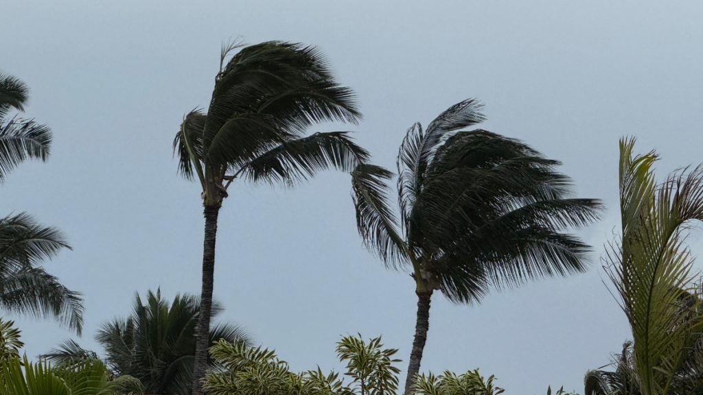
Strong high pressure to the north will slowly weaken tonight through the next several days. As a result, the windy trade winds will remain hazardous tonight before gradually decreasing back down to normal levels tomorrow into next week. Showers will favor windward and mountain areas, staying on the lighter side through the next few days before potentially increasing slightly during the middle of next week.
Short term update
Minor adjustments were made to PoPs to account for current trends. Winds should slowly decrease overnight.
Prev discussion
Issued at 326 PM HST Sat Aug 1 2026
Windy trade winds are expected to blow through tonight with a few showers passing through windward and mountain areas. Based on satellite and radar, most of these showers are on the lighter side. Based on current observations and high-res model guidance, strong to windy trade winds with 50 mph gusts could linger through a good portion of tonight, therefore the high wind advisory has been extended through the overnight hours. The strongest winds will be felt over the windy areas along ridges, through mountainous gaps and downslope mountain areas. By tomorrow the trade winds should decrease considerably back down to the normal summertime levels and remain breezy into next week.
By midweek, trades will further ease as Tropical Storm Genevieve weakens to a post-tropical depression and tracks far northeast of the state, disrupting trade wind flow. Bands of moisture will move over the state, returning typical scattered showers to windward and mauka slopes. Model guidance continue to show a tropical upper level trough shifting just northwest of Kauai by the middle of the week. In addition an area of enhanced moisture may move from east to west across the state. If this comes to fruition, expect a steady increase in low to upper level moisture/clouds and increasing chances moderate to locally heavy windward and mauka showers, especially for the western half of the state.
Aviation
Breezy to windy trade winds will prevail overnight. Occasional MVFR ceilings and visibilities will occasionally occur within SHRA primarily across windward and upslope mauka exposures.
AIRMET Tango is in effect for moderate low level turbulence over and immediately S through W of mountainous terrain of all Hawaiian Islands as a result of strengthened trade winds. Evening and early morning lowering ceilings over Kauai and Oahu's upper terrain has an AIRMET SIERRA in effect for mountain obscuration.
Marine
Issued at 326 PM HST Sat Aug 1 2026
Strong surface high pressure north of the state will maintain strong to locally near gale easterly trade winds across all coastal waters through tonight. The Small Craft Advisory (SCA) is in effect for all coastal zones through tonight for winds and also seas potentially exceeding 10 feet. Overnight as winds begin to trend down, the SCA has been trimmed back to just the windier waters and channels around Maui County and the Big Island through Sunday. The combination of a strong mid- latitude trough and Tropical Storm Genevieve passing far northeast of the islands induces a weakness in the ridge which will then keep trade winds more moderate to locally fresh for the first half of next week.
Surf along south facing shores will stay below seasonal averages as consecutive small south to southwest medium period swells impact the shorelines through the middle of next week.
East facing shores will remain rough and choppy through tonight due to a combination of strong trade winds and a small, medium period easterly swell generated from Tropical Storm Genevieve that will linger into early next week. By early next week as trade winds gradually weaken, surf will also decline slightly.
Surf along north facing shores will remain flat to tiny through the forecast period except for areas exposed to the easterly trade wrap.
Fire weather
Issued at 326 PM HST Sat Aug 1 2026
Windy trades will continue across the state with some locations under a Wind Advisory though tonight. A relatively dry and stable airmass with inversion heights around 5,000 ft, will allow gusty downslope winds and lower RH values to persist tonight. Any showers will be light and mostly limited to windward locations. While the KBDI will remain below the critical thresholds, this dry and windy pattern will maintain near critical fire weather concerns through the evening, especially for areas above the inversion heights and downslope of ridges. Trades are expected to decrease to locally breezy levels Sunday into early next week. A steady increase in low to upper level moisture could also fill in across the state next week if an upper level low ends up moving close to the islands. This could also raise the inversion and lower fire weather risks.
HFO Watches/Warnings/Advisories
Wind Advisory until 6 AM HST Sunday for Big Island Interior, Big Island North, Big Island South, Big Island Southeast, Kahoolawe, Kauai South, Kohala, Koolau Leeward, Lanai Leeward, Lanai Mauka, Lanai Windward, Maui Central Valley North, Maui Central Valley South, Maui Leeward West, Molokai Leeward South, Molokai North, Molokai West, South Haleakala, Waianae Mountains.
Small Craft Advisory until 6 AM HST Sunday for Big Island Windward Waters, Kaiwi Channel, Kauai Channel, Kauai Leeward Waters, Kauai Northwest Waters, Kauai Windward Waters, Maui County Leeward Waters, Maui County Windward Waters, Oahu Leeward Waters, Oahu Windward Waters.
Small Craft Advisory until 6 PM HST Sunday for Alenuihaha Channel, Big Island Leeward Waters, Big Island Southeast Waters, Maalaea Bay, Pailolo Channel.
Kauai Now Weather is brought to you by Blue Hawaiian Helicopters.
Check out their Kaua‘i Helicopter Tours today!
Data Courtesy of NOAA.gov