Island forecast
Princeville, Kaua`i Weather
Clear daily guidance, radar access and the latest regional weather reporting in one place.
- Change Towns
- Anahola
- Lihue
- Princeville
- Waimea
Multi-day outlook
Forecast timeline
Scroll for the full forecast
Tonight
Friday
Friday Night
Saturday
Saturday Night
Sunday
Sunday Night
Monday
Monday Night
Tuesday
Tuesday Night
Wednesday
Wednesday Night
Thursday
Latest Weather News
 Weather Radar
Regional forecast
Regional Kaua`i Weather Forecast May 15, 2026
West Kaua’i
Rest Of Tonight: Mostly cloudy with scattered showers. Lows around 70 near the shore to around 60 above 3000 feet. Northeast winds up to 10 mph in the evening becoming light. Chance of rain 50 percent.
Friday: Partly sunny with scattered showers and isolated thunderstorms. Locally heavy rainfall possible. Highs 81 to 86 near the shore to around 73 above 3000 feet. Northeast winds up to 10 mph shifting to the southeast in the afternoon. Chance of rain 50 percent.
Friday Night: Partly cloudy. Isolated showers in the evening. Locally heavy rainfall possible in the evening. Lows around 71 near the shore to around 61 above 3000 feet. Northeast winds up to 10 mph in the evening becoming light. Chance of rain 20 percent.
South Kaua’i
Rest Of Tonight: Mostly cloudy with scattered showers. Lows 68 to 73. Northeast winds 10 to 15 mph. Chance of rain 50 percent.
Friday: Mostly cloudy with scattered showers and isolated thunderstorms. Locally heavy rainfall possible. Highs 76 to 85. Northeast winds 10 to 15 mph. Chance of rain 50 percent.
Friday Night: Mostly cloudy with scattered showers in the evening, then partly cloudy with isolated showers after midnight. Locally heavy rainfall possible in the evening. Lows around 71. Northeast winds around 10 mph. Chance of rain 40 percent.
Kaua’i Mountains
Rest Of Tonight: Cloudy. Numerous showers in the evening, then showers after midnight. Lows 62 to 68 in the valleys to around 58 above 4000 feet. Northeast winds 10 to 15 mph. Chance of rain 90 percent.
Friday: Mostly cloudy with numerous showers and isolated thunderstorms. Locally heavy rainfall possible. Highs 73 to 79 in the valleys to around 65 above 4000 feet. East winds up to 10 mph. Chance of rain 70 percent.
Friday Night: Mostly cloudy in the evening then becoming partly cloudy. Scattered showers. Locally heavy rainfall possible in the evening. Lows 64 to 69 in the valleys to around 60 above 4000 feet. East winds around 10 mph. Chance of rain 50 percent.
North Kaua’i
Rest Of Tonight: Mostly cloudy with scattered showers. Lows 61 to 71. East winds around 10 mph. Chance of rain 50 percent.
Friday: Mostly cloudy. Numerous showers and isolated thunderstorms in the morning, then scattered showers and isolated thunderstorms in the afternoon. Locally heavy rainfall possible. Highs 69 to 82. East winds up to 15 mph. Chance of rain 70 percent.
Friday Night: Partly cloudy. Scattered showers in the evening, then isolated showers after midnight. Locally heavy rainfall possible in the evening. Lows 62 to 72. East winds up to 10 mph. Chance of rain 40 percent.
East Kaua’i
Rest Of Tonight: Mostly cloudy with scattered showers. Lows 65 to 72. Northeast winds around 10 mph. Chance of rain 50 percent.
Friday: Mostly cloudy with numerous showers and isolated thunderstorms. Locally heavy rainfall possible. Highs 75 to 83. Northeast winds 10 to 15 mph. Chance of rain 70 percent.
Friday Night: Mostly cloudy in the evening then becoming partly cloudy. Scattered showers. Locally heavy rainfall possible in the evening. Lows 66 to 73. East winds around 10 mph. Chance of rain 50 percent.
Detailed Forecast
Synopsis
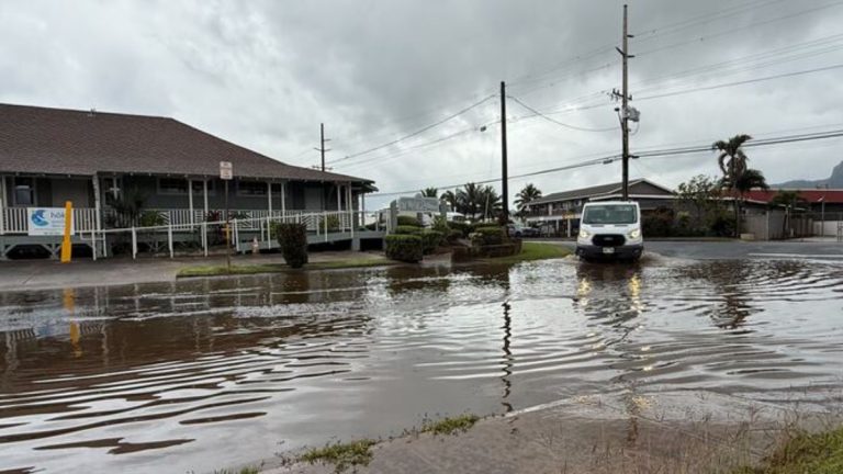
Breezy trade winds will persist into this evening, with showers favoring windward and mauka areas. An upper level disturbance will briefly move over the state on Friday and will bring the threat of heavy rain and isolated thunderstorms over select areas. While widespread heavy rain is not anticipated, pockets of heavy rain with some flooding impacts will be possible on Friday. Wetter than normal conditions will likely persist through the weekend, especially over windward and mauka areas, where scattered showers are expected.
Discussion
High pressure far north of the state continues to maintain breezy trade winds across the region this afternoon, with clouds and showers focusing primarily over windward and mauka areas. These locally breezy trades will continue into the evening hours, but are anticipated to weaken to more moderate levels overnight.
An upper level low that can currently be seen on water vapor imagery entering the northern offshore waters this afternoon is expected to continue digging southward towards the island chain tonight. Latest global guidance remains in good agreement that this upper low will arrive near Kauai in the pre-dawn hours Friday morning, then move over the Garden Isle during the day with temperatures aloft at 500mb anticipated to be as cold as -15C. This will lead to increasing instability over the state, and the strength of the upper level low will induce a surface trough, serving as a trigger for heavy showers and isolated thunderstorms.
Given that the upper low is expected to be centered over Kauai at its closest pass, the best forcing is expected to be over Oahu and parts of Maui County, where guidance is showing over 1000 J/kg of CAPE by Friday afternoon. Of particular note, latest QPF guidance has trended upward, and the official forecast has been adjusted accordingly, but with great uncertainty. In particular, some guidance is hinting at the possibility of a plume of moisture developing from Molokai towards Oahu from late morning into the afternoon within a slightly more ESE wind regime. Should this occur, there is potential for heavy rain to train over portions of Oahu, which could lead to flooding concerns. This scenario in a few hi-res members that make up the National Blend of Models (NBM) is likely the reason for an unusually large discrepancy between the QPF 50th percentile for Oahu on Friday and the mean, with the mean being significantly higher. Meanwhile, Rapid Refresh Forecast System (RRFS) members seemingly range from not much notable rain over the islands on Friday, to interior and leeward afternoon convection development, to pluming and potential training of heavy rain and thunderstorms leading to flooding. These scenarios are similar (though to a lesser degree) for Kauai and the islands of Maui County as well, and slight deviations of the main upper low could shift convective focus east or west accordingly. In summary, the QPF forecast for Friday has significant and unusual uncertainty. There likely will be heavy rain over some locations, and given lighter low-level winds, showers could be slow moving with the potential for anchoring on island terrain. However, not confident enough at this point to issue a Flood Watch given the mesoscale effects that could be at play and the lack of a clear focus or consensus, but it is certainly worth keeping an eye on for flooding impacts. At this time, have opted instead to continue the heavy rain and thunderstorm mentions in the forecast.
This weekend, the upper level low will begin to drift further away from the state, which should decrease the threat of thunderstorms. While the instability decreases over the weekend, low level moisture will increase from the southeast with precipitable water values approaching 2 inches by late Saturday over windward Big Island. Periods of heavy rain will be possible over windward and southeast Big Island this weekend, with some enhanced showers possible elsewhere across the state. By next week, a more typical trade wind pattern looks to return to the region.
Aviation
Moderate to locally breezy trades are expected for next day or so. Low ceilings and showers are expected at times along windward and mauka locations through tonight with dominant VFR and brief periods of MVFR. An upper low near the state may provide the potential for periods of heavy downpours through Friday, especially over the central islands.
AIRMET Tango remains in effect for low-level turbulence over and in the lee of terrain due to the breezy trades through at least tonight.
Marine
High pressure far north of the islands will maintain locally strong trades through this evening before the pattern changes. An upper level low is inducing a surface trough just to the north of Kauai this afternoon and as it moves south, it will cause the winds to veer east-southeast and weaken to moderate to fresh speeds tomorrow into the weekend. The Small Craft Advisory (SCA) has been extended for the windier zones of Maui County and the Big Island through 6 AM HST Friday morning. The upper level disturbance will bring the threat of heavy rain and isolated thunderstorms to the island chain on Friday.
A new small to moderate, long period NW to NNW (320 degree to 330 degree) swell will likely peak late this afternoon into the evening and produce above average surf along north facing shores. Observations at buoy 51001 showed this swell peaked at about 5 feet 14 seconds around mid morning. This swell should gradually fade tonight into the weekend.
A mix of small, medium to long period south swells will maintain small surf along south facing shores into the weekend. A series of gales initially passing south of New Zealand and now setting up to its east should send a series of small south swells to the Hawaiian Islands all throughout next week. Surf should rise to near the summer average around Sunday and hold through the week. Meanwhile along east facing shores, locally strong trades will maintain rough and choppy surf. A slight decrease of wind swell is expected tonight into the weekend as the trades weaken to moderate to locally fresh speeds.
Tides peak around 2.5 ft MLLW this weekend. Combined with ongoing trades and a modest boost in south swell, water levels will peak around 3.0 ft late this weekend into early next week. Minor overwash of low lying coastal areas will be possible during the afternoon high tides at this time.
HFO Watches/Warnings/Advisories
Small Craft Advisory until 6 AM HST Friday for Maalaea Bay, Pailolo Channel, Alenuihaha Channel, Big Island Leeward Waters, Big Island Southeast Waters.
Kauai Now Weather is brought to you by Blue Hawaiian Helicopters.
Check out their Kaua‘i Helicopter Tours today!
Data Courtesy of NOAA.gov


