

Island forecast
Anahola, Kauai Weather
Clear daily guidance, radar access and the latest regional weather reporting in one place.
- Change Towns
- Anahola
- Lihue
- Princeville
- Waimea
Multi-day outlook
Forecast timeline
Scroll for the full forecast
Overnight
Monday
Monday Night
Tuesday
Tuesday Night
Wednesday
Wednesday Night
Thursday
Thursday Night
Friday
Friday Night
Saturday
Saturday Night
Sunday
Latest Weather News
 Weather Radar
Regional forecast
Regional Kauai Weather Forecast August 03, 2026

West Kaua’i
Rest Of Tonight: Mostly clear. Isolated showers after midnight. Lows around 73 near the shore to around 63 above 3000 feet. Northeast winds up to 15 mph. Chance of rain 20 percent.
Monday: Mostly sunny with isolated showers. Highs 84 to 91 near the shore to around 76 above 3000 feet. Northeast winds up to 15 mph shifting to the west in the afternoon. Chance of rain 20 percent.
Monday Night: Partly cloudy in the evening then becoming mostly cloudy. Isolated showers. Lows around 74 near the shore to around 63 above 3000 feet. Light winds. Chance of rain 20 percent.
South Kaua’i
Rest Of Tonight: Breezy. Mostly cloudy with scattered showers. Lows 71 to 76. Northeast winds 10 to 20 mph. Chance of rain 40 percent.
Monday: Partly sunny with scattered showers. Highs 78 to 89. Northeast winds 10 to 15 mph. Chance of rain 50 percent.
Monday Night: Mostly cloudy with scattered showers. Lows 71 to 76. Northeast winds 10 to 15 mph. Chance of rain 50 percent.
Kaua’i Mountains
Rest Of Tonight: Mostly cloudy with scattered showers. Lows 66 to 71 in the valleys to around 61 above 4000 feet. Northeast winds up to 15 mph. Chance of rain 50 percent.
Monday: Mostly cloudy. Numerous showers in the morning, then scattered showers in the afternoon. Highs 73 to 81 in the valleys to around 68 above 4000 feet. East winds up to 15 mph. Chance of rain 70 percent.
Monday Night: Mostly cloudy with scattered showers. Lows around 69 in the valleys to around 61 above 4000 feet. Light winds. Chance of rain 50 percent.
North Kaua’i
Rest Of Tonight: Mostly cloudy with scattered showers. Lows 64 to 74. East winds 10 to 15 mph. Chance of rain 50 percent.
Monday: Partly sunny with scattered showers. Highs 70 to 86. East winds up to 15 mph shifting to the northeast in the afternoon. Chance of rain 50 percent.
Monday Night: Mostly cloudy with scattered showers. Lows 64 to 73. East winds up to 10 mph. Chance of rain 50 percent.
East Kaua’i
Rest Of Tonight: Mostly cloudy with scattered showers. Lows 67 to 75. Northeast winds 10 to 15 mph. Chance of rain 50 percent.
Monday: Partly sunny with scattered showers. Highs 77 to 85. Northeast winds 10 to 15 mph. Chance of rain 50 percent.
Monday Night: Mostly cloudy with scattered showers. Lows 68 to 76. Northeast winds up to 10 mph. Chance of rain 50 percent.
Detailed Forecast
Synopsis
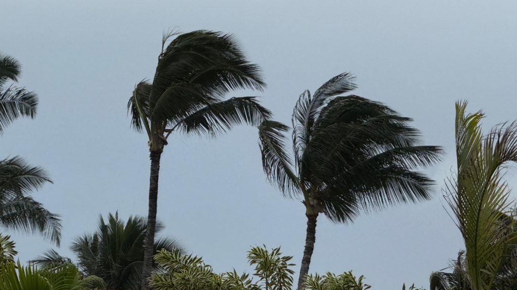
High pressure far northeast will drive trade winds tonight. Wind speeds will taper off through much of this week as remnants of Tropical Cyclone Genevieve linger between the high and Hawaii. Clouds and showers will favor windward and mauka areas, with some enhancement possible for the western half Tuesday through Thursday due to an upper trough setting up to the west.
Discussion
A 1032 mb surface high centered far northeast of Hawaii will drive breezy trade winds tonight. Winds will carry in scattered low clouds and showers focusing across windward slopes. Wind speeds will decline to gentle to moderate through much of the week as remnants of former Tropical Cyclone Genevieve linger between Hawaii and the high pressure system. It is not expected to impact Hawaii aside from the decrease in wind speeds.
Model guidance continue to show an upper level trough near the western end of the state Tuesday through Thursday, which may provide some enhancement of incoming trade wind clouds and showers over the western half of the state. This feature will move north away from the area on Friday. Models are hinting at some incoming tropical moisture along a trough connected to the ITCZ. Trades will push this area of moisture across Big Island and Maui.
Aviation
Generally VFR with slowly weakening but still breezy trade winds. Occasional MVFR ceilings and visibilities in isolated stronger showers mainly over windward and upslope mauka exposures. No AIRMETs currently in effect and none expected.
Marine
A ridge of high pressure north of the state will weaken tonight as a front passes far north of the state. This will allow the trade winds to steadily weaken through Tuesday. Winds should decrease below Small Craft Advisory thresholds by Monday. The current SCA is for the windier waters around Maui County and the Big Island through tonight. Trade winds should restrengthen by the end of the week as a strong high rebuilds far northeast of the state.
Surf along south facing shores will stay below seasonal averages with mainly background energy throughout most of this week. The next small, long period south swell will arrive by Saturday with a slight bump in south shore surf heights through next weekend. A series of south swells are expected the following week (week of Aug 9th), which should produce surf heights at or above seasonal averages.
East facing shores will remain rough and choppy through tonight, but should see a steady decrease as the trade winds weaken into Monday. Small, medium period easterly swell generated from former TC Genevieve will linger over the next few days.
Surf along north facing and west shores will remain flat to tiny through the forecast period except for areas exposed to the easterly trade wrap.
HFO Watches/Warnings/Advisories
Small Craft Advisory until 6 AM HST Monday for Maalaea Bay, Pailolo Channel, Alenuihaha Channel, Big Island Leeward Waters, Big Island Southeast Waters.
Kauai Now Weather is brought to you by Blue Hawaiian Helicopters.
Check out their Kaua‘i Helicopter Tours today!
Data Courtesy of NOAA.gov