


Update at 5:41 p.m. July 25: National Weather Service National Hurricane Center forecasters report in a 5 p.m. July 25 update that Category 2 Hurricane Fausto is holding steady.
The hurricane was about 1,060 miles to the east of Hilo with maximum sustained winds still at 100 mph and continuing to move west at a slightly slower speed than earlier today at 13 mph.
That general motion is still also expected to continue for the next several days as a
strong subtropical ridge remains positioned north of the cyclone storm.
Hurricane force winds now extend outward up to 50 miles from Fausto’s center, with tropical storm force winds now extending up to 185 miles.
Fausto is forecast to weaken as it approaches the vicinity of the Hawaiian Islands early next week, and although confidence is increasing that the strongest winds and heaviest rainfall will remain offshore to the north of the islands.
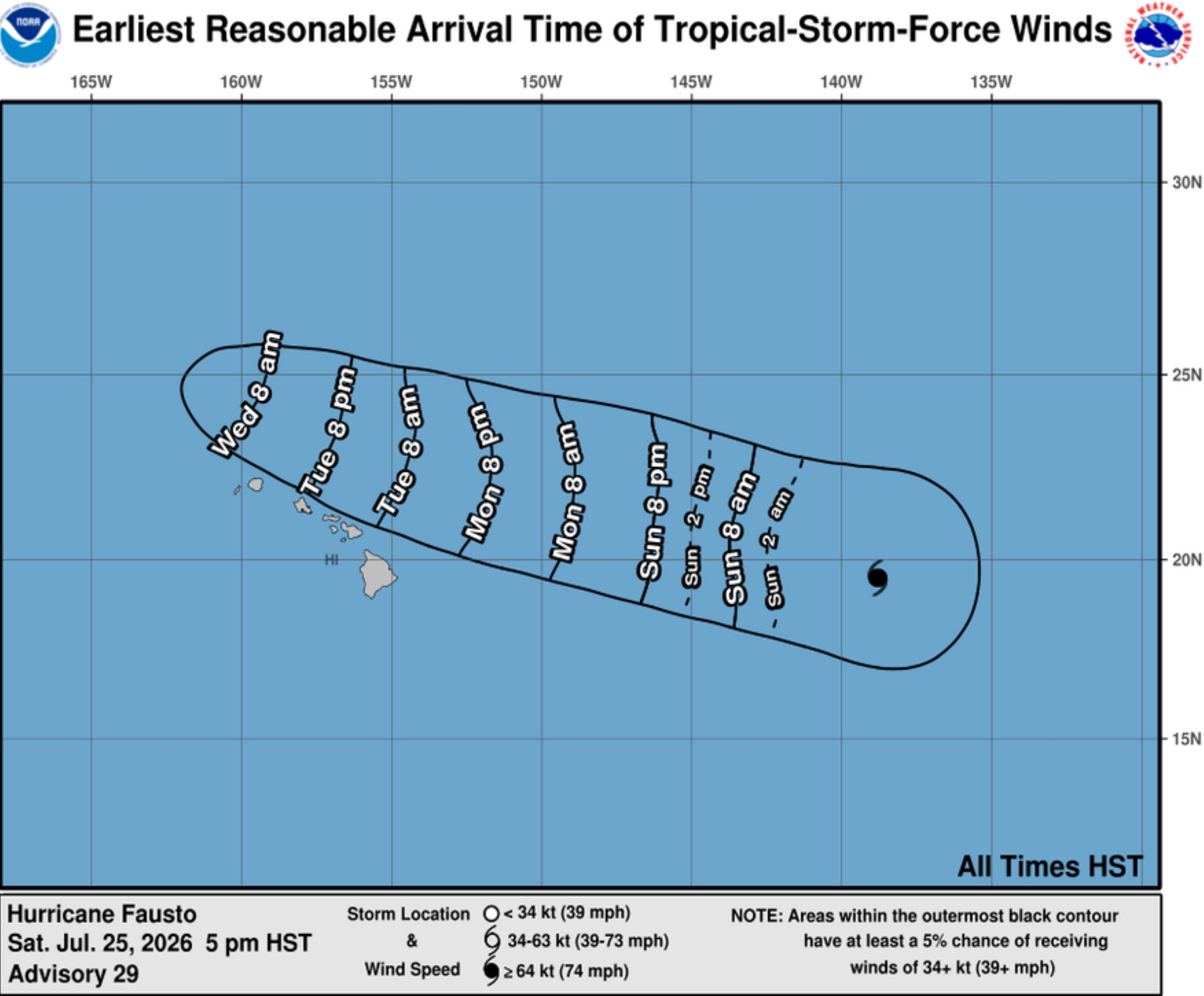
Risk of sustained tropical force winds on land should be low as long as the forecast track stays north of the islands.
However, the public and all stakeholders should continue to monitor the storm’s progress.
There are no coastal watches or warnings in effect related to the hurricane; however, forecasters continue to report that surf from Fausto is expected to being building across eastern shores of the islands — at the eastern end of the state first — July 26 and then spread west Sunday night into July 27.
Surf will continue building through July 28 as the storm approaches and moves into the area.
Swells from Fausto are likely to cause life-threatening surf and rip current conditions along east-facing shores.
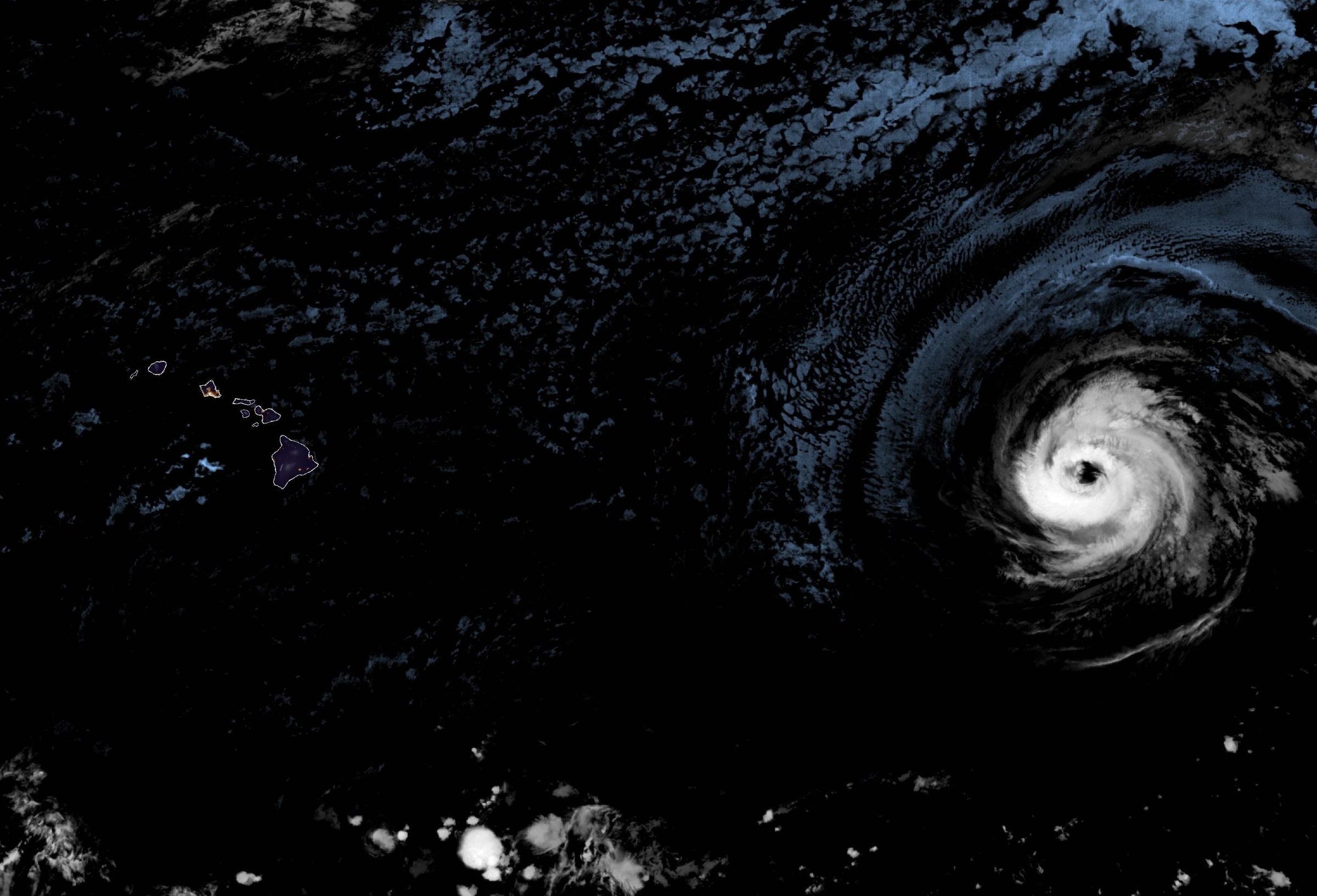
Satellite imagery indicates the hurricane’s overall structure has changed little throughout the past several hours and maintained is convective structure, with a symmetric eyewall and well-established outflow despite the dry environment and occasional dry air intrusion.
The ragged eye, however, recently became obscured by clouds.
National Hurricane Center shows Fausto again nudged slightly northward. The latest track guidance is now in better agreement, with it tightly clustered through the middle portion of next week as the system passes north of the Hawaiian Islands.
Simulated satellite imagery maintains a well-defined cyclone into Sunday before it reaches drier mid-level air over marginal sea-surface temperatures and convection gradually erodes Sunday night into early next week.
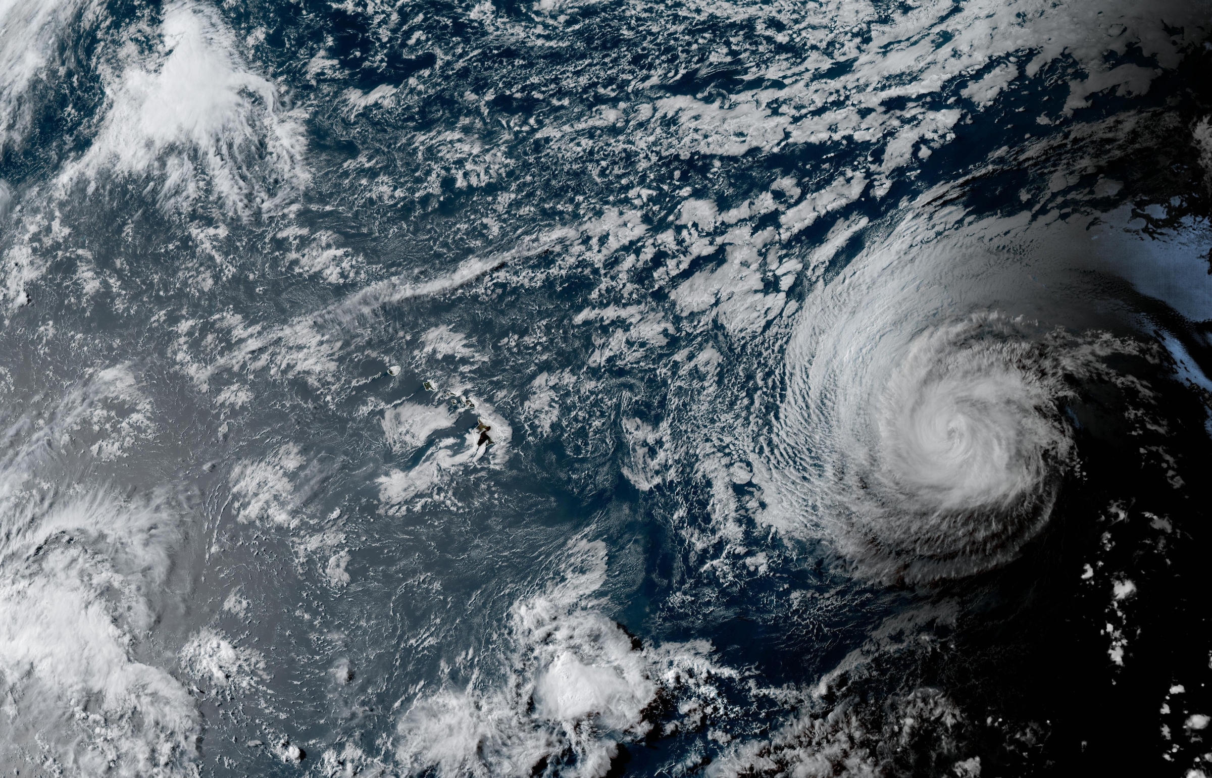
By the time Fausto moves into the vicinity of the Hawaiian Islands, it is forecast to be a weakening tropical storm, with the deepest convection becoming increasingly displaced from the low-level center and strongest winds confined to the northern side of the circulation.
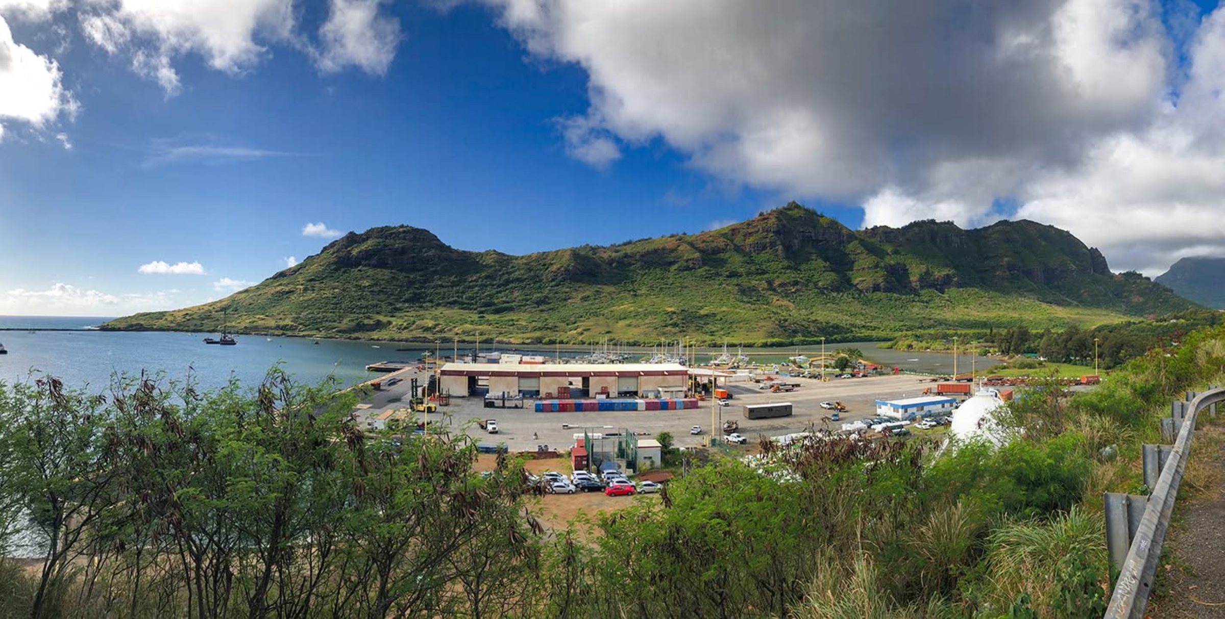
Shipping firm Young Brothers reported Saturday afternoon it has not changed any shipping schedules; however, it does anticipate there could be increased harbor surge caused by Fausto possibly leading to potential delays or impeding the company’s ability to safely berth, ramp or discharge barges.
The shipping company is keeping a close eye on Fausto as the storm continues to move toward the islands.
Update at 9:53 a.m. July 25: National Weather Service forecasters in Honolulu reported July 25 in a morning briefing that confidence is increasing in the track of Hurricane Fausto, which remains a Category 2 hurricane and moves westward at about 14 mph.
But it’s still not a “sure thing,” and they have low confidence of any impacts to Hawai’i.
The one impact forecasters in Honolulu and at National Weather Service National Hurricane Center in Miami agree on is that dangerous — life-threatening — surf will likely begin to swell into the islands by sometimes July 26, well-ahead of any other impacts and the arrival of the hurricane in the area.
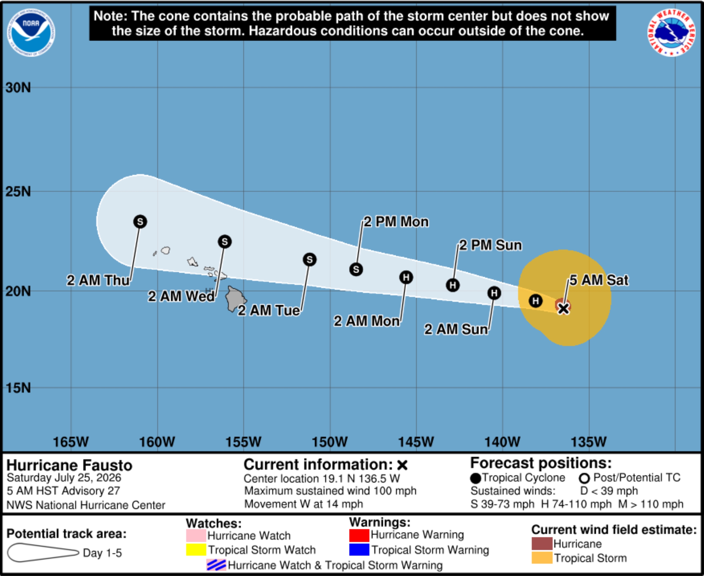
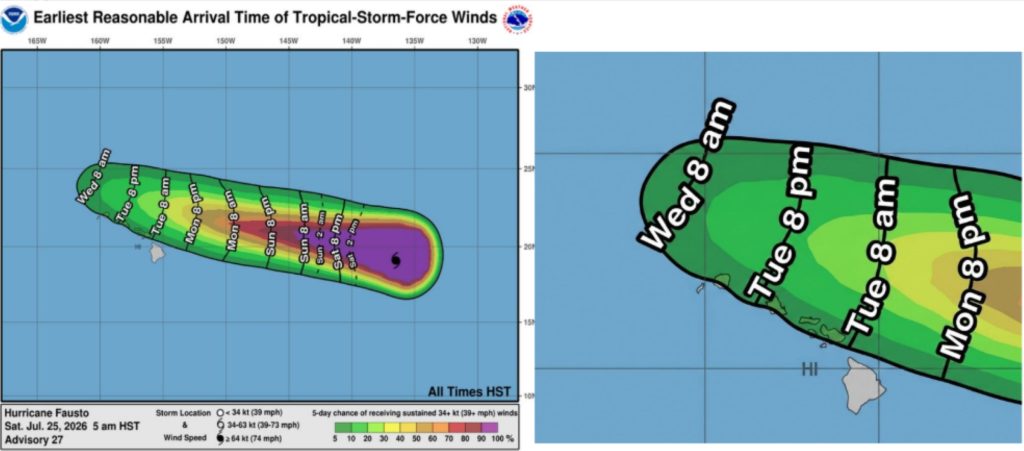
Fausto could bring rain and wind by Tuesday/Wednesday to the islands, but it’s still too early to determine the exact location or magnitude. There’s a 5% to 10% chance of tropical storm force winds reaching the islands — except the Big Island, which has a less than 5% chance.
Windward coastal waters have a 10% to 15% chance of tropical storm force winds.
Hurricane Fausto was about 1,300 miles east of Hilo as of 5 a.m. Saturday, with maximum sustained winds of 100 mph. Hurricane force winds extend outward up to 40 miles from the storm’s center, and tropical storm force winds extend up to 205 miles.
The storm will continue to move generally westward, with a slight northerly motion during the next several days. Fausto is also near its peak intensity and expected to weaken to a tropical storm before approaching the Hawaiian Islands.
Fausto will run into cooler water and drier air — along with more wind shear — during the next few days, all of which will help to weaken the storm.
Honolulu forecasters reiterated that east shores will likely begin to see dangerous high surf building the night of July 26 into July 27 along east-facing shores.
National Weather Service National Hurricane Center reported earlier Saturday morning that surf generated by Fausto is still expected to begin building Sunday across east-facing shores of the eastern end of the state, spreading westward Sunday night into Monday, and continue building through Tuesday as the storm approaches and moves into the area.
“These swells are likely to cause life-threatening surf and rip current conditions,” said the latest advisory.
 Earliest arrival of tropical storm force winds to the Hawaiian Islands. (Courtesy graphic: National Weather Service in Honolulu)
- A different National Weather Service satellite image of Category 2 Hurricane Fausto and its location as well as intensity from earlier the morning of July 25. 2026.
- National Weather Service Satellite image of Category 2 Hurricane Fausto from earlier the morning of July 25. 2026.
- Here is the 7-day graphical tropical weather outlook from the National Weather Service in Honolulu.
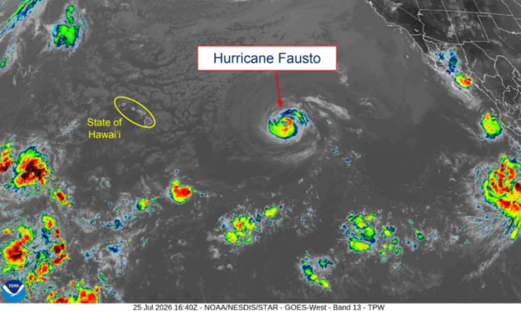
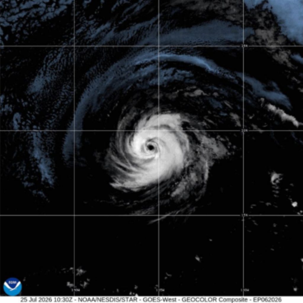
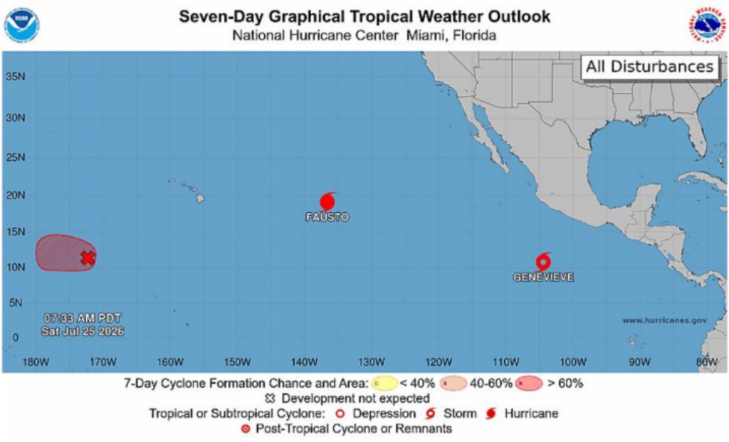
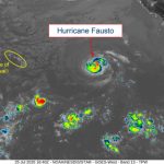
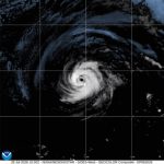
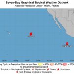
This is the first tropical cyclone of the 2026 Central Pacific Basin hurricane season. Regardless of potential impacts, forecasters in Honolulu said it is crucial that the public prepare.
They said Fausto is a reminder to review and practice emergency plans and offered several preparation pointers:
- Check your emergency kits and fill up on supplies — 14 days of food, water and medication.
- Check in with family and friends: how you will get in contact and where you will go during an emergency or evacuation?
- Know your zone: check if you are in a flood prone area or exposed to strong winds
- Prepare your home: trim trees, clean gutters, seal gaps, bring in loose outdoor items.
- Check insurance policy and have information handy.
A high surf advisory for south-facing shores of the entire state — unrelated to Fausto — also was extended again until 6 a.m. Sunday, with large breaking waves of 7 to 10 feet and strong currents continuing to make swimming and other recreational ocean activities along those shores dangerous.
National Weather Service forecasters in Honolulu said the current south-southwest swell that triggered the initial high surf advisory toward the end of this week is on a gradual decline.
However, an overlapping pulse of south-southwest swell is expected to push south shore surf again to advisory levels by midday Saturday through at least tonight — and possibly through Sunday.
Original story posted at 3:07 a.m. July 25, 2026: U.S. Coast Guard set Port Heavy Weather Condition Whiskey for all commercial ports throughout Hawaiʻi, effective at 8 p.m. July 24 because of expected gale force winds generated by Hurricane Fausto possible within the next 3 days.
Although Fausto is expected to weaken as it approaches the Hawaiian Islands early next week, National Weather Service National Hurricane Center forecasters continue to be uncertain about its exact track and intensity.
Confidence is high, however, that swells generated by Fausto will reach Hawaiʻi by July 26, well in advance of the storm, likely causing life-threatening surf and rip current conditions.
Fausto had weakened slightly by 11 p.m. Friday as it continues its westward trek toward Hawaiʻi.
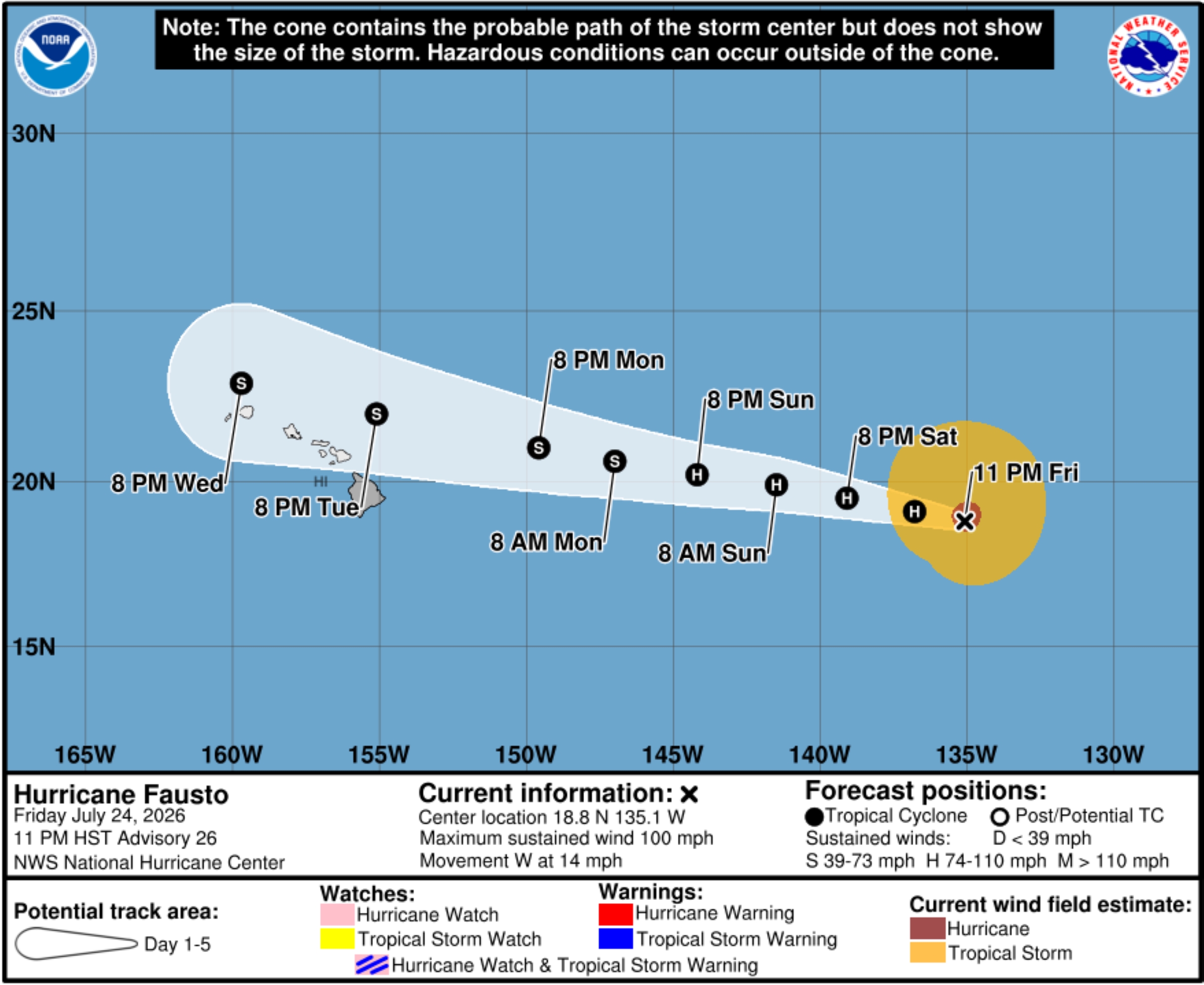
The hurricane was exhibiting maximum winds of 100 mph and was about 1,305 miles east of Hilo. Hurricane force winds extended up to 45 miles outward from the storm’s center, while tropical storm force winds extended up to 205 miles from its center.
Fausto had sustained winds of 105 mph Friday morning.
The hurricane continues to move west at about 14 mph, which forecasters expect to hold for the next several days.
Surf is expected to begin building across east-facing shores of the eastern end of the state Sunday, spreading westward Sunday night into Monday, and continue building through Tuesday as Fausto approaches and moves into the area.
There are no coastal watches or warnings in effect yet, however, but the public and all other stakeholders in Hawaiʻi should continue to monitor the hurricane’s progress.
Current forecast models brings the center just north of the islands, but a track farther south would result in a greater risk of stronger winds and heavier rainfall.
Satellite imagery at 11 p.m. Friday indicated Fausto’s overall structure has changed little during the past several hours. However, intermittent intrusions of mid-level dry air began to erode the deep convection over the northwestern quadrant and eyewall.
Despite these fluctuations and lowered intensity, Fausto continues to maintain a well-defined eye and well-established upper-level outflow.
A strong subtropical ridge is forecast to remain positioned north of Fausto, steering the cyclone generally westward during the next several days. The latest track guidance remains tightly clustered through about the next 4 days, with somewhat greater spread developing thereafter as the system passes just north of the main Hawaiian Islands.
Although the current forecast brings Fausto just north of the Hawaiian Islands during the July 28-29 time frame, the islands remain well within the typical day 4 to 5 track error envelope.
The hurricane is expected to remain well-organized through much of July 25 while moving over warm waters. Thereafter, progressively cooler sea surface temperatures, a drier surrounding environment and increasing westerly vertical wind shear by early next week should result in continued weakening.
By the time Fausto approaches the Hawaiian Islands, it is forecast to be a weakening tropical storm, with the deepest convection becoming increasingly displaced from the low-level center.
During U.S. Coast Guard Port Heavy Weather Condition Whiskey, port facilities are open to all commercial traffic and all transfer operations can continue, however:
- All pleasure craft shall seek sheltered waters.
- Operators of vessels 200 gross tons and greater should plan to depart port. The ports captain might direct departures to reduce the number of vessels in port.
- Vessels that desire to remain in port must submit a safe mooring plan and receive written permission from the ports captain and Hawaiʻi Department of Transportation Harbors Division.
- Requests should be submitted immediately. Requests received after Port Condition X-Ray might not be considered. Send requests to D14-DG-SH-SecHono-MTSRU@uscg.mil and HawaiiDistrict.heavyweather.request@hawaii.gov.
- Vessels transiting within the vicinity of the Hawaiian Islands should seek sheltered waters and anticipate additional restrictions and possible port closures as conditions progress.
- The ports captain can restrict operations of or deny port entry to vessels transporting oil or certain hazardous materials.
- If and when Port Condition Yankee is set because sustained tropical storm force winds of 39 mph are expected within 24 hours, ports are closed to incoming traffic without specific approval from the ports captain.
“Our community knows how quickly conditions can change on our island, and we have seen time-and-again that the families who stay informed and prepare early are the ones who weather these events best,” said Kauaʻi County Mayor Derek Kawakami on Friday. “Right now there is no immediate threat to Kauaʻi, and we are not asking anyone to be alarmed.”
However, Kawakami is asking everyone on Kauaʻi to be prepared.
Officials encourage every household to:
- Maintain a 14-day supply of food, water, medication and other essentials.
- Prepare a portable disaster supply “go kit.”
- Keep important documents in a waterproof container.
- Understand the hazards that could affect their home or neighborhood.
- Review potential refuge options.
- Make arrangements in advance for pets, kūpuna and family members with access or functional needs.
U.S. Coast Guard also advises the public to:
- Stay off the water. The Coast Guard’s search-and-rescue capabilities degrade as storm conditions strengthen. This means help could be delayed. Boaters should heed weather watches, warnings and small craft advisories.
- Secure belongings. Owners of large boats are urged to move their vessels to inland marinas, where they will be less vulnerable to breaking free of their moorings or sustaining damage. Trailerable boats should be pulled from the water and stored in a place not prone to flooding. Those leaving boats in the water are reminded to update their beacon’s registration and secure all devices safely to their vessel prior to a major storm. Ensure life rings, life jackets, and small boats are secured.
- Stay clear of beaches. Wave heights and currents typically increase before a storm makes landfall. Swimmers should stay clear of beaches until local lifeguards and law enforcement officials say the water is safe.
- Stay informed. The public should monitor the progress and strength of the storm through local television, radio and internet. Mariners should monitor VHF-FM Channels 16 and 22A for broadcast notice to mariners and watch for updates via email. Monitor the U.S. Coast Guard Navigation Center website for up-to-date port status information.
Contact the Maritime Transportation System Recovery Unit via email at D14-DG-SH-SecHono-MTSRU@uscg.mil or U.S. Coast Guard Sector Honolulu Command Center at 1-800-552 6458 for additional information about port services and closings.
A high surf advisory for south-facing shores of the entire state — unrelated to Fausto — also was extended until 6 p.m. Saturday as a long-period south-southwest swell continues to produce advisory level surf along those shores.
National Weather Service forecasters in Honolulu said the swell was expected to decline overnight Friday into Satuday, but a reinforcing pulse of long-period south-southwest energy is expected to bring surf back to advisory level by Saturday afternoon and possibly continuing through the weekend.
Additional updates will be provided as Fausto continues to spin toward Hawai‘i.

