

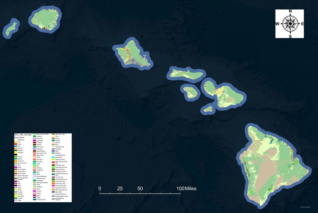
Newly released agriculture maps of the state of Hawaiʻi are expected to improve monitoring of crop diversity, evaluate land-use changes, and design programs that support food security and sustainable agriculture.
The new resource also can aid in post-fire disaster assessments and soon could help better evaluate wildfire risks before a major disaster occurs, such as the 2023 Maui wildfires.
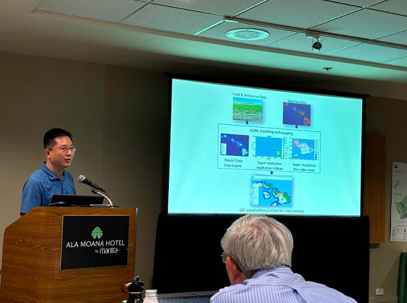
Project Director Qi Chen, professor in the Department of Geography and Environment at the University of Hawaiʻi at Mānoa, released the high-resolution, crop-specific dataset maps.
They are publicly available through National Agricultural Statistics Service’s geospatial portals, CroplandCROS and AgriWatch.
The University of Hawaiʻi at Mānoa collaborated with National Agricultural Statistics Service to develop the maps called the Hawaiʻi Cropland Data Layer using Google Earth Engine and Google’s DeepMind AI-powered data.
Hawaiʻi previously lacked annual agricultural maps, which hinder efforts to track crops, assess land use, and support food security, Chen said.
After the 2023 Maui wildfires, agencies were unable to quickly quantify the extent of cropland loss, identify which crops were most affected or prioritize recovery resources because they did not have up-to-date, field-scale crop maps, Chen said.
“Instead, assessments had to be pieced together from outdated maps, secondary sources and on-the-ground reports, delaying an accurate picture of the disaster’s effect on Hawaiʻi’s agricultural sector,” Chen said.
Developing such maps for Hawaiʻi is critical due to the state’s unique agricultural landscape. Unlike large-scale monocultures common on the U.S. mainland, Hawaiʻi’s farms are often small, fragmented, and characterized by diverse crops grown side by side.
“While it makes mapping more difficult, it also means that accurate, high-resolution crop maps can provide transformative insights into resource allocation, irrigation planning, invasive species management and resilience to environmental change,” said Zhe Li, project co-director and geographer with the U.S. Department of Agriculture.
Li added that since annual crop maps for Hawaiʻi are now available, they can be integrated with real-time satellite data on weather, drought and wildfire risk to safeguard agricultural production.
“Consider a situation similar to the 2023 Maui wildfires: If high-resolution crop maps had been in place, emergency managers could have quickly overlaid fire perimeters with known crop locations to estimate economic losses and identify which producers needed the most help and immediate support,” Chen said.
The same maps also can be used proactively to identify cropland areas that are most vulnerable to drought or invasive species. Agencies then can direct irrigation resources, extension services or pest management programs to the farmers who need them most.
Other members of the research team include Noa Lincoln, a researcher in the Department of Tropical Plant and Soil Sciences in UH Mānoa’s College of Tropical Agriculture and Human Resilience; Zhengwei Yang, geographer with the USDA; Haonan Chen, associate professor of electrical and computer engineering at Colorado State University; and Changyong Cao, chief of NOAA’s Satellite Calibration and Data Assimilation Branch in the Satellite Meteorology and Climatology Division.
This project was supported by a $268,472 grant from the U.S. Department of Agriculture, and maps are currently available for 2024 and 2023. The Hawaiʻi Cropland Data Layer for the 2025 crop year will be released in February 2026.
