

Powerful quake east of Russia results in no tsunami threat for Hawai‘i less than hour after watch issued
Hawai’i was briefly under the threat of a possible tsunami — based on available data being investigated by forecasters in Honolulu at the time — on July 19, with a tsunami watch issued just after 9 p.m. following a large earthquake that struck off the eastern coast of Russia in the northern Pacific Ocean.
But within less than an hour, the National Weather Service Pacific Tsunami Warning Center said there was no threat and canceled the watch.
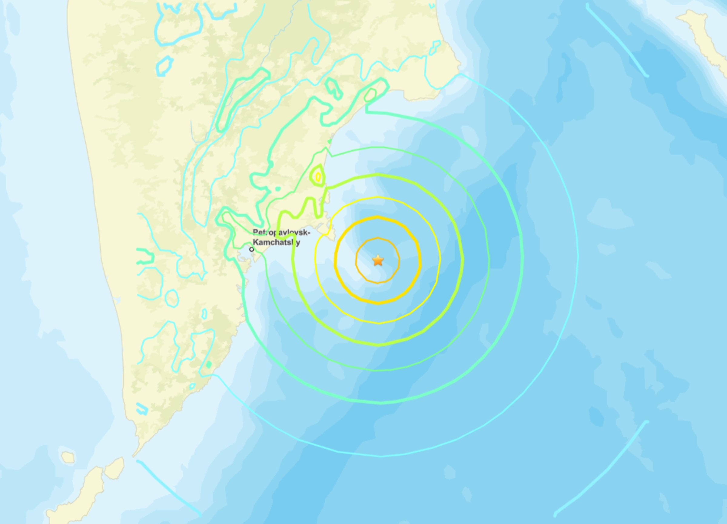
The warning center in Honolulu issued the tsunami watch for Hawai‘i following what at first was recorded as a 7.5-magnitude earthquake reported at 8:49 p.m. located 89.5 miles east of Petropavlovsk-Kamchatsky, Russia.
Forecasters issued the watch because available data at the time indicated there might be the threat of a possible destructive tsunami generated by the quake off the east coast of Kamchatka, Russia, that could impact coastal areas even far away from its epicenter.
Further updates were planned for every hour — or as conditions warranted — until the threat passed.
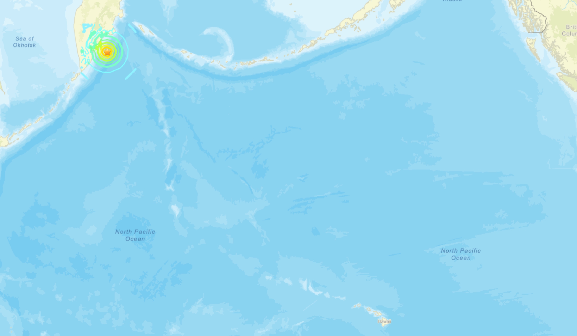
If one of the terrible series of large ocean waves was heading toward Hawai‘i, the earliest estimated time of arrival would have been about 5 hours and 40 minutes after the watch was issued, at 2:43 a.m. July 20.
It took forecasters less than an hour, however, to pour over the data and determine whether there was a tsunami threat to the islands.
Pacific Tsunami Warning Center sent out a new notification at 9:42 p.m. declaring the tsunami watch canceled and with a slightly downgraded magnitude for the earthquake of 7.4.
“Based on all available data, there is no tsunami threat to the state of Hawai‘i,” the agency said in its later notification. “This will be the final message issued for this event unless additional data are received.”
After people began to realize there no longer was a threat, a giant sigh of relief washed over social media, with many thanking God or “the Lord” and saying amen for the good news. There was at least one “Hallelujah.”
“[Watch] has been cancelled,” replied Judy Kelley to her own post in the Everything Kaua‘i group on Facebook. “Relax. Enjoy your Mai Tai.”
U.S. Geological Survey explained that the 7.4-magnitude quake occurred as the result of reverse faulting at a depth of about 12 miles.
At the location of this earthquake, the Pacific plate is moving west-northwest with respect to the North America plate at about 3 inches per year.
Note: The North America plate extends westward beyond the North American continent. The earthquake’s location and sense of motion is consistent with the faulting on the subduction zone plate interface of the Kuril-Kamchatka Arc.
While commonly plotted as points on maps, earthquakes of this size are more appropriately described as slips over a larger fault area.
The Kuril-Kamchatka arc has frequent moderate to large earthquakes and has hosted 29 additional 6.5-magnitude or above events within about 155 miles of the July 19 earthquake throughout the preceding century.
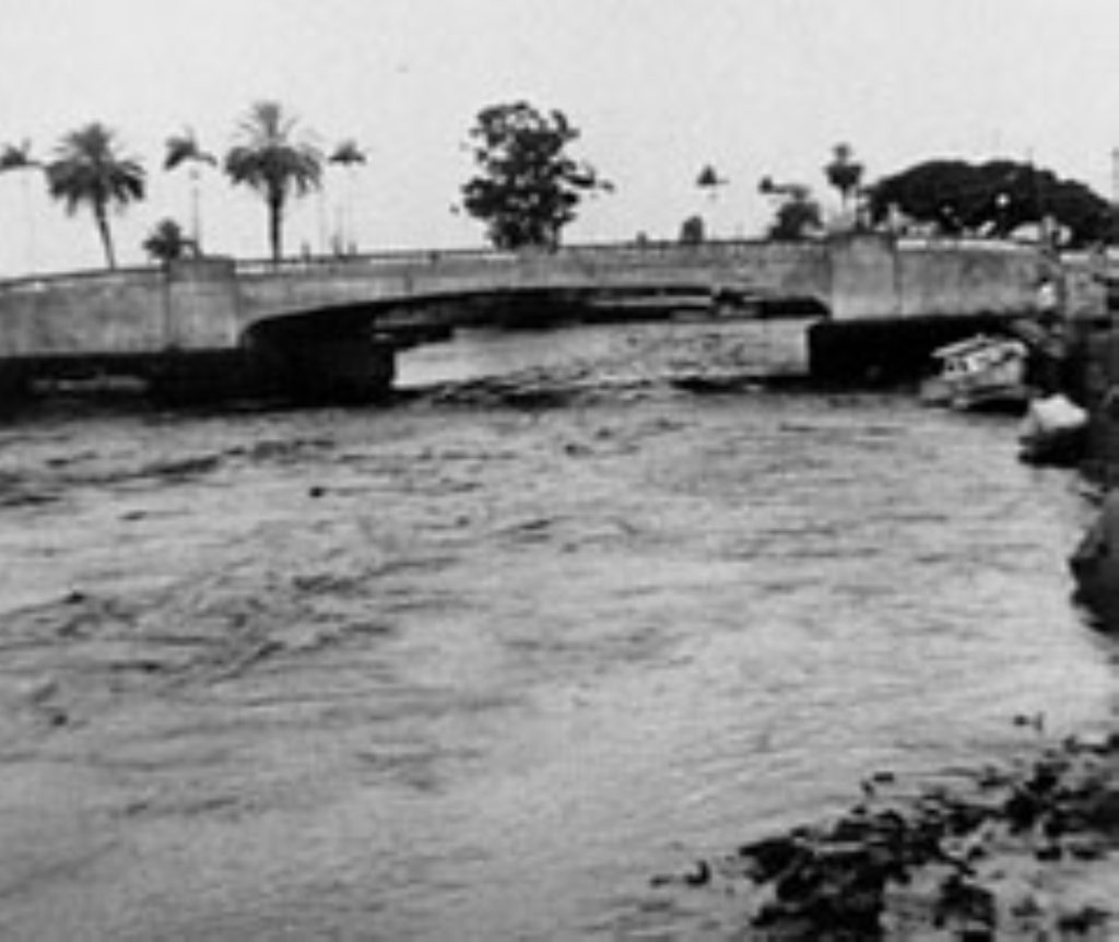
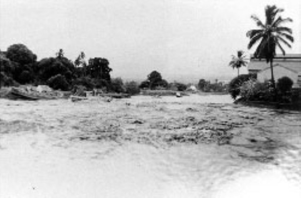
A magnitude-9 Kamchatka earthquake in November 1952 resulted in a destructive Pacific-wide tsunami that reached the shores of Hawai‘i, causing damage on the Big Island and elsewhere.
Information from University of Washington College of the Environment Department of Earth and Space Sciences shows tsunami waves destroyed boats, knocked down telephone lines, destroyed piers, scoured beaches and flooded lawns in 1952.
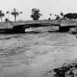
A small bridge connecting Cocoanut Island to the shore at Hilo Bay was destroyed by a wave when it was lifted off its foundation and smashed down when water swept in with a runup of 12 feet.
Elsewhere around Hilo Bay — which recorded the highest levels of runup from the 1952 tsunami generated by the magnitude-9 Kamchatka quake — water levels could have gotten as high as 11.5 feet. The water level rose to 11 feet at Reed’s Bay.
The July 19 temblor struck roughly 45 miles northeast from the 1952 quake’s epicenter.
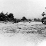
 Wailoa River in Hilo recedes in November 1952 because of a tsunami generated by a magnitude-9 earthquake that happened east of Kamchatka, Russia, that left boats stranded. (Photo Courtesy: Pacific Tsunami Museum/Fujii Collection)
- Wailoa River in Hilo recedes in November 1952 because of a tsunami generated by a magnitude-9 earthquake that happened east of Kamchatka, Russia, that left boats stranded. (Photo Courtesy: Pacific Tsunami Museum/Fujii Collection)
Some on social media said it’s still important to be vigilant regardless if there is no longer a threat of tsunami waves striking Hawai‘i shores.
“Just FYI,” replied Rob Jr. See to a Facebook post by Dane DuPont in the Hawai‘i Tracker group letting people know the tsunami watch was canceled. “I’ve been through a lot of watches and warnings. The surge still exists. I’ve seen many pulled out to sea because of this. Stay vigilant. Don’t be stupid and think you’re invincible while picking ʻopihi or diving during this time.”
A member of a private Hawaiian Paradise Park group on Facebook informed people the watch was canceled, but encouraged everyone to “feel free to sleep with surfboard tonite for extra precaution.”
The U.S. Geological Survey showed at least an additional nine earthquakes, aftershocks, of magnitude-5 or above — one magnitude-6.6 and another magnitude 6.7 — had followed the 7.4-magnitude monster that caused the tsunami excitement.
Adding in quakes of magnitude-4 or above, there were 15 more strong shakers before this story was published.
Visit the National Weather Service Honolulu forecast office website or call the automated weather line at 808-245-6001 for weather updates
Visit the Pacific Tsunami Warning Center website for additional tsunami information.
Sponsored Content
