


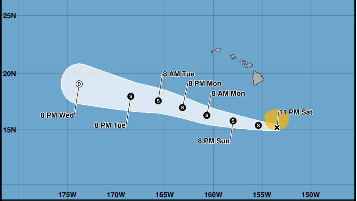
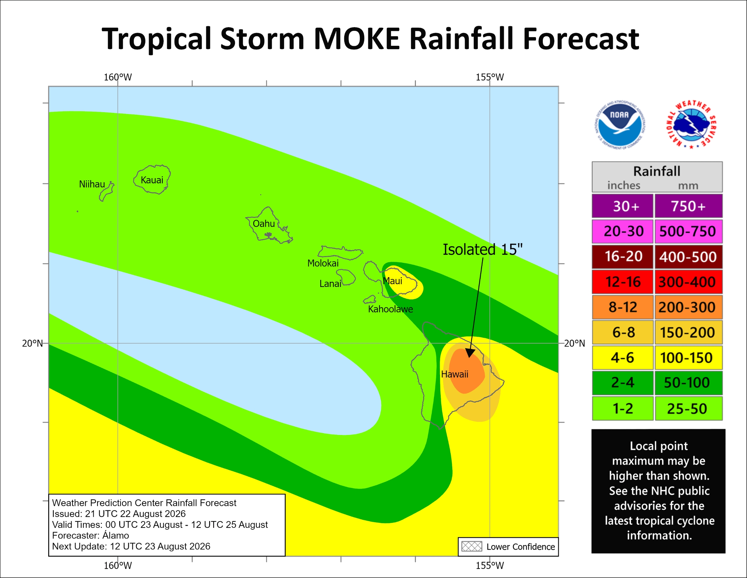
The Big Island was holding its breath late Saturday night as Tropical Storm Moke continued its approach toward the state, with its center still expected to pass south of the island Sunday but not before dumping 5 to 10 inches of rain, and possibly up to 15 inches in some areas, many of which were hit hard just a week ago by Hurricane Lala.
Meanwhile, possible rainfall totals of 3 to 6 inches are expected over eastern Maui and up to 1 to 2 inches for western Maui and the remainder of the state, including Kauaʻi, as rains from Moke spread west across the islands while the storm continues to draw moisture northward while passing well south by early this week.
Moke was holding steady as of the Central Pacific Hurricane Center’s last Saturday update at 11 p.m., with maximum winds consistent at 45 mph and still moving west, now at about 12 mph.
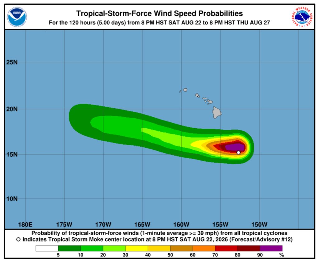
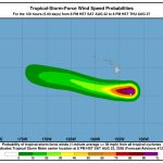
The storm was about 330 miles south-southeast of Hilo, with tropical storm force winds extending up to 115 miles outward from its center.
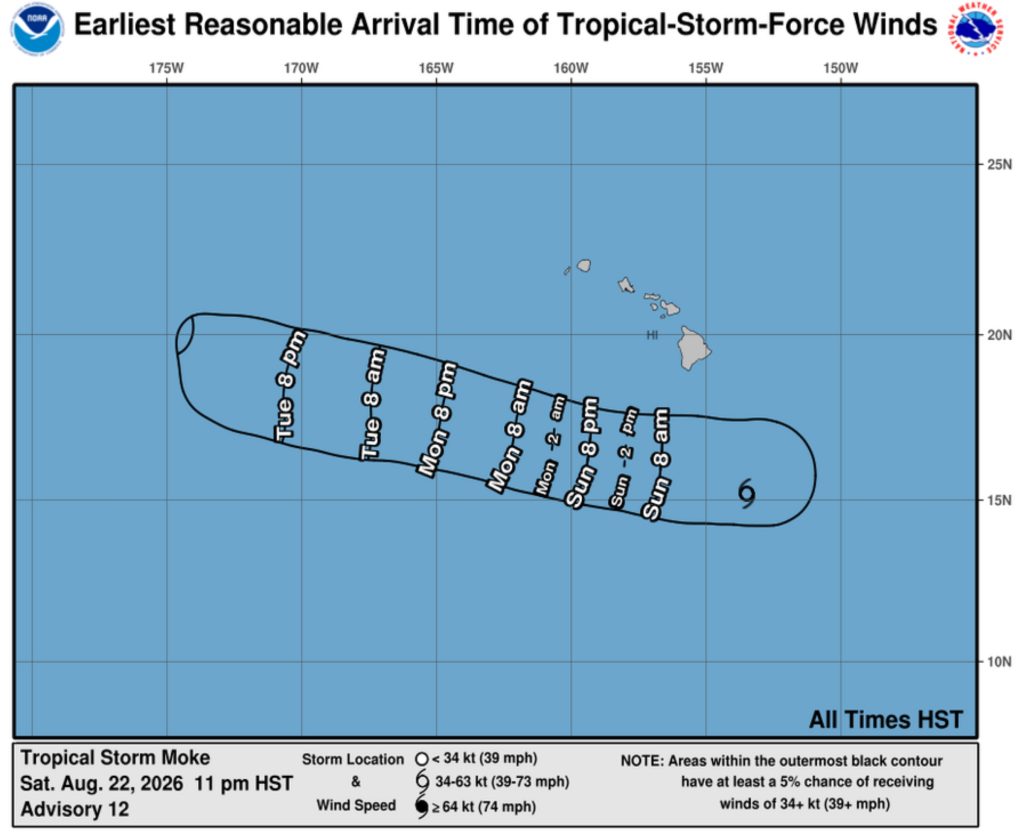
Heavy rainfall associated with the tropical storm is forecast to begin impacting the Big Island early Sunday morning as the storm passes a couple of hundred miles to the south.
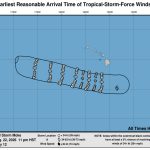
The forecast track has it already around the southern portion of the island by 8 a.m. today and then passing well south of the smaller main Hawaiian Islands thereafter.

Despite Moke’s center remaining south of the Hawaiian Islands, it is forecast to pass close enough to produce gusty enhanced trade winds caused by a tight pressure gradient that will impact higher elevations and locations downslope on the Big Island.
It will also produce those previously discussed heavy rains during the next couple of days, which could cause life-threatening flooding and even mudslides for windward and southeast areas of the island, especially locations with steep terrain and already saturated soil.
That includes parts of the Big Island devastated by Lala, such as Nāʻālehu, Pāhala and Waiʻōhinu.
A flood watch is in effect through Monday for the island, plus a wind advisory — mainly for leeward locations in the north, south and southeast areas of the island — also remains in effect.
A general west-northwestward motion is expected to continue during the next several days as Moke is steered by a strong low- to mid-level ridge that remains to the north.
Little change in strength is expected overnight before a gradual weakening trend is forecast to begin today.
Moke likely peaked in intensity Saturday. An increasingly dry and stable surrounding environment should limit any chances for additional strengthening.
“Thereafter, increasing vertical wind shear and continued entrainment of dry air should cause Moke to weaken further through early next week,” said the 11 p.m. advisory, adding the tropical storm becoming largely devoid of deep convection and possibly weakening to a remnant low pressure system by as early as Wednesday and then dissipate.
The next complete advisory/update from the Central Pacific Hurricane Center is scheduled for 5 a.m. today.
“State and county teams are ready to respond and I urge everyone to remain alert, follow official updates and avoid unnecessary risks as the storm passes,” said Hawaiʻi Gov. Josh Green on Saturday in a state release.
No closures of state parks or camping areas are anticipated on the Garden Isle because of Tropical Storm Moke.
Small boat harbors and their restrooms remain open. Vessel groundings should be immediately reported to the state Division of Boating and Ocean Recreation.
State health officials continue to monitor health and medical operations statewide.
Air medical and ground EMS services are operating normally statewide. Hospitals are operating at normal capacity. The Medical Operations Coordination Center continues to monitor 9-1-1, EMS, air medical services, hospitals and Healthcare Emergency Management Coalition.
 Courtesy Graphic: National Hurricane Center and Central Pacific Hurricane Center website
- Courtesy Graphic: National Hurricane Center and Central Pacific Hurricane Center website
Other state departments as well as University of Hawaiʻi continue closely watching Moke and standing by if their resources are necessary, any closures are issued and if their response is needed for any potential impacts.
The fall semester at all 10 university and community college campuses throughout the state begins Monday.
Check the National Weather Service Honolulu forecast office website for your specific community/area forecast and to stay updated about any other advisories, watches or warnings are issued.

