


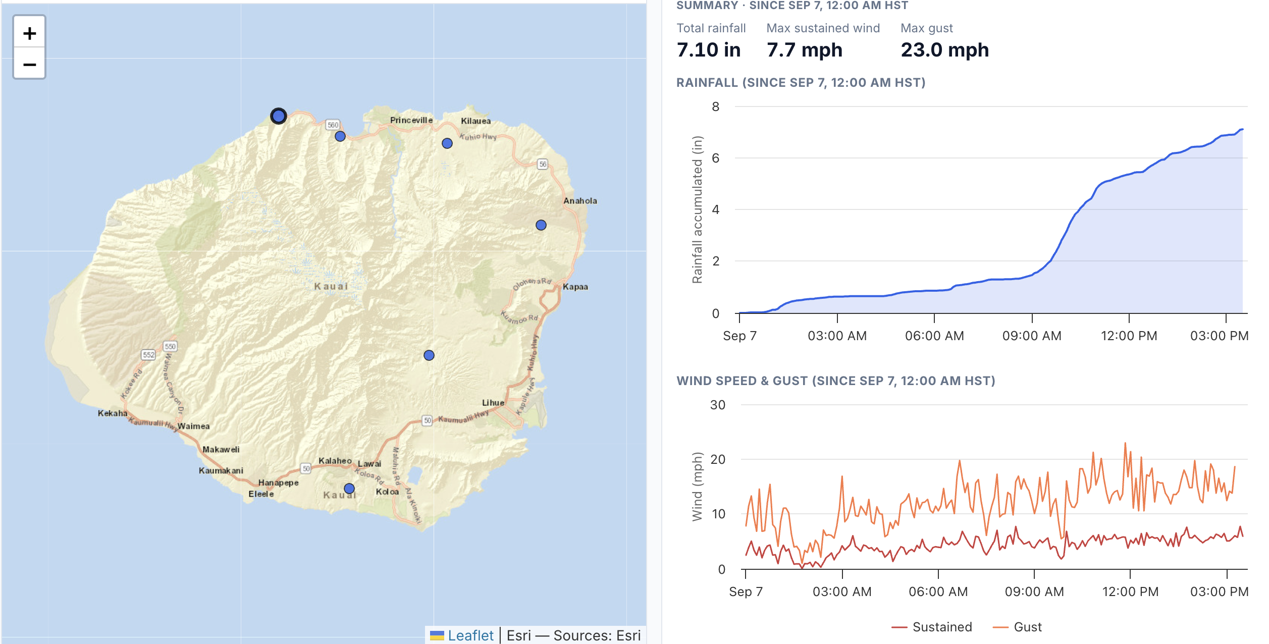
With numerous storm systems affecting the islands this year, a team at the University of Hawaiʻi has created a tracker to provide access to the most recent rainfall and wind speed data.
Hawaiʻi Mesonet, a statewide advanced weather and climate monitoring network, and the Hawaiʻi Climate Data Portal team at the University of Hawaiʻi are utilizing the 75 active Mesonet stations to monitor the heavy rainfall and strong winds that are a major concern across the Hawaiian Islands.
These active stations in the network offer detailed up-to-date information on a wide range of weather variables such as rainfall, air temperature, relative humidity, wind speed and direction, air pressure, and solar radiation. With Hurricane Lowell forecast to make a close approach to Niʻihau and Kauaʻi, the focus is primarily on rainfall and wind speed.
The new website provides up-to-date rainfall accumulation and maximum wind and wind gust speeds at Hawaiʻi Mesonet stations for the period that started at midnight on Monday, Sept. 7. Data is updated every 15 minutes.
“Events like Hurricane Lowell show us how important it is to have a dense network that covers all areas on each island,” said Tom Giambelluca, Hawaiʻi Mesonet project lead. “We urge everyone to pay close attention to updates from the Central Pacific Hurricane Center and warnings issued by the National Weather Service and county (Kauaʻi, Honolulu, Maui, Hawaiʻi) and state emergency management agencies.”
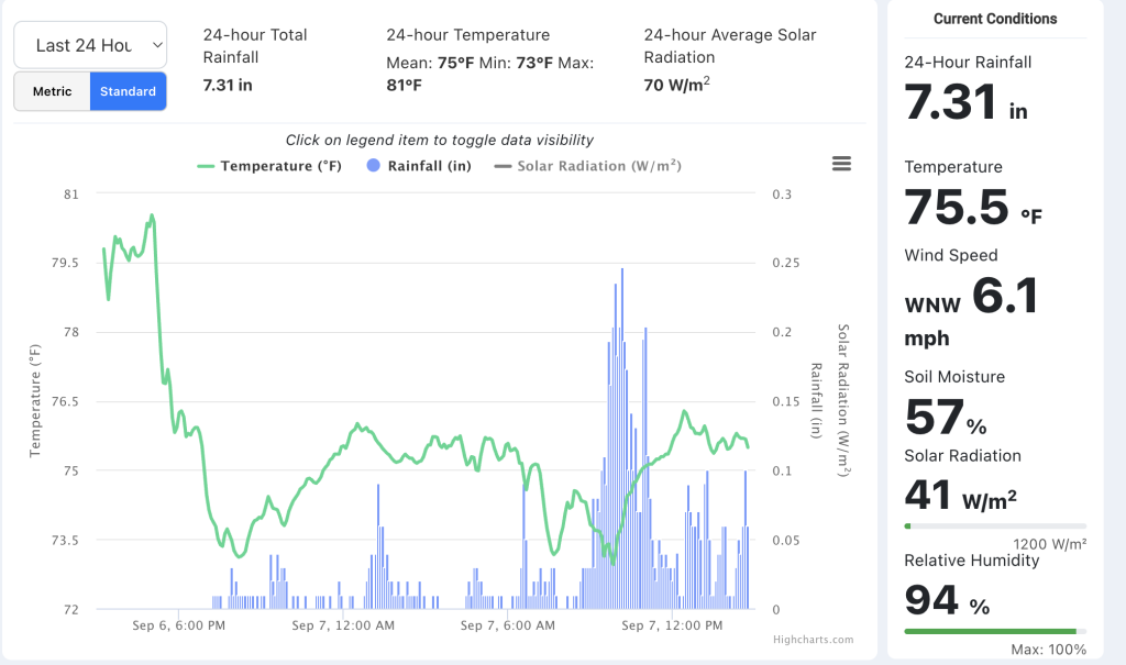
In addition to the new Hurricane Lowell website, the University of Hawaiʻi team provides summaries of recent extreme weather events and maintains a real-time weather dashboard offering public access to live weather data from 75 monitoring stations currently active across the state.
The dashboard updates data every 15 minutes, allowing users to view current, localized conditions including temperature, rainfall, wind, humidity, solar radiation, and soil moisture. This creates one of the most comprehensive and timely weather resources available in Hawaiʻi.

