


National Weather Service and National Hurricane Center are monitoring a new tropical cyclone south of the state, which as of now does not present an immediate threat to the state.
Tropical Storm Lowell as of about 5 a.m. today (Aug. 29) was located about 1,370 miles east-southeast of Hilo, moving west at 8 mph.
Lowell is generating sustained winds of 45 mph, with higher gusts; tropical storm force winds extend outward 70 miles from the storm’s center.
Residents and business are encouraged to review or develop preparedness plans for all tropical cyclones, especially since the outlook for this year’s hurricane season is predicting above average activity in the Central Pacific.
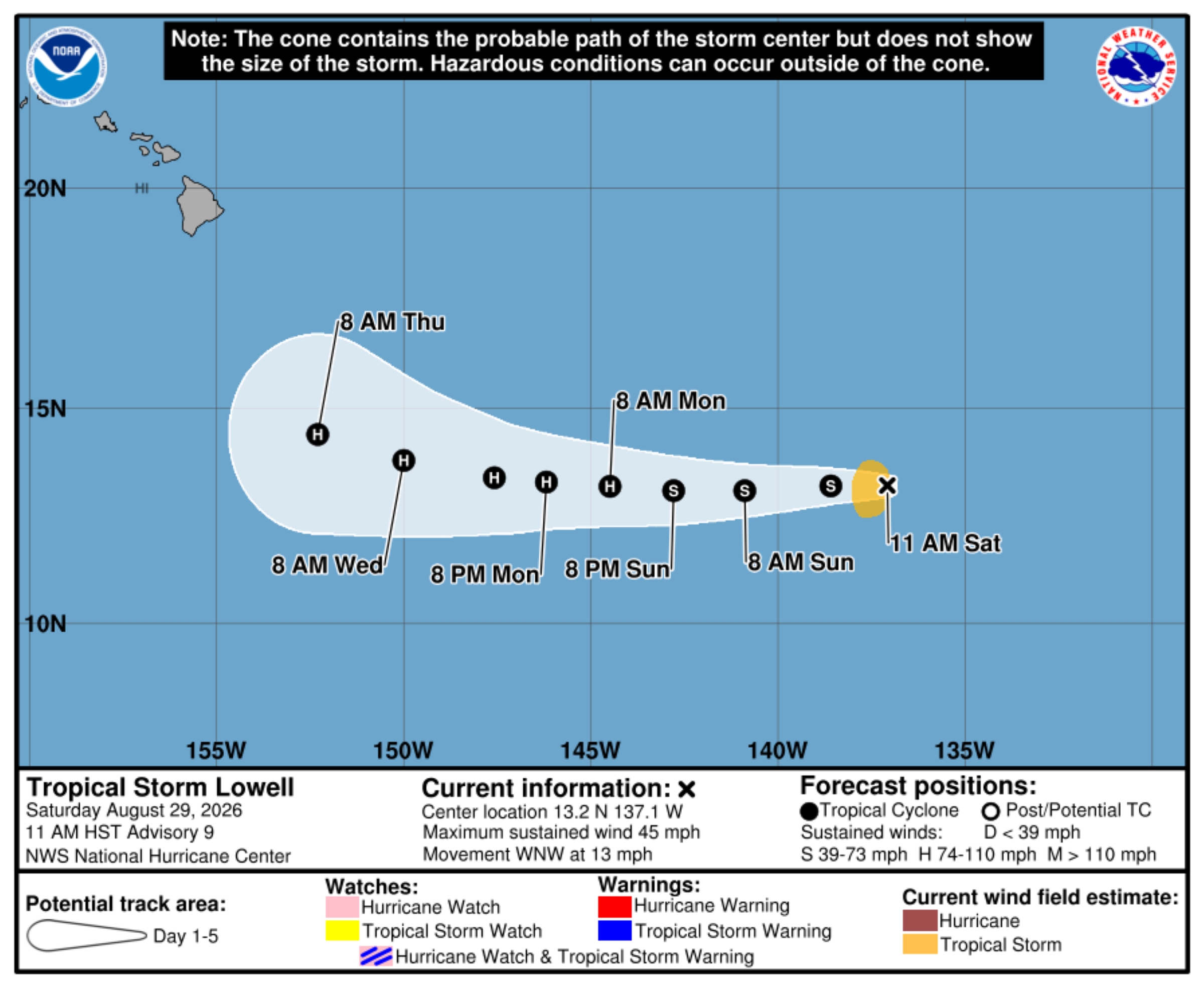
National Hurricane Center forecasters reported in an 11 a.m. Tropical Storm Lowell update Saturday that the storm had jogged west-northwest since earlier that morning and was about 1,275 miles east-southeast of Hilo.
Lowell was moving faster, too, now at 13 mph and continuing on a west-northwest trek. Maximum sustained winds were unchanged, with higher gusts, and tropical storm force winds still extended outward up to 70 miles from the storm’s center.
A westward motion should resume during the next few hours and continue for the next several days.
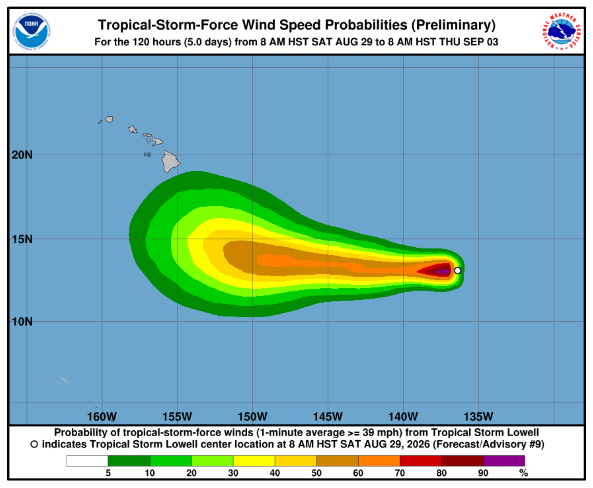
Gradual strengthening is expected during the weekend. Lowell could become a hurricane by Monday or Monday night.
There are no coastal watches or warnings in effect.

