


Updated 6:50 p.m. Saturday, Aug. 22
Tropical Storm Moke weakened slightly Saturday afternoon, now with maximum winds of 45 mph as of the 5 p.m. advisory from Central Pacific Hurricane Center, down from 50 mph as of late morning.
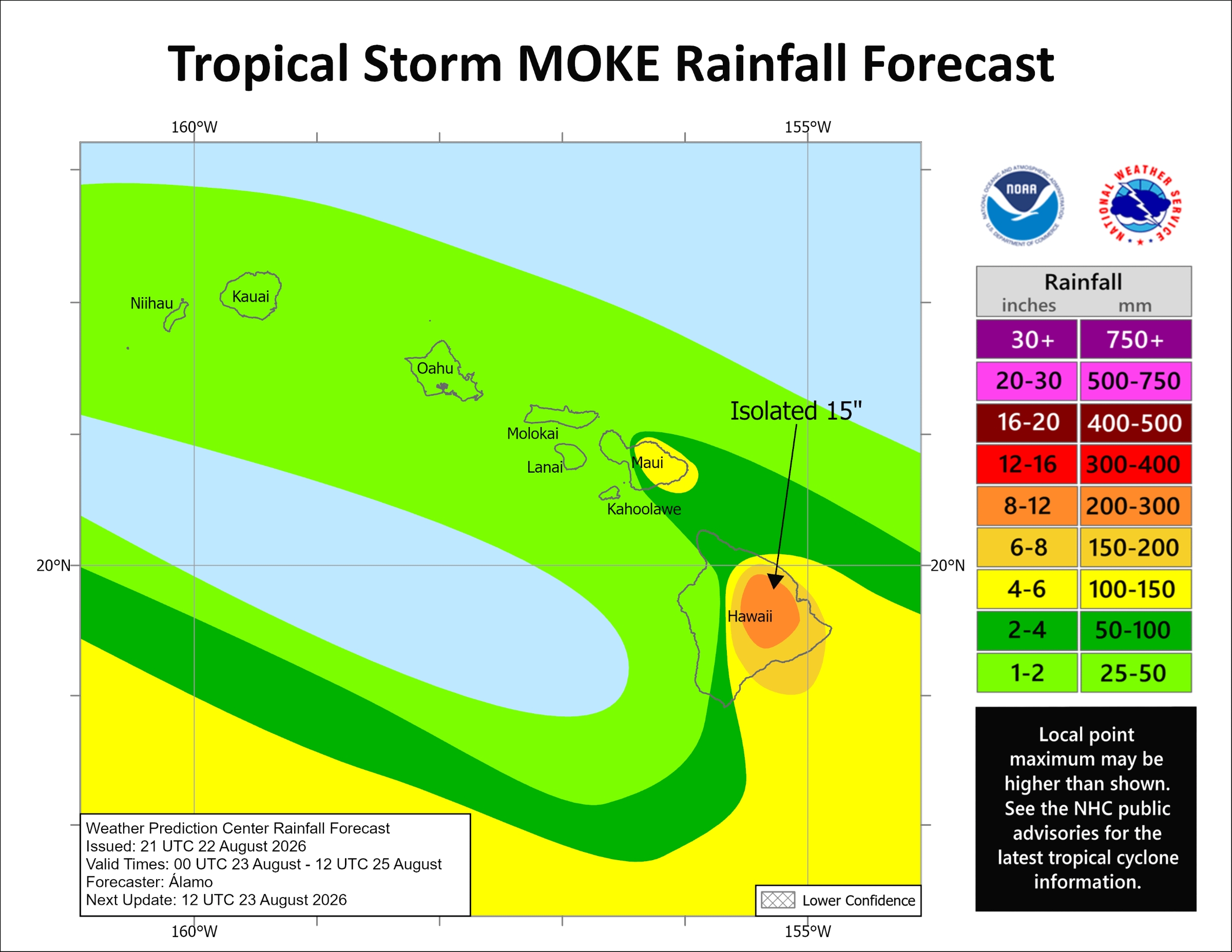
However, while little change in strength is expected tonight and more of a weakening trend to begin Sunday, the threat of 5 to 10 inches of rain, with up to 15 inches in some localized areas, remains for windward and southeast portions of the Big Island.
That heavy rainfall could cause life-threatening flooding and mudslides, especially in areas impacted a week ago by Hurricane Lala.
Strong enhanced trade winds caused by a pressure gradient created by the storm as it passes a couple of hundred miles to the south of the Big Island also remain possible at high terrain and downslope, including many locations still suffering from Lala impacts as well.
The strongest winds will blow tonight through Sunday night from 25 to 35 mph, with gusts up to 55 mph. There is even a chance gusts could approach high wind warning criteria of 58 mph or stronger in the normally windiest spots in leeward Kohala and near South Point.
Areas of concern include Kaʻū, lower Puna, Hāmākua Coast and Kohala.
A flood watch is in effect from midnight Sunday through Monday for the island, plus a wind advisory went into effect at noon today for mainly leeward locations in the north, south and southeast areas of the island.
Windward Maui is forecast to see 2 to 4 inches of rain with locally higher amounts. The rest of the state is still expected to receive about 1 to 2 inches of rain, with some amounts higher in localized areas.
Confidence in the heavy rainfall potential and flooding is highest for the Big Island.
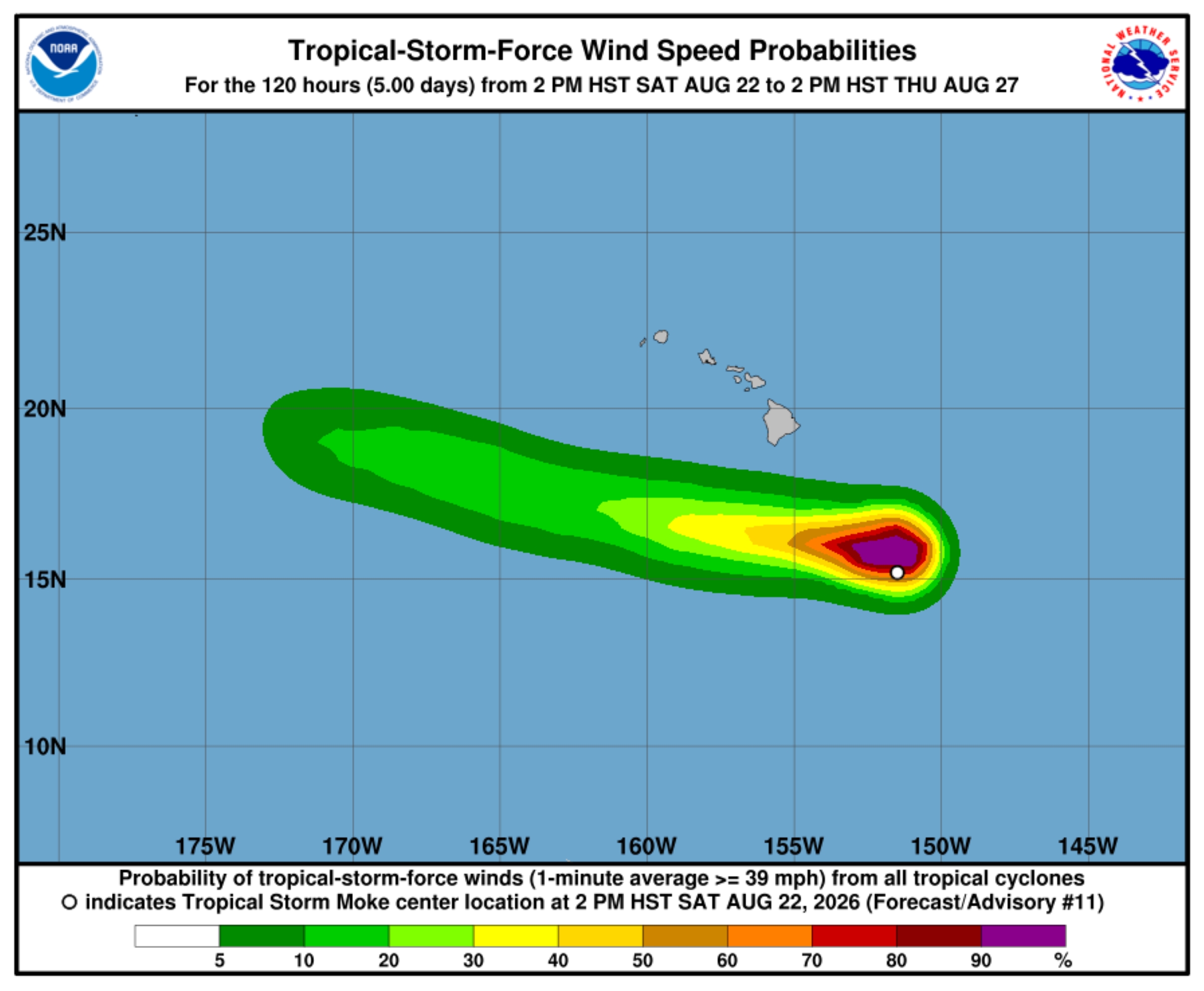
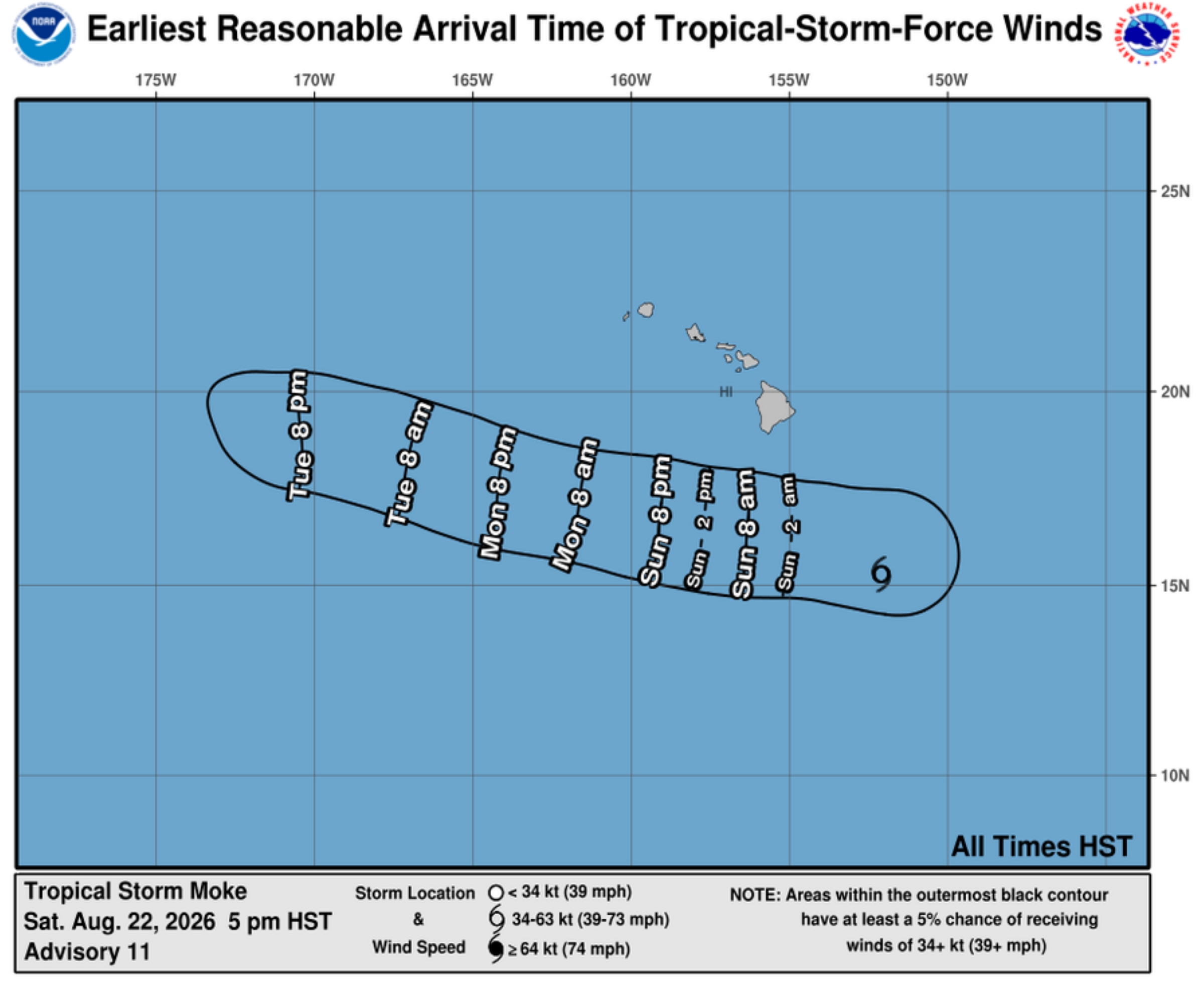
Moke was about 360 miles south-southeast of Hilo as of the 5 p.m. update, moving west at 14 mph. No tropical storm watches or warnings are expected because of the compactness of the storm and how far winds from the storm itself will stay south of the islands.
That general motion is expected during the next several days, with the storm’s center expected to pass south of the Big Island on Sunday and then well-south of the the smaller main Hawaiian Islands early next week.
Tropical storm force winds extended about 115 miles outward from Moke’s center.
More from the forecast
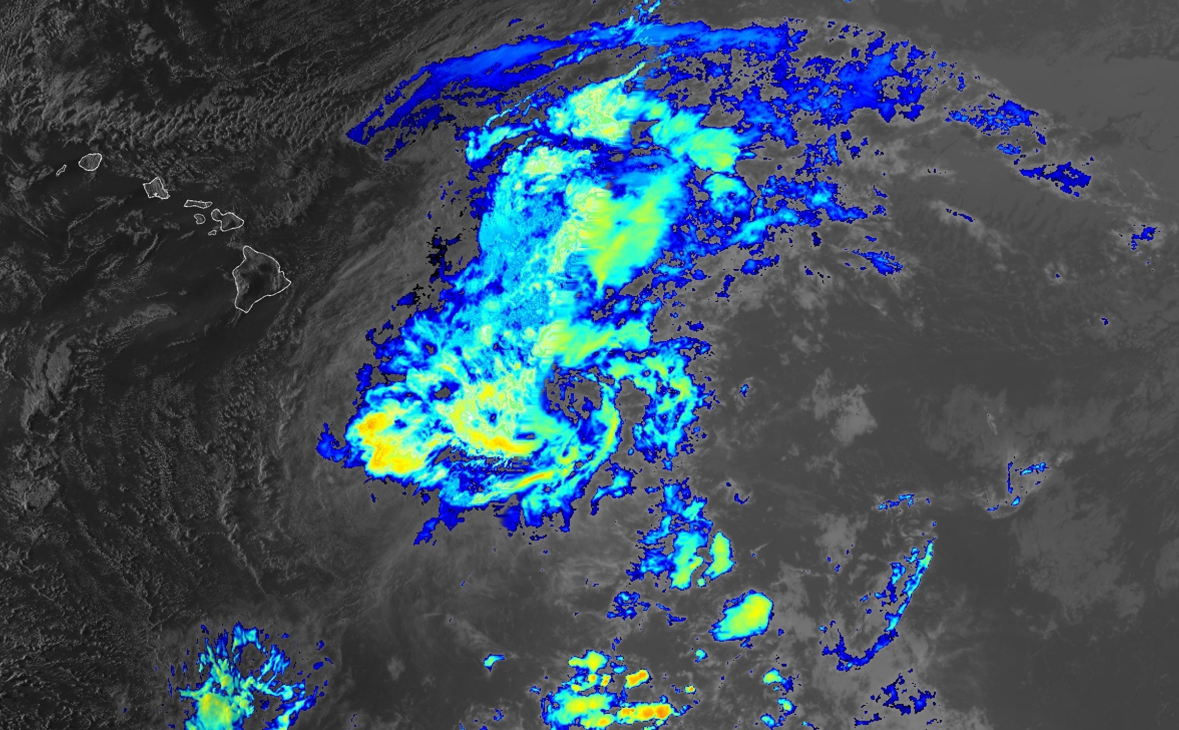
Persistent deep convection that was previously located over and north of the storm’s circulation overnight Friday and through the morning hours Saturday largely collapsed, with Moke’s cloud tops warming noticeably.
The deterioration appears to be, at least in part, because of ongoing southwesterly vertical wind shear and dry mid-level air.
A low- to mid-level ridge strengthening to the north of Moke will continue steerings it in that continued west-northwest direction, eventually moving into an increasingly drier and stable environment that will lead to the storm’s gradual weakening trend.
Moke could degenerate into a remnant low by Wednesday.
The next complete advisory for Tropical Storm Moke will be issued at 11 p.m. today by Central Pacific Hurricane Center.
From the state
State agencies remain ready to respond to Tropical Storm Moke and support county emergency response efforts. State personnel and resources are on standby to address possible impacts.
“State and county teams are ready to respond and I urge everyone to remain alert, follow official updates and avoid unnecessary risks as the storm passes,” said Hawaiʻi Gov. Josh Green in a state release.
Hawaiʻi National Guard continues was preparing additional personnel and resources for Tropical Storm Moke, with 153 personnel positioned statewide.
No closures of state parks or camping areas are anticipated on the Garden Isle because of Tropical Storm Moke.
State small boat harbors and their restrooms remain open, subject to available mooring space and vessel size, to provide safe harbor. Boat owners and operators should check moorings and lines, bilge pumps, cabins and hatches and take precautions to protect themselves, their vessels and natural resources.
Vessel groundings should be immediately reported to the state Division of Boating and Ocean Recreation.
Hawaiʻi Department of Law Enforcement is standing by to provide security support for state shelters. Department drones also are on standby for deployment, if needed, to identify areas of concern.
Hawaiʻi state health officials continue to monitor health and medical operations statewide.
Air medical and ground EMS services are operating normally statewide and hospitals are operating at normal capacity. The Medical Operations Coordination Center continues to monitor 9-1-1, EMS, air medical services, hospitals and the Healthcare Emergency Management Coalition.
The 10 University of Hawaiʻi campuses also continue to monitor the storm and its potential impacts. The fall semester begins Monday with the first day of classes.

