


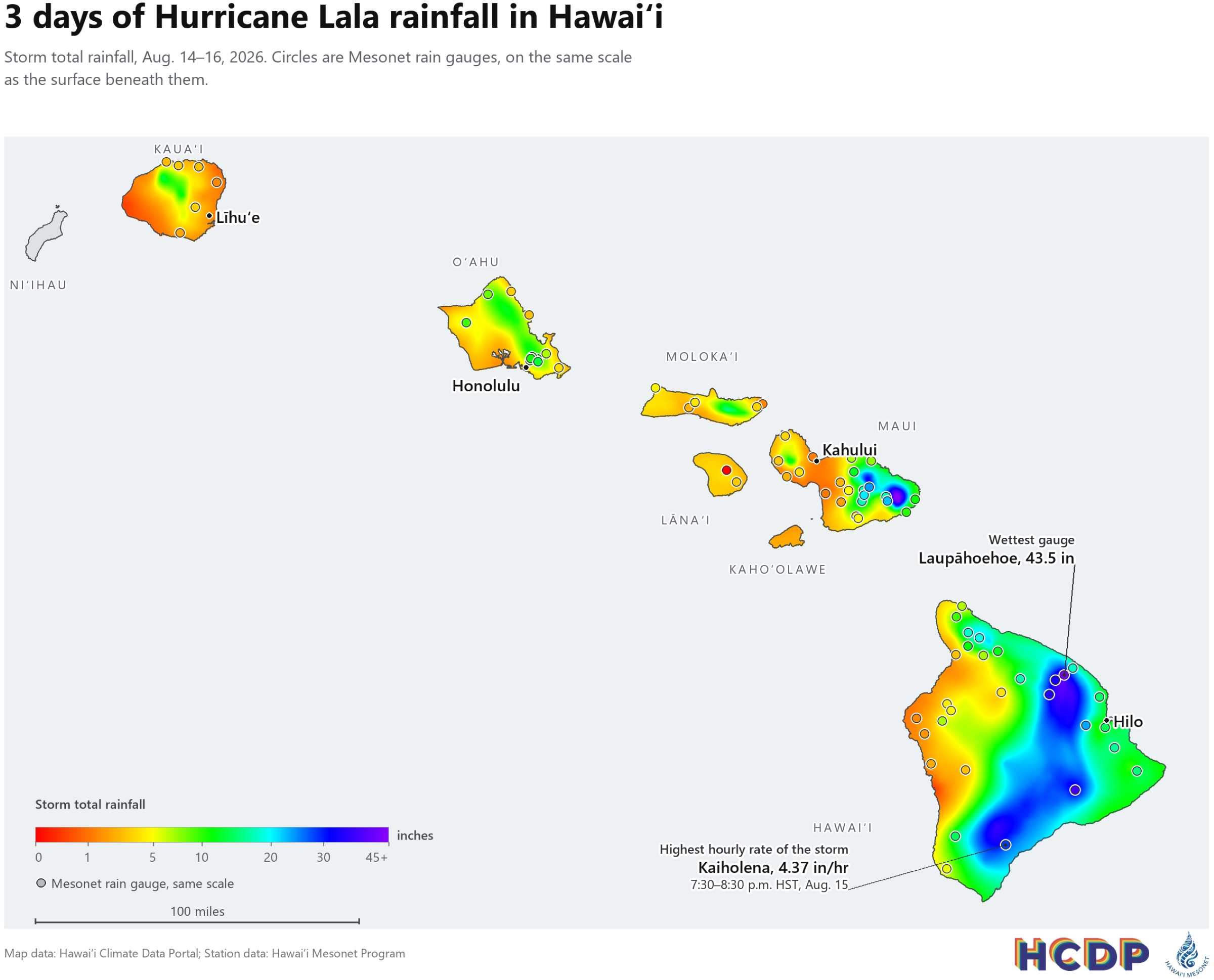
Almost 2 million Olympic-size swimming pools of water — a deluge of 1.3 trillion gallons of rain — inundated Hawaiʻi from Aug. 14-16 as Hurricane/Tropical Storm Lala tracked just south of the islands.
Lala delivered one of the state’s most significant tropical cyclone impacts in decades, triggering severe flash flooding and damaging winds.
Researchers captured the massive scale of the storm through Hawaiʻi Mesonet and Hawaiʻi Climate Data Portal at University of Hawaiʻi.
Lala never made official landfall, but its close pass the Big Island as a Category 1 hurricane and then moving up the island chain as a tropical storm resulted in an average statewide rainfall amount of 11.4 inches.
Hawaiʻi County received 66% of the total rainfall volume — equivalent to 1.2 million Olympic-size swimming pools, or 833 million gallons of water. Communities such as Nāʻālehu in the Big Island’s Kaʻū District experienced devastating inundation from flash flooding.
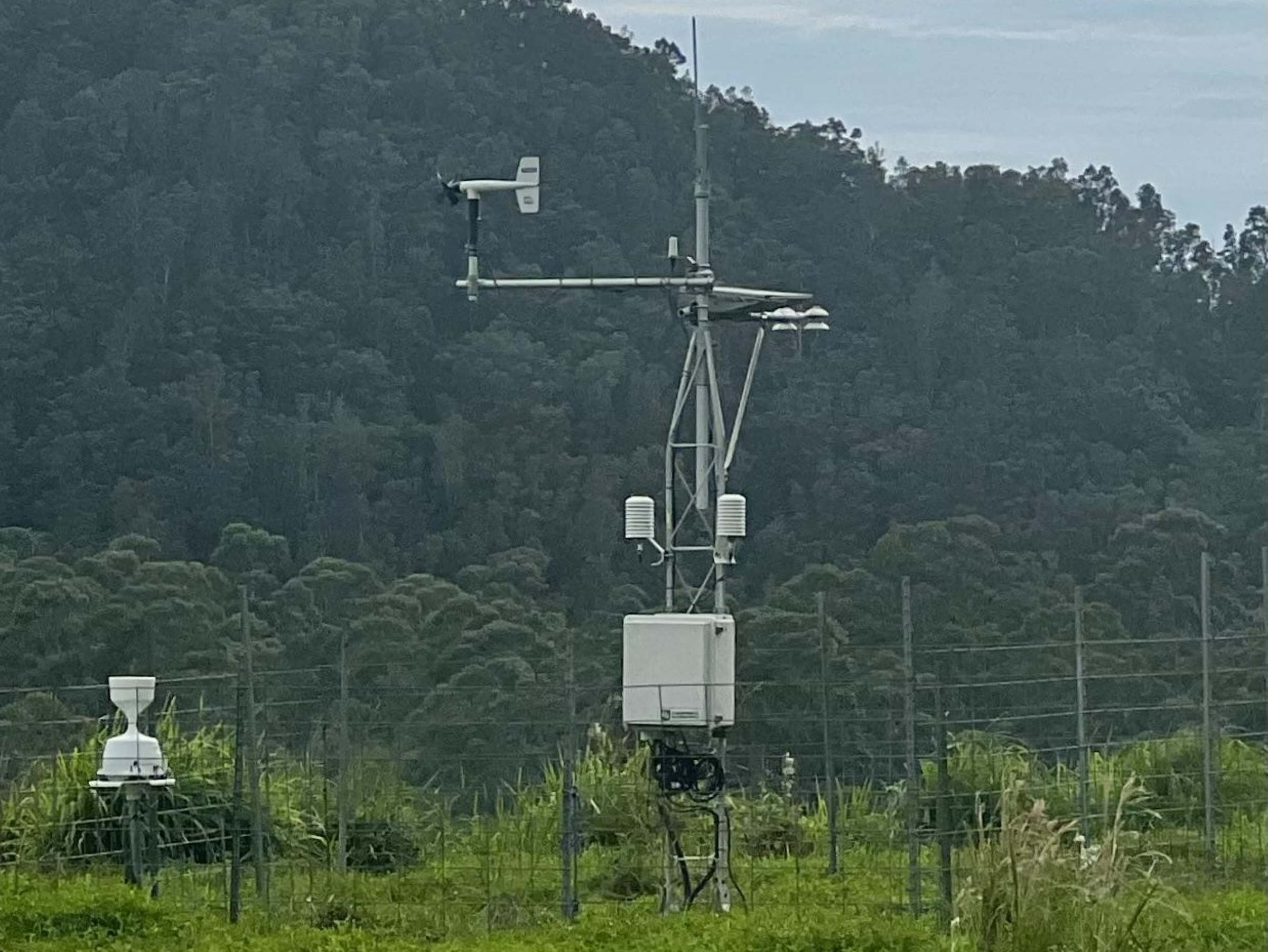
Hawaiʻi Mesonet stations highlighted the extreme localized intensity of the storm:
- Laupāhoehoe station in Hāmākua on Aug. 15 recorded a daily maximum rainfall of 32.1 inches.
- Almost simultaneously, Kaiholena station upslope of Nāʻālehu recorded 24.4 inches, including a remarkable 4.4 inches of rain in a single hour from 7:30 to 8:30 p.m. This was the highest observed hourly rainfall rate in the state during the entire 3-day event. Combined with steep mountain slopes, this intense rainfall resulted in flash flooding that severely impacted Nāʻālehu.
The rest of the state’s counties experienced peak rainfall amounts Aug. 16, a day later, as the storm progressed.
While their totals were lower than Hawaiʻi Island’s, they still saw substantial averages:
- Maui County recorded a cumulative 6.6 inches of rain, equivalent to 203,595 Olympic-size swimming pools, or 134 million gallons.
- City and County of Honolulu (Oʻahu) recorded 5.5 inches of rain, equivalent to 86,357 Olympic-size swimming pools, or 57 million gallons.
- Kauaʻi County recorded 3.1 inches, equivalent to 45,055 Olympic-size swimming pools, or 29 million gallons.
“Storms like Lala remind us why sustained, high-quality rainfall measurement matters so much in Hawaiʻi,” said Hawaiʻi Mesonet Director Tom Giambelluca in a university release. “Our terrain can turn the same storm into a 2-inch event in one valley and a 40-inch event a few miles away — without a dense network like the Mesonet, we’d have no way to capture that difference or understand what actually happened on the ground.”
The storm also unleashed high winds, with station-derived hourly wind speeds peaking at 60 mph on Hawaiʻi Island.
Strong winds were also measured on Maui (56 mph), Oʻahu (39 mph) and Kauaʻi, which led to downed power lines and fallen trees throughout the islands.
Wind gusts of 80 mph were recorded at Puʻuloa in Kohala on the Big Island and up to 79 mph on Haleakalā on Maui. Researchers expect that wind gusts were even more intense in some areas that do not have a climate station.
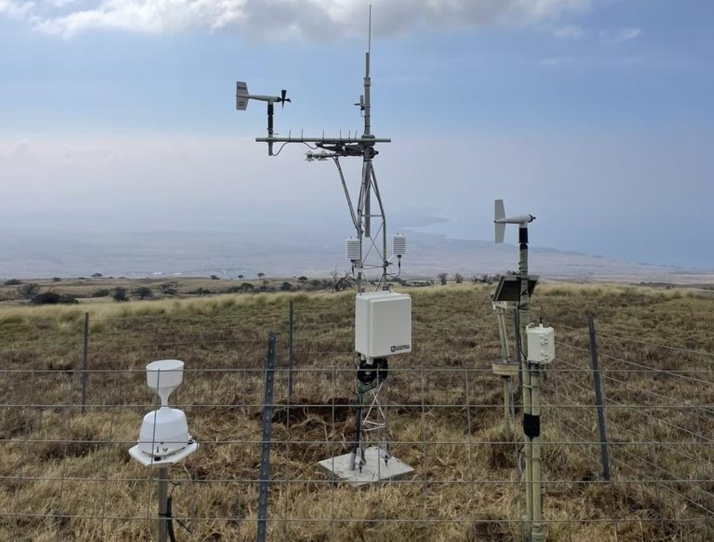
“One of the biggest challenges with wind is that we simply don’t have stations everywhere, especially at higher elevations and in remote terrain,” said Hawaiʻi Climate Data Portal Product Development Lead Matt Lucas in the university release. “Newly developed high-resolution wind speed maps let us estimate conditions in the gaps between stations, especially in extreme terrain where winds can be accelerated [2 to 4 times] by landscape effects. This means disaster responders, property owners and land managers aren’t left guessing about what happened in places where we didn’t have a station.”
Hawaiʻi Mesonet, a statewide network of state-of-the-art weather stations, provides critical weather information throughout the islands, giving a bird’s-eye view into data behind extreme weather events.
Using Hawaiʻi Mesonet observations and digital maps produced on Hawaiʻi Climate Data Portal maps, the team released a new interactive website documenting the weather impacts from Hurricane Lala.
Visit the Hawaiʻi Climate Data Portal extreme event page to explore new interactive rainfall and wind speed maps as well as station data from the storm.
Users can sort information by county and for each day of the storm.

