


The National Weather Service and Hawaiʻi officials are closely monitoring two tropical disturbances in the East Pacific Ocean that could develop into something more serious.
While it is too early to determine the track, intensity, magnitude or potential impact on these disturbances, residents should prepare again for possible bad weather.
The first tropical disturbance, an area of low pressure located well to the east-southeast of the Hawaiian Islands, is producing showers and thunderstorms that continue to show signs of organization, according to the National Hurricane Center in Miami.
Environmental conditions appear favorable for further development of this system, and a
tropical depression is likely to form during the next day or so as the system moves westward to west-northwestward at 10 to 15 mph and crosses into the Central Pacific.
“Interests in the Hawaiian Islands should closely monitor the progress of this system,” the National Hurricane Center said during an 11 am. advisory on Wednesday.
Forecasters are monitoring a disturbance in the East Pacific that is currently producing a large area of showers and thunderstorms with some signs of organization.
Forecasters with the National Weather Service say environmental conditions appear conducive for further development, and a tropical depression is likely to form during the next couple of days.
The current movement is toward the west-northwest at 10 to15 mph.
Locally, tropical moisture and increased precipitation chances are expected by early next week, and the public is advised to monitor the forecast for further updates.
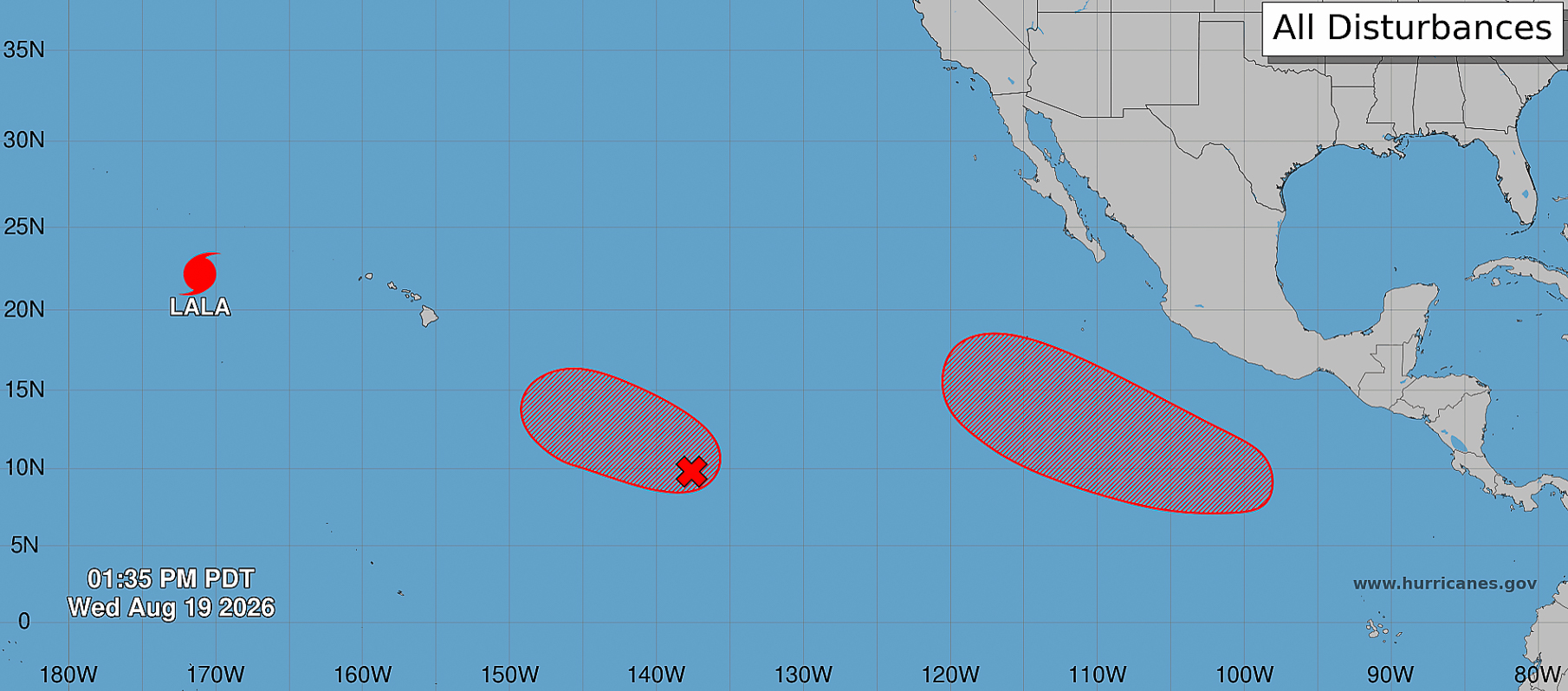
A second area of low pressures is expected to form several hundred miles off the coast of Mexico. Gradual development of this system is expected, with a tropical depression expected to form this weekend as it moves north-northwest.

