


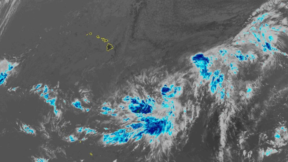
Editor’s note: This story was updated at 11:45 a.m. on Aug. 12.
The National Weather Service anticipates issuing a tropical storm watch on Thursday as a developing storm system gathers strength east-southeast of the Hawaiian Islands.
According to the 11 a.m. public advisory from the National Hurricane Center and Central Pacific Hurricane Center, the storm is 895 miles from Hilo on the Big Island and 1,100 miles east-southeast of Honolulu.
The disorganized system of showers and thunderstorm activity is expected to become a tropical storm within the next day, and forecasters list a 90% chance that it will develop into a tropical cyclone within the next 48 hours.
“It is too soon to specify the exact location and magnitude of the impacts,” according to the advisory.
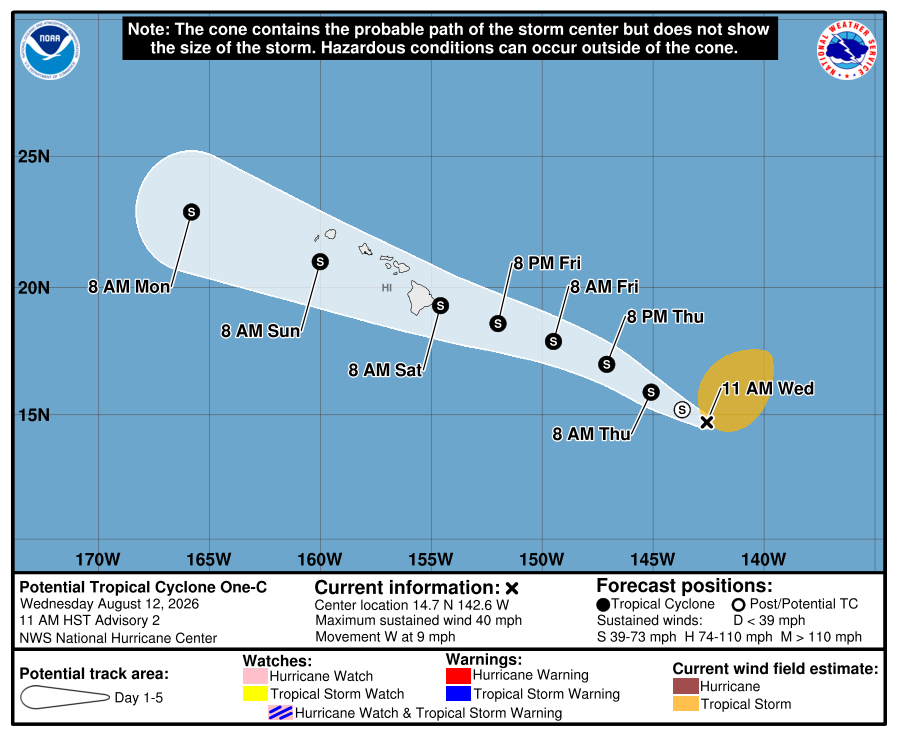
Location or magnitude of potential impacts remain uncertain; however, the storm is closer to Hawai‘i than cyclones typically are, meaning impacts could occur with less warning than usual.
The disturbance is moving toward the west at about 9 mph. On the forecast track, the center of the system will be nearing the Hawaiian Islands by late Friday. Maximum sustained winds have increased from 35 mph to 40 mph with higher gusts.
Tropical-storm-force winds extend outward up to 275 miles.
According to the advisory, there is an increasing risk of wind impacts to the Hawaiian Islands, regardless of the exact track of the system. Additionally, rainfall totals are expected to be 5 to 10 inches across the state with 20 inches possible.
The storm is expected to bring high surf for east-facing shores on Friday, then spreading to the west and building over the weekend.
Heavy rainfall associated with the system is expected to begin to impact the Big Island Friday, spreading westward into Maui on Saturday, and across Lana‘i, Moloka‘i, O‘ahu and Kaua‘i on Sunday. This rainfall may produce life-threatening flooding and mudslides, especially in areas of steep terrain, according to the advisory.
This is a developing story. More information will be provided as it becomes available.

