

More than 2 trillion gallons of water — enough to fill 3 million Olympic-sized swimming pools — inundated Hawaiʻi in March.
The accumulated rainfall throughout 14 days reached as high as 3,000% of normal historical levels for this time of year, culminating in a destructive “rain bomb” over Oʻahu.
Researchers captured the scale of back-to-back kona low systems, mapping localized threats and providing crucial data about the state’s severe flooding, using University of Hawaiʻi’s Hawaiʻi Mesonet and Hawaiʻi Climate Data Portal.
Statewide rainfall averaged 18.25 inches from March 1-23 — more than 2.6 times the standard March average of 6.85 inches.
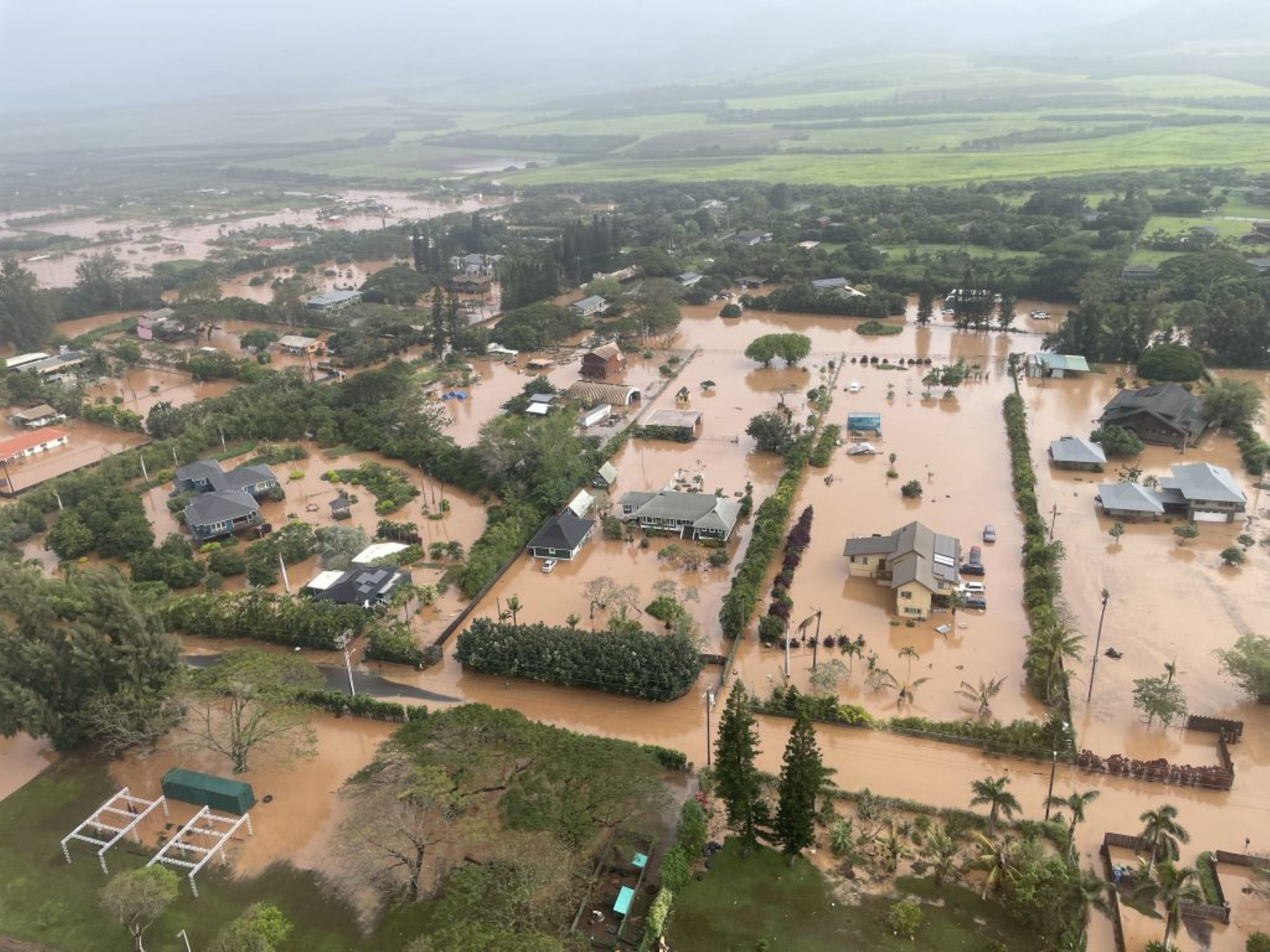
While the first storm from March 10–16 brought hurricane-force wind gusts of 135 mph to Hawaiʻi Island and up to 62 inches of rain on Maui, the second kona low from March 19-23 triggered a new wave of devastation, dumping up to 61 inches of rain in localized areas, producing destructive floods throughout eastern and central Molokaʻi, West Maui and Oʻahu.
Communities such as Waialua and Haleʻiwa on Oʻahu’s North Shore experienced devastating inundation.
Hawaiʻi Mesonet stations highlighted the widespread intensity of the storm: the Kaʻala station recorded the island’s highest 2-day rainfall of roughly 22 inches, including 19.67 inches in a 24-hour period beginning the evening of March 19.
Almost simultaneously, the nearby Kalaheʻe Ridge station above Waimea Valley recorded 9.75 inches in 24 hours.
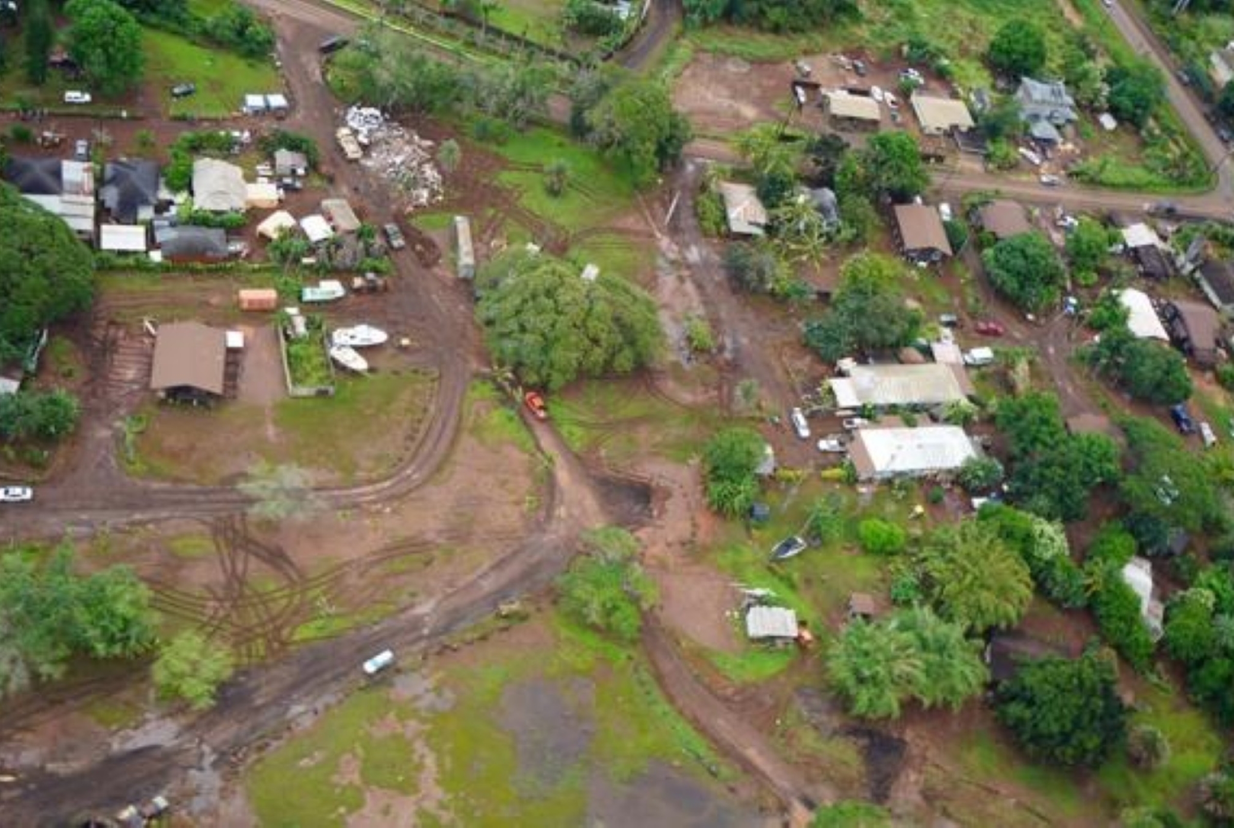
An intense, localized atmospheric event struck Mānoa and Palolo Valley on March 23 as the 2-week rainy period neared its end.
Honolulu Mayor Rick Blangiardi described it as a “classic rain bomb,” heavy rain caused by a stationary storm cell. This “rain bomb,” over Mānoa and Palolo Valley, dropped 2 to 4 inches of rain per hour.
Six Hawaiʻi Mesonet stations in the Nuʻuanu-Mānoa area recorded between 3.5 and 6.5 inches of rain, the majority of which fell within a 3-hour window. Falling on already saturated ground, this turned streams into raging torrents and triggered significant flash floods.
“We are building the mesonet to serve multiple purposes, including research, resource management, support for farmers and ranchers and others,” said Hawaiʻi Mesonet project lead Thomas Giambelluca in a university release. “But providing data when and where it is most needed before and during extreme events like floods and wildfires might be its most important purpose.”
Hawaiʻi Mesonet, a statewide network of state-of-the-art weather stations, is proving to be a critical source of weather information, especially valuable during extreme events.
“Mesonet data will make us better prepared for future events by improving weather forecasts and enabling emergency managers to plan for and respond to extremes,” Giambelluca said.
