

“Volcano Watch” is a weekly article and activity update written by U.S. Geological Survey Hawaiian Volcano Observatory scientists and affiliates.
Episode 43 at the summit of Kīlauea volcano on the Big Island began at 9:17 a.m. March 10 and continued for 9 hours.
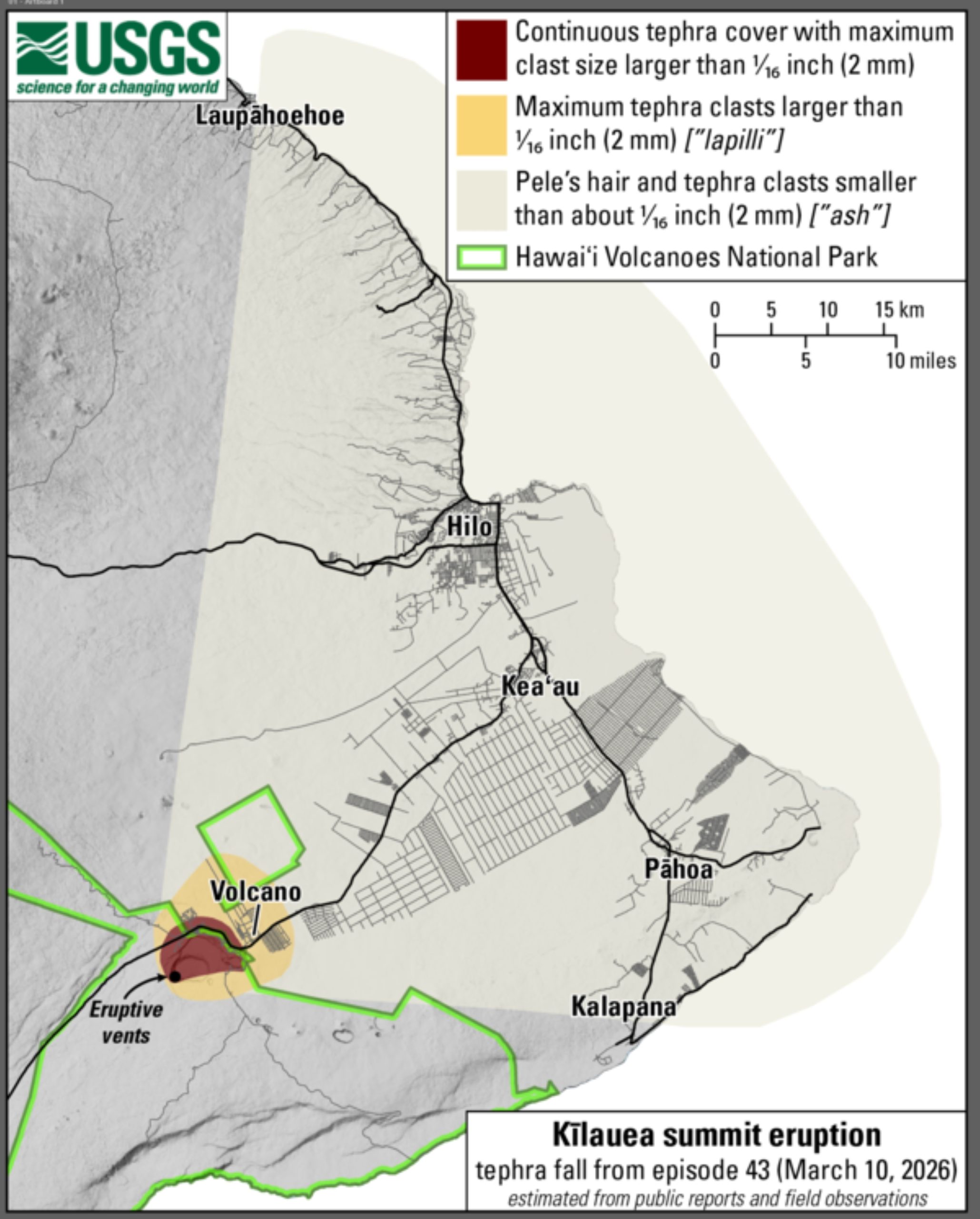
The north and south vents erupted lava fountains, with the south vent fountain reaching 1,770 feet high — a new record for this rare episodic summit eruption.
Southwesterly winds carried tephra toward visitor overlooks and nearby communities near and far.
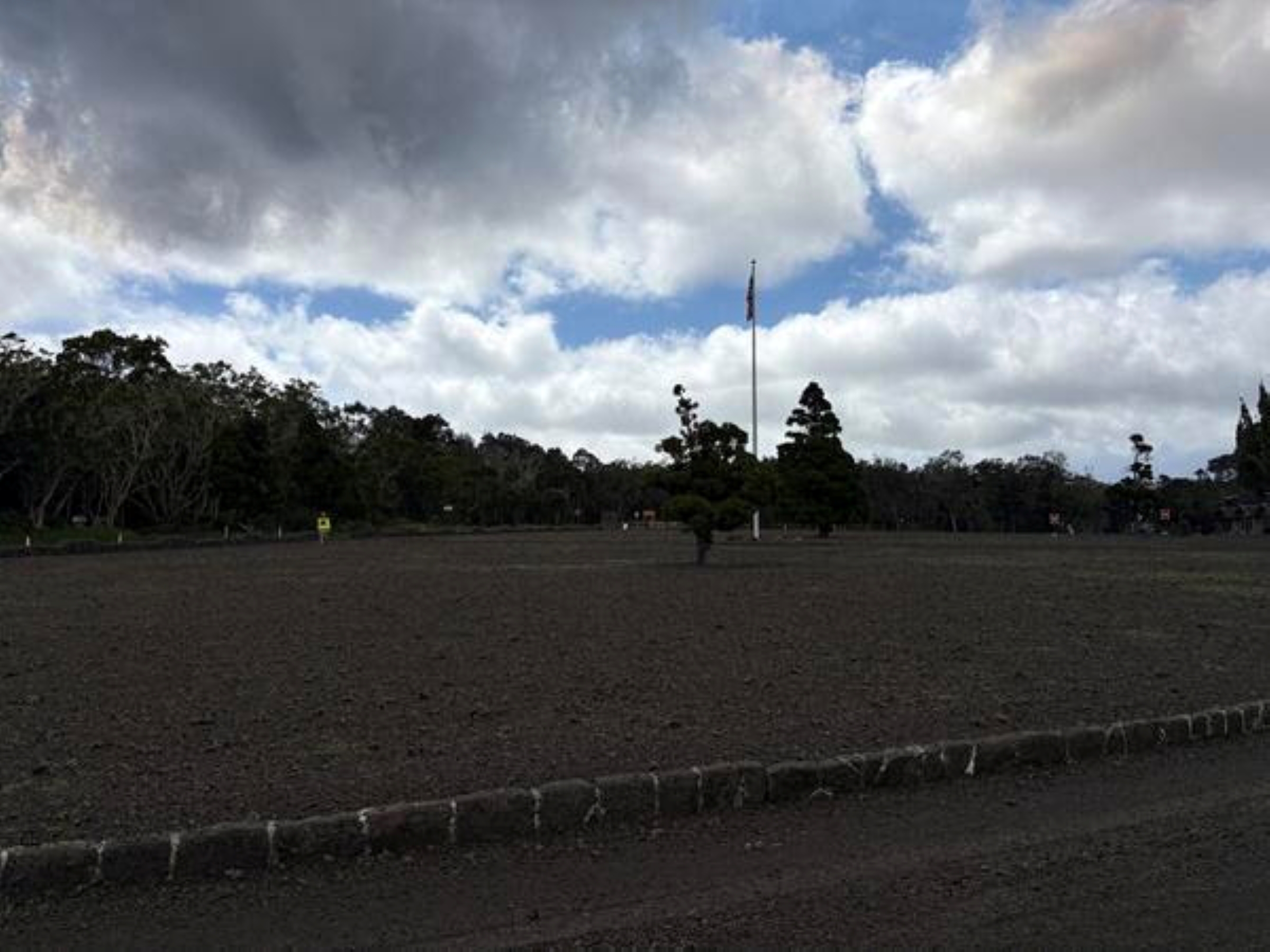
Most of the fallout accumulated at Uēkahuna Overlook and Kīlauea Military Camp in Hawaiʻi Volcanoes National Park, as well as portions of Highway 11 and the Volcano Golf Course area.
These areas, located northeast of the vents, experienced continuous ground coverage.
Part of Highway 11 and Hawaiʻi Volcanoes National Park were temporarily closed for safety purposes and to allow for tephra cleanup.
Lighter but still widespread tephra was reported in other parts of the Volcano Golf Course area as well as Volcano Village and Mauna Loa Estates. These areas received sparser fallout, ranging up to lapilli in size — or larger than 1/16th of an inch.
More distant communities reported only ash — less than 1/16th of an inch in size — and volcanic glass shards called Pele’s hair.
Mahalo to residents and visitors who reported fallout using the “Is Tephra Falling?” web tool to share real-time observations.
These observations helped responding agencies track the extent and timing of the fallout. Hawaiian Volcano Observatory relayed these ground observations to the National Weather Service, which used the information to issue ashfall advisories and warnings early during Episode 43.
More than 200 tephra fall reports were submitted in total. The first came in about 10:30 a.m. from areas within Hawaiʻi Volcanoes National Park and communities surrounding Kīlauea summit. Reports of ash and Pele’s hair were received from Mountain View by midday, followed by Keaʻau, Pāhoa and Hilo about 1 p.m.
Ashfall observations from communities along the Hāmākua Coast began about 2 p.m.
The farthest confirmed observations ranged from Kalapana in the south to Laupāhoehoe in the north, with the latter received about 3:30 p.m.
Tephra fall raises concern for residents who rely on rooftop rainwater catchment systems, and data from previous eruptions can provide useful guidance about what to expect.
Episode 41 on Jan. 24 similarly deposited abundant tephra on communities that rely on rainwater catchment near Kīlauea summit.
Scientists and community volunteers collected ash, rooftop runoff and catchment tank water samples from affected areas to understand how these tephra deposits might affect water quality.
One of the main concerns is fluoride, which can coat tephra particles and then dissolve into water. Testing found fluoride in catchment tank water after Episode 41 ranged from 0.06 to 0.3 parts per million, well below the U.S. Environmental Protection Agency limit of 4 parts per million for public water systems.
Runoff collected from roofs during the first rainfall after the tephra fell was higher: 7 to 10 parts per million from roofs that were not cleared of tephra, and about 1.5 parts per million from a cleaned roof.
The lower level from the cleaned roof demonstrates how cleaning tephra can substantially reduce contamination.
Other potential contaminants associated with volcanic ash — such as arsenic, cadmium, chromium, copper and lead — were too low to detect.
In most cases, water affected by ash is likely to taste unpleasant or look discolored before contaminants reach levels of health concern.
The largest impact on water quality occurs during the first flush of rain after an eruption, when most contaminants are washed from the tephra.
Residents using rainwater catchment systems can reduce risk by temporarily disconnecting downspouts before tephra fall, covering storage tanks and cleaning tephra from roofs and gutters before reconnecting their systems.
These precautions are effective at minimizing impacts, and continued rainfall will naturally dilute any remaining contamination.
Additional guidance for protecting catchment water during ashfall is available from University of Hawai‘i Sea Grant College Program.
Tephra is also an eye, skin and respiratory irritant.
When clearing tephra, wear personal protective equipment such as a particulate mask, eye protection, gloves and protective clothes such as long-sleeves, a hat and covered shoes.
More information on cleanup is available at “Impacts & Mitigation — Personal Protection PPE.”
The area affected by tephra fallout during Kīlauea summit episodes can vary depending on lava fountaining behavior and wind conditions.
As future eruptive episodes approach, monitor the weather forecast and follow guidance from Hawai‘i County Civil Defense so you can prepare for these events if you live in an area that could experience tephra fallout.
VOLCANO ACTIVITY UPDATES
KĪLAUEA volcano
VOLCANO ALERT LEVEL: Watch
Kīlauea has erupted episodically within the summit caldera since Dec. 23, 2024. Episode 43 lava fountaining happened for just 9 hours on March 10. No unusual activity has been noted along Kīlauea’s East Rift Zone or Southwest Rift Zone.
WHAT’S NEXT? Summit region inflation since the end of Episode 43 indicates another fountaining episode is possible, with models suggesting Episode 44 could begin between March 28 and April 14.
MAUNA LOA volcano
VOLCANO ALERT LEVEL: Normal
Mauna Loa is not erupting. Click here to read the most recent Mauna Loa activity update.
Hawaiian Volcano Observatory continues to closely monitor Kīlauea and Mauna Loa.
EARTHQUAKES
Three earthquakes were reported felt in the Hawaiian Islands during the past week:
- MAGNITUDE-3.1 at 9:03 p.m. March 10 located 1 mile east-northeast of Honalo at a depth of 14 miles.
- MAGNITUDE-2.8 at 11:05 a.m. March 10 located 4 miles southeast of Mākena.
- MAGNITUDE-2.9 at 8:45 p.m. March 6 located 8 miles south of Volcano at a depth of 3 miles.
Visit the Hawaiian Volcano Observatory website for past “Volcano Watch” articles, Kīlauea and Mauna Loa updates, volcano photos, maps, recent earthquake information and more. Email questions to askHVO@usgs.gov.
