

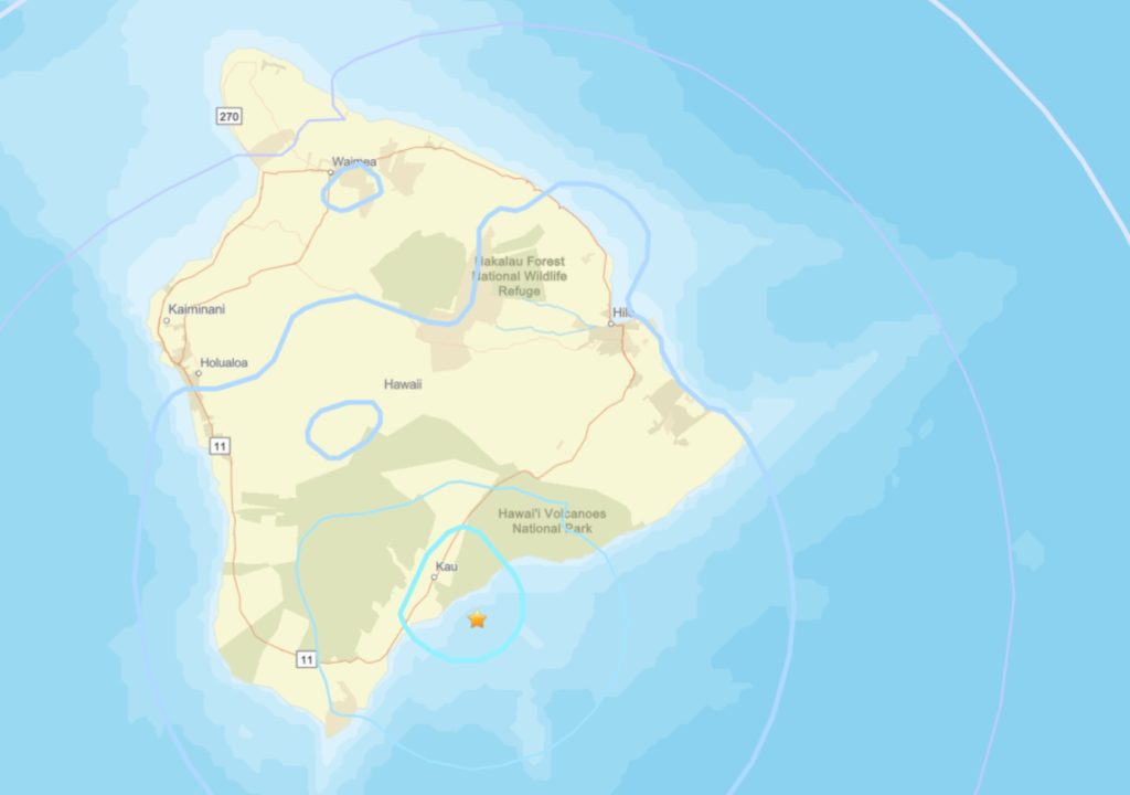
Hawaiian Volcano Observatory reported a magnitude-4.4 earthquake struck at 5:16 p.m. Thursday (March 12) about 8 miles east-southeast of Pāhala in the southern portion of the Big Island at a depth of 18 miles.
The quake had no apparent impact on either Mauna Loa or Kīlauea volcanoes and is part of the seismic swarm under the Pāhala area, which has been ongoing since 2019.
Earthquakes in this region have been observed as far back as at least the 1960s.
Hawaiian Volcano Observatory continues to monitor Hawaiian volcanoes for any changes.
EARTHQUAKE DESCRIPTION
- Magnitude: 4.4
- Time and date: 5:16 p.m. March 12
- Location: 8 miles east-southeast of Pāhala in Kaʻū on the Big Island
- Depth: 18 miles below sea level
- Aftershocks are possible in the coming days to weeks
EARTHQUAKE INTENSITY AND AFFECTED AREA
- Potential damage: No damage to buildings or infrastructure expected based on earthquake intensity
Maximum intensity, Modified Mercalli Scale:
- Community-reported: IV, light shaking
- Instrument-derived: IV, light shaking
- Felt Reports: More than 155 within the first half-hour after the quake struck
- Felt Area: Around Hawaiʻi Island
Hawai‘i County Civil Defense earlier reported the temblor as a magnitude-4.2 that struck off the Kaʻū Coast.
Pacific Tsunami Warning Center also reported the temblor was not large enough to cause a tsunami for the Big Island.
