

UPDATE: High surf advisory remains in place for east-facing shores of Kauaʻi
Update at 6:33 a.m. Feb. 18: National Weather Service forecasters in Honolulu report that strong trade winds continue to cause rough ocean conditions and high surf.
Advisory level surf is now forecast to be in place through Thursday (Feb. 19) along east-facing shores of Kauaʻi. Therefore, the high surf advisory previously in effect is extended until 6 p.m. Thursday.
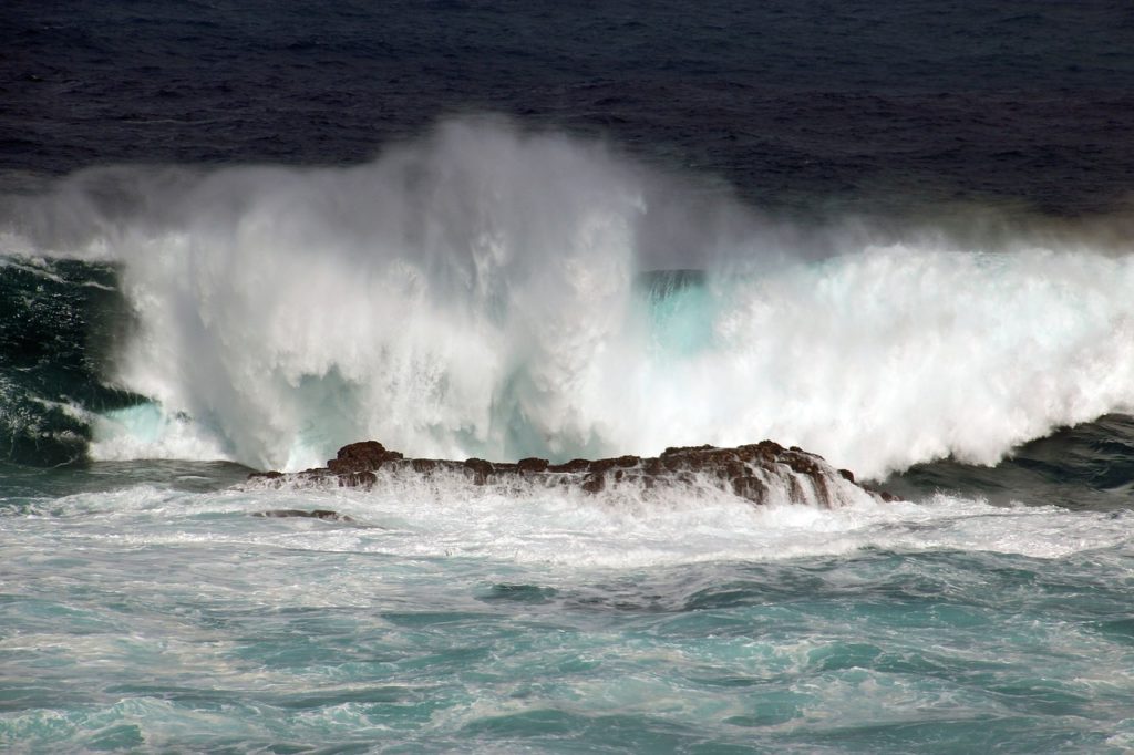
Surf of 8 to 12 feet will continue to cause strong breaking waves and strong currents that will make swimming and other ocean activities along those eastern shorelines dangerous.
Update at 2:48 p.m. Feb. 17, 2026: The National Weather Service extended the high surf advisory until 6 a.m. Thursday (Feb. 19) for east-facing shores of Kauaʻi.
Strong trade winds will maintain high surf, rough coastal conditions and potential for rip tides.
Forecasters said breaking waves of 8 to 12 feet are expected on the east-facing shores.
Strong breaking waves and strong currents will make swimming and other ocean activities along eastern shorelines dangerous.
Update at 3:30 p.m. Feb. 16, 2026: A high surf advisory remains in effect for east-facing shores of Kauaʻi until 6 a.m. Wednesday, according to the National Weather Service in Honolulu.
Strong trade winds are expected to maintain elevated, short-period surf along the island’s eastern coastline through the advisory period.
Forecasters said breaking waves of 7 to 12 feet are expected along east-facing shores.
The advisory warns that strong breaking waves and powerful currents pose a danger to swimmers.
Ocean safety officials urge the public to heed all posted warnings and avoid entering the water if conditions appear hazardous.
Update at 4:23 a.m. Feb. 16, 2026: Strong trade winds will maintain relatively short period high surf along east-facing shores of Kauaʻi lasting into Wednesday.
As a result, the National Weather Service forecast office in Honolulu has extended the high surf advisory until 6 p.m. Tuesday (Feb. 17) for the eastern and southeastern shores of the island.
Large breaking waves of 7 to 12 feet are still expected.
Story originally posted at 5:45 p.m. Saturday, Feb. 14: Already strong trade winds will strengthen another notch Sunday (Feb. 15) and produce high surf along east-facing shores during the next several days throughout the state.
As a result, National Weather Service forecasters in Honolulu issued a high surf advisory in effect until 6 a.m. Tuesday (Feb. 17) for eastern and southeastern shorelines of Kauaʻi.
A high surf advisory means surf will be higher than normal. Strong breaking waves and strong currents also will make swimming and other ocean activities dangerous.
Large breaking waves of 7 to 10 feet are forecast, rising to surf of 8 to 12 feet by late Sunday into Sunday night for eastern shores.
Beach-goers, swimmers and surfers should heed all advice given by ocean safety officials and exercise caution when entering the water.
National Weather Service forecasters reminded the public: when in doubt, don’t go out.
Winds are expected to stay strong through the middle of next week, so the advisory could be extended.
Head to the National Weather Service Honolulu forecast office website for the most up-to-date weather information, including advisories, watches and warning.
Sponsored Content
