

“Volcano Watch” is a weekly article and Big Island volcanic activity update written by U.S. Geological Survey Hawaiian Volcano Observatory scientists and affiliates.
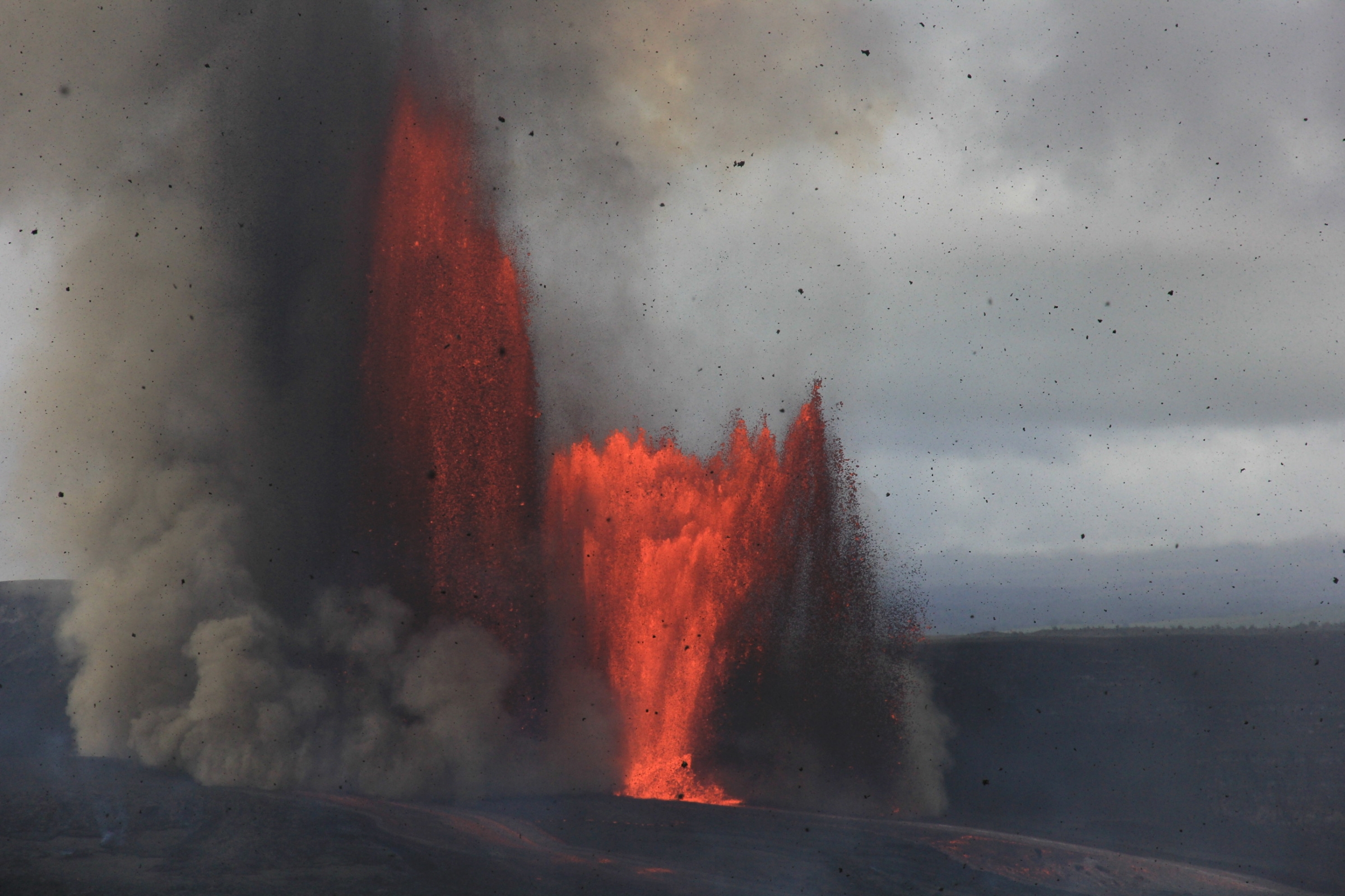
Hawaiʻi Island residents and visitors alike via email, phone calls and through social media shared stories and observations about tephra falling during Episode 41 — the most recent lava fountaining event — of the ongoing episodic eruption at the summit of Kīlauea volcano on the Big Island.
A new online tool allows people to share their observations in a more systematic way.
“Is Tephra Falling?” is borrowed from colleagues at Alaska Volcano Observatory, though Hawaiian Volcano Observatory made some small updates to reflect different volcanic conditions here in Hawaiʻi.
Like the “Did You Feel It?” earthquake reporting tool helps make maps of areas affected by shaking, “Is Tephra Falling?” helps scientists map areas affected by tephra fallout.
Tephra is a word kamaʻāina, or Hawaiʻi residents, have become familiar with throughout the past year. It describes anything that erupted out of a volcano and traveled through the air before landing on the ground.
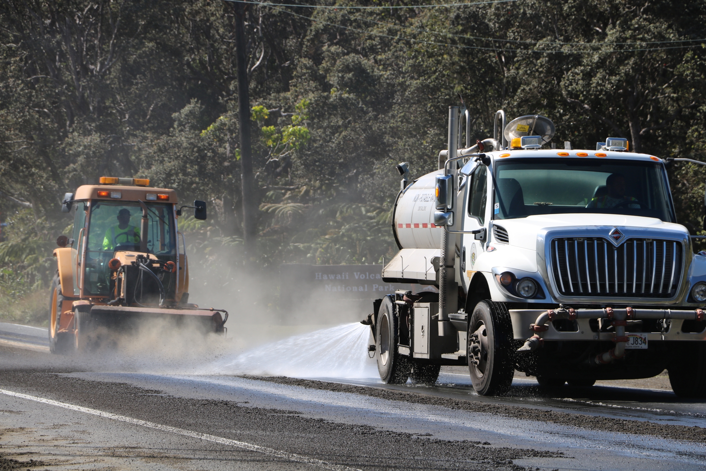
Many Hawaiʻi Island communities downwind from the eruptive vents in the southwest portion of Halemaʻumaʻu Crater inside the summit caldera of Kīlauea have been affected by tephra fall since the episodic eruption and its lava fountains began Dec. 23, 2024.
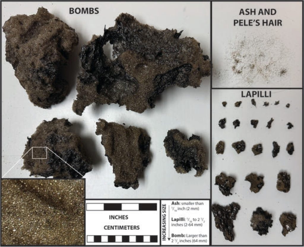
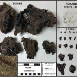
Tephra can range in size and density — which is related to the vesicularity, or bubble abundance.
There are different names for certain size ranges, and special names for certain vesicularities. This characterization system helps scientist map deposits such as those being created during Kīlauea lava fountaining episodes.
The smallest particles of tephra are volcanic ash; they are smaller than 1/16th of an inch. Tephra between 1/16th of an inch and 2.5 inches in size is called lapilli.
Any tephra larger than 2.5 inches is called a bomb or block, depending on whether it is fresh lava or older material.
Lava fountains also create a special type of tephra; long, thin strands of volcanic glass called Pele’s hair, which is difficult to classify by size.
The online tool in Alaska is called “Is Ash Falling?” because communities there have mostly seen fallout of ash-sized particles.
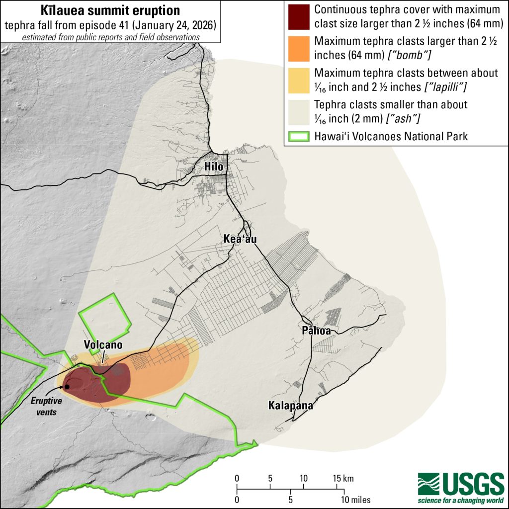
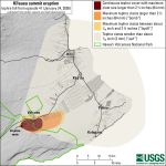
Up to bomb-size tephra fell in populated areas closer to Kīlauea’s summit during Episode 41, while ash-sized particles fell in communities farther away. That’s why in Hawaiʻi the tool is called “Is Tephra Falling?”
The bomb-sized pieces that fell on communities were very lightweight and frothy. We call these reticulite, and they are made up mostly of bubbles geologists call vesicles.
Other types of bombs with different vesicle abundances are called pumice and scoria, in order of decreasing vesicle abundances. Cinder is a word often used synonymously with scoria.
These types of tephra are full of bubbles because gas exsolving out of the lava is a large part of what is driving the lava fountaining process.
That — in combination with the narrow conduits of the north and south vents — allow the tall lava fountains to form.
Where the tephra lands depends on fountaining dynamics and wind conditions.
Aspects of fountaining dynamics include whether both vents are fountaining, height of the fountains and whether the lava geysers are inclined. Wind condition aspects include wind speeds and directions at different levels in the atmosphere.
Episode 42 lava fountaining is forecast to start between Feb. 11 and 16.
The weather forecast for that timeframe shows trade winds could be present, which blow to the southwest. Communities in Kaʻū and South Kona have been affected by ash fall during past fountaining episodes with trade wind conditions.
Forecasts can change, however, so it’s important to stay aware of weather conditions and eruption forecast if you live in an area that can be affected by tephra fall.
Consider letting us know if you do experience tephra fall by submitting a “Is Tephra Falling?” report online. You can describe the size and percentage of a given area covered and even share a photo.
 This annotated photograph shows different size categories of tephra associated with recent lava fountaining episodes at the summit of Kīlauea volcano on the Big Island. The inset photo at the bottom left shows the vesicular — or bubble-rich — texture of most of these clasts. (Photo Courtesy: U.S. Geological Survey)
- This map shows the tephra fall Jan. 24, 2026, associated with Episode 41 lava fountaining of Kīlauea’s episodic summit eruption. (Map Courtesy: U.S. Geological Survey)
Your observations will be used to assess the character and size of the Kīlauea eruption plumes, along with the dispersal pattern of tephra fall.
Your observations will be shared with Hawaiʻi County Civil Defense and National Weather Service. We appreciate any information you can share.
VOLCANO ACTIVITY UPDATES
KĪLAUEA VOLCANO
VOLCANO ALERT LEVEL: Watch
Kīlauea has erupted episodically since Dec. 23, 2024, within the summit caldera inside Hawaiʻi Volcanoes National Park. Episode 41 lava fountaining happened for just more 8 hours Jan. 24.
No unusual activity has been noted along Kīlauea’s East Rift Zone or Southwest Rift Zone.
WHAT’S NEXT? Summit region inflation since the end of Episode 41 indicates another lava fountaining episode is possible and could occur between Feb. 11 and 16.
MAUNA LOA VOLCANO
VOLCANO ALERT LEVEL: Normal
Mauna Loa is not erupting. Seismic activity, however, increased slightly during the past month, with a tight clustering of events under Mokuʻāweoweo — Mauna Loa’s summit caldera — and upper Southwest Rift Zone early during the month, a continuation of elevated earthquake activity at the end of the previous month.
A total of 123 earthquakes were detected beneath Mauna Loa’s summit region in the January reporting period, while the prior month had 94 earthquakes.
Global positioning system data from instruments on Mauna Loa show variable rates of inflation at the summit during the past 6 months. This is associated with refilling of the summit reservoir system following the 2022 eruption, as well as recent refilling of a magma chamber under the southern caldera region.
Hawaiian Volcano Observatory continues to closely monitor Kīlauea and Mauna Loa.
Visit the Hawaiian Volcano Observatory website for past “Volcano Watch” articles, Kīlauea and Mauna Loa updates, volcano photos, maps, recent earthquake information and more. Email questions to askHVO@usgs.gov.
