

Updated at 3:30 p.m., Nov. 3, 2025: The National Weather Service in Honolulu has canceled the high surf advisory for Kauaʻi and Niʻihau.
The north swell is continuing to diminish tonight, with surf heights now below advisory thresholds.
Update at 7:34 a.m. Nov. 2, 2025: Forecasters with the National Weather Service office in Honolulu say a mix of a moderate, medium-period north-northwest swell and a shorter period north-northeast swell will keep advisory level surf breaking along many of the state’s north and west shorelines, particularly those of the state’s smaller islands.
Therefore, the high surf advisory in effect until early this morning for those shores on Kaua‘i and Ni‘ihau was extended until 6 a.m. Monday (Nov. 3).
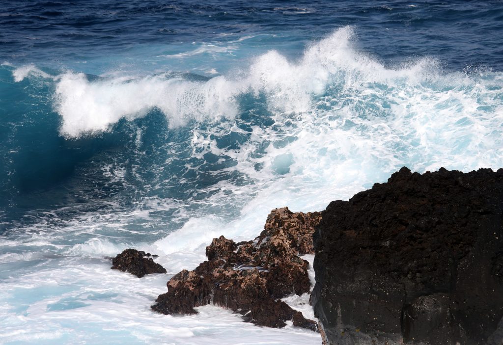
Moderate impacts should be expected, with large breaking waves of 10 to 15 feet forecast for north-facing shores and breakers as high as 8 to 12 feet along west-facing shores.
Swimming will continue to be dangerous among the strong breaking waves and accompanying strong currents, so the public should heed all advice from ocean safety officials.
Forecasters also reminded the community: When in doubt, don’t go out.
Get the latest weather information — including advisories, watches and warnings — and up-to-date local forecasts by visiting the National Weather Service Honolulu forecast office website.
Original story posted at 4 a.m. Nov. 1, 2025: A moderate, medium-to-long-period swell is forecast to produce advisory level surf along many north- and west-facing shores of the smaller islands of Hawai’i this weekend, including Kaua‘i and Ni‘ihau.
So meteorologists with the National Weather Service office in Honolulu have issued a high surf advisory that goes into effect from noon today (Nov. 1) through 6 a.m. Sunday (Nov. 2).
Both islands can expect large breaking waves of 10 to 15 feet along northern shorelines, with waves as high as 8 to 12 feet likely along western shorelines.
Those strong breaking waves — and accompanying strong currents — will make swimming dangerous.
Forecasters advise the public to heed all advice from ocean safety officials, and remember: when in doubt, don’t go out.
Surf was expected to begin increasing Friday night (Oct. 31) in response to the north-northwest swell, with meteorologists in Honolulu by 3:43 p.m. Friday saying in their marine area forecast it would peak at high surf advisory levels late this morning and then hold there through tonight.
A short-period north-northeast swell — associated with an approaching front with gale winds — is expected to arrive Sunday, primarily impacting the surf at the western end of the state where it will mix with the north-northwest swell.
That boost will likely bring high surf advisory level waves back to Kaua‘i and O‘ahu by Sunday afternoon and gradually fade out next week.
A moderate-to-large swell is then possible by about the middle of next week.
Surf along east-facing shores, meanwhile, will remain small to moderate through today, and then be impacted by the short-period north-northeast swell associated with the approaching front.
South shore surf was forecast to decrease Friday night and remain small through the weekend.
Get the latest weather information — including weather advisories, watches and warnings — and up-to-date local forecasts by visiting the National Weather Service Honolulu forecast office website.
