

This story was updated on Dec. 1 at 4:51 p.m.
The leading edge of the Mauna Loa flow closest to Daniel K. Inouye Highway continues to have minimal movement and remains near the 7,000 foot elevation and more than 3 miles from the highway.
For a map of the Mauna Loa lava flow, refer to the Civil Defense Hazard Impact Map at https://www.hawaiicounty.gov/hazard-impact-map.
Daniel K. Inouye Highway is open in both directions.
A traffic hazard safety route has been developed and is accessed from DKI across the Gilbert Kahele Recreation Area. The one way route will provide safe viewing of the lava flows.
This story has been updated on Dec. 1 at 10 a.m.
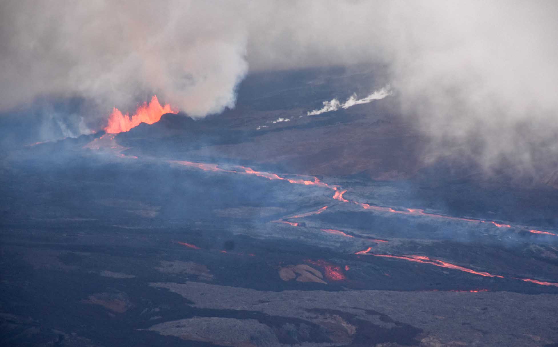
The Mauna Loa eruption has slowed as lava from fissure 3 has reached the flats below the volcano, with the leading edge 3.4 miles away from Daniel K. Inouye Highway.
With the current rate of 0.025 miles per hour, or about 30 to 40 yards per hour, experts predict the earliest the lava could reach the main East-West thoroughfare is a week.
During a press conference Thursday morning, Scientist-in-Charge of the Hawaiian Volcano Observatory Ken Hon said the flow is on the divide about whether it will go east to Hilo or west to Kona. The hope is it will go toward Kona because there’s less chance it will cross the highway.
Because it’s on flat ground, Hon said there is less direction for the lava’s path. There’s a lot of uncertainty.
“If the eruption continues, the road and lava are destined to meet at some point,” Hon said.
In an effort to address road congestion on the highway for those going to see the eruption, Hawai’i County Civil Defense administrator Talmadge Magno said the county worked with Pōhakuloa Training Area and the State Highways Division to open the old part of Saddle Road to the public using a one-way traffic pattern from Gilbert Kahele Recreation Area to Pu‘uhuluhulu.
Magno said the public will be able to travel on the road, park and safely view the lava without congesting the 60 mph highway.
Fissure 4 is still active with lava flows moving toward the northeast at a rate of 0.04 miles per hour. The northeast fissure 4 lava flow crossed the Mauna Loa Weather Observatory road overnight.
A small lobe is moving to the east from fissure 4 at a slower rate than the main lobe.
Winds have shifted to the south, carrying strands of volcanic glass, also known as Pele’s hair, as far out as 15 miles away. Hon said they expect SO2 and Pele’s hair to impact communities in the south.
Seismic monitoring detects tremor (high rates of earthquakes) in the location of the currently active fissures, indicating that magma is still being supplied, and activity is likely to continue as long as we see this signal.
Hon said there is a possibility of new fissures opening up.
There is no active lava within Moku’āweoweo caldera, and the Southwest Rift Zone is not erupting. Experts do not expect any eruptive activity outside the Northeast Rift Zone. No property is at risk currently.
