

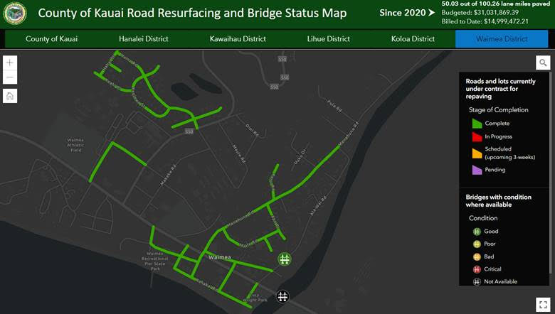
The County of Kaua‘i has launched an online Road Resurfacing and Bridge Status map, which enables the public to easily track the location of past, current and upcoming road projects.
The map is located on the County’s website by clicking on the link: “Click Here to Access the Map.”
The map also tracks what funds were budgeted for road resurfacing and how much was spent to date. This system can help motorists plan their routes around potential traffic delays.
The Department of Public Works and Information Technology Division created a geographic information system that tracks the progress of the Island Wide Road Resurfacing project and the status of County bridges. It is part of the county’s Land Information Management System (LIMS) project.
“Because infrastructure is a top priority for our administration, one of our first integrations into LIMS is showcasing the real-time progress of our road resurfacing and status of bridges,” Mayor Derek S. K. Kawakami said. “We hope to integrate more infrastructure and other projects into LIMS to make this information easily accessible to the public.”
For more information or questions, email kauaigis@kauai.gov.
