2:16 PM HST, Sunday, July 26, 2020
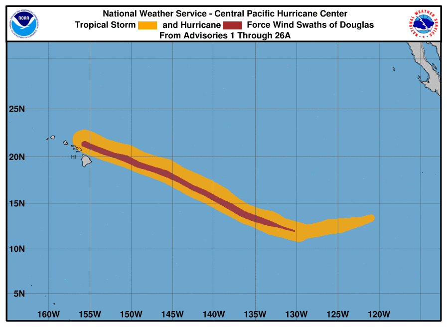
Dangerous Hurricane Douglas Passing North of Maui
CHANGES TO WATCHES AND WARNINGS:
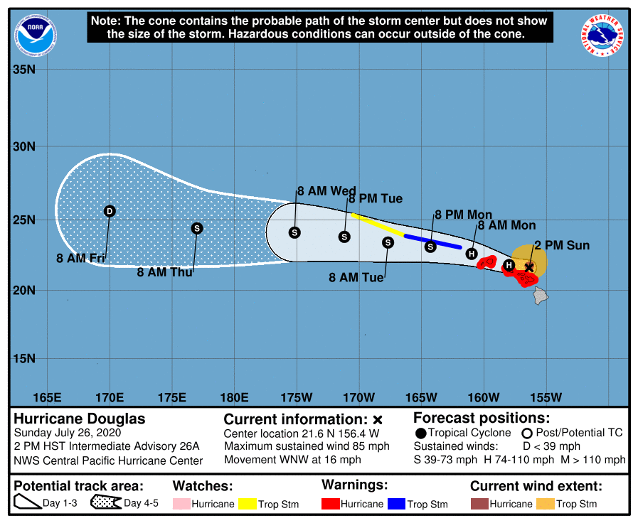
The Tropical Storm Warning has been canceled for the Big Island
CURRENT WATCHES AND WARNINGS:
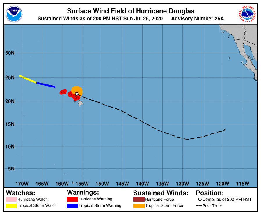
A Hurricane Warning is in effect for Central O‘ahu, Haleakala Summit, Kaho‘olawe, Kaua‘i Leeward, Kaua‘i Mountains, Kaua‘i Windward, Lana‘i Makai, Lana‘i Mauka, Leeward Haleakala, Maui Central Valley, Maui Leeward West, Maui Windward West, Moloka‘i Leeward, Moloka‘i Windward, Ni‘ihau, O‘ahu Koolau, O‘ahu North Shore, O‘ahu South Shore, Olomana, Waianae Coast, Waianae Mountains, and Windward Haleakala.
STORM INFORMATION
Hurricane Douglas is located about 100 miles east-northeast of Honolulu or about 50 miles north of Kahului at 21.6°N 156.4°W. Maximum winds are sustaining at around 85 mph as the storm moves west-northwest at 16 mph.
SITUATION OVERVIEW
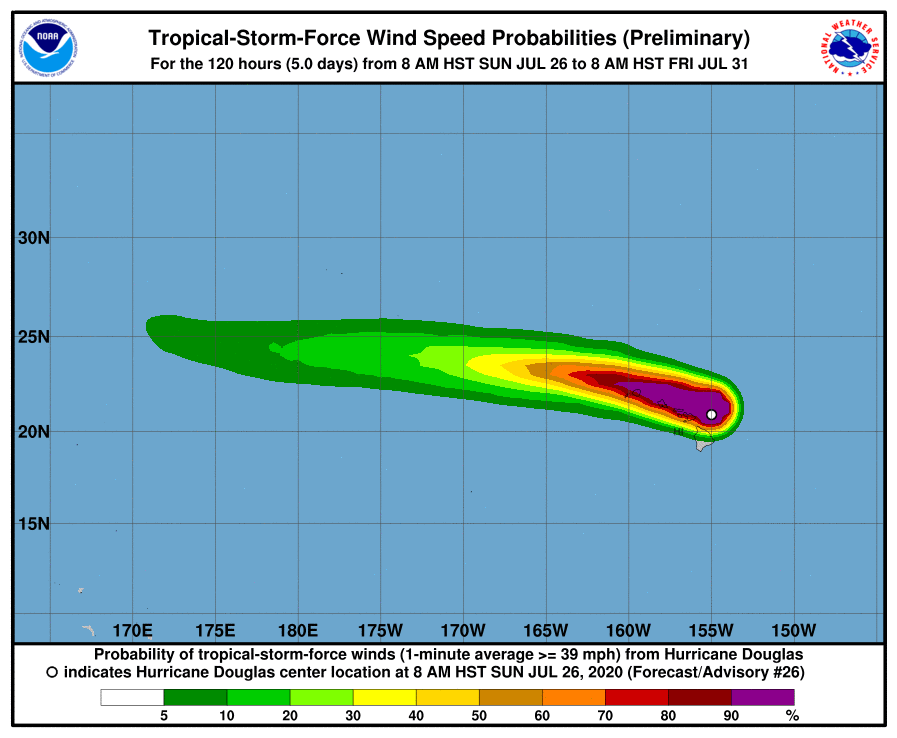
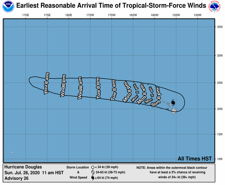
As Hurricane Douglas quickly moves through the area over the next 24 hours from east to west, expect damaging winds, heavy rainfall, coastal flooding, and life-threatening surf. Douglas is now passing dangerously close to Maui and is expected to move near or directly over portions of O‘ahu this afternoon into tonight, then Kaua‘i County tonight into Monday.
Regardless of the exact track, interests are reminded that impacts can occur well away from the tropical cyclone center. It is also important to note that the mountainous terrain of the islands can cause strong localized accelerations of the wind through gaps and where winds blow downslope.
Total rainfall accumulations of 5 to 10 inches, with locally higher amounts to 15 inches, will be possible as Douglas moves through. While the highest rainfall will favor windward and northern facing slopes, leeward and southern facing slopes could also experience flooding.
Significant coastal impacts are expected due to life-threatening surf along exposed shores. A combination of higher than predicted water levels, storm surge, and surf will lead to significant beach erosion, with water potentially overwashing onto vulnerable low- lying coastal roadways, especially at and around the daily high tides.
POTENTIAL IMPACTS
WIND: Protect against life-threatening wind having possible extensive impacts across Hawai‘i. Potential impacts in this area include considerable roof damage to sturdy buildings, with some having window, door, and garage door failures leading to structural damage. Mobile homes could be severely damaged, with some destroyed. Damage may be accentuated by airborne projectiles. Locations may be uninhabitable for weeks. Many large trees could be snapped or uprooted along with fences and roadway signs blown over. Some roads may prove impassable from large debris, and more within urban or heavily wooded places. Several bridges, causeways, and access routes may prove impassable. Large areas could be affected by power and communications outages.
SURGE: Protect against locally hazardous surge having possible limited impacts across Hawai‘i. Potential impacts in this area include localized inundation with storm surge flooding mainly along immediate shorelines and in low-lying spots, or in areas farther inland near where higher surge waters move ashore. Sections of near-shore roads and parking lots that may become overspread with surge water. Driving conditions that could prove dangerous in places where surge water covers the road. Moderate beach erosion is possible. Heavy surf also breaching dunes, mainly in usually vulnerable locations, is a possibility. Strong rip currents are likely. Minor to locally moderate damage to marinas, docks, boardwalks, and piers are possible. A few small craft may break away from moorings.
FLOODING RAIN: Protect against life-threatening rainfall flooding having possible extensive impacts across Hawai‘i. Potential impacts include major rainfall flooding that may prompt many evacuations and rescues. Rivers and tributaries that may rapidly overflow their banks in multiple places. Small streams, creeks, canals, arroyos, and ditches may become dangerous rivers. In mountain areas, destructive runoff may run quickly down valleys while increasing susceptibility to rockslides and mudslides. Flood control systems and barriers may become stressed. Flood waters can enter many structures within multiple communities, with some structures becoming uninhabitable or washed away. Many places where flood waters may cover escape routes. Streets and parking lots can become rivers of moving water with underpasses submerged. Driving conditions may become dangerous. Many road and bridge closures could result, with some weakened or washed out.


